The Mississippi River is the primary river, and second-longest river, of the largest drainage basin in the United States. From its traditional source of Lake Itasca in northern Minnesota, it flows generally south for 2,340 miles (3,766 km) to the Mississippi River Delta in the Gulf of Mexico. With its many tributaries, the Mississippi's watershed drains all or parts of 32 U.S. states and two Canadian provinces between the Rocky and Appalachian mountains. The main stem is entirely within the United States; the total drainage basin is 1,151,000 sq mi (2,980,000 km2), of which only about one percent is in Canada. The Mississippi ranks as the thirteenth-largest river by discharge in the world. The river either borders or passes through the states of Minnesota, Wisconsin, Iowa, Illinois, Missouri, Kentucky, Tennessee, Arkansas, Mississippi, and Louisiana.

The St. Croix River is a tributary of the Mississippi River, approximately 169 miles (272 km) long, in the U.S. states of Wisconsin and Minnesota. The lower 125 miles (201 km) of the river form the border between Wisconsin and Minnesota. The river is a National Scenic Riverway under the protection of the National Park Service. A hydroelectric plant at the Saint Croix Falls Dam supplies power to the Minneapolis–St. Paul metropolitan area.

The St. Croix River is a river in northeastern North America, 71 miles (114 km) in length, that forms part of the Canada–United States border between Maine (U.S.) and New Brunswick (Canada). The river rises in the Chiputneticook Lakes and flows south and southeast, between Calais and St. Stephen. It discharges into Passamaquoddy Bay, in the Bay of Fundy.

Glacial Lake Wisconsin was a prehistoric proglacial lake that existed from approximately 18,000 to 14,000 years ago, at the end of the last ice age, in the central part of present-day Wisconsin in the United States.

Lake Hopatcong is the largest freshwater body in New Jersey, United States, about 4 square miles (10 km2) in area. Located 30 miles (48 km) from the Delaware River and 40 miles (64 km) from Manhattan, New York City, the lake forms part of the border between Sussex and Morris counties in the state's northern highlands region.

The Huron River is a 130-mile-long (210 km) river in southeastern Michigan, rising out of the Huron Swamp in Springfield Township in northern Oakland County and flowing into Lake Erie, as it forms the boundary between present-day Wayne and Monroe counties. Thirteen parks, game areas, and recreation areas are associated with the river, which passes through the cities of Dexter, Ann Arbor, Ypsilanti, Belleville, Flat Rock and Rockwood that were developed along its banks.

The Fox–Wisconsin Waterway is a waterway formed by the Fox and Wisconsin Rivers. First used by European settlers in 1673 during the expedition of Marquette & Joliet, it was one of the principal routes used by travelers between the Great Lakes and the Mississippi River until the completion of the Illinois and Michigan Canal in 1848 and the arrival of railroads. The western terminus of the Fox–Wisconsin Waterway was at the Mississippi at Prairie du Chien, Wisconsin. It continued up the Wisconsin River about 116 miles (187 km) until reaching Portage, Wisconsin. There travelers would portage to the Upper Fox River, or eventually, use the Portage Canal. It continued about 160 miles (260 km) down the Fox River, following it through Lake Winnebago and continuing on the Lower Fox over 170 feet of falls to the eastern terminus of Green Bay.

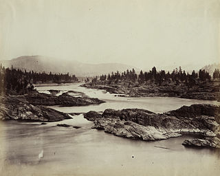
Kettle Falls was an ancient and important salmon fishing site on the upper reaches of the Columbia River, in what is today the U.S. state of Washington, near the Canada–US border. The falls consisted of a series of rapids and cascades where the river passed through quartzite rocks deposited by prehistoric floods on a substrate of Columbia River basalt. The river dropped nearly 50 feet (15 m), and the sound of the falls could be heard for miles away. Kettle Falls was inundated in 1940, as the waters of the reservoir Lake Roosevelt rose behind Grand Coulee Dam, permanently flooding the site.

The Payette River is an 82.7-mile-long (133.1 km) river in southwestern Idaho and is a major tributary of the Snake River.

Lake Pepin is a naturally occurring lake on the Mississippi River on the border between the U.S. states of Minnesota and Wisconsin. It is located in a valley carved by the outflow of an enormous glacial lake at the end of the last Ice Age. The lake formed when the Mississippi, a successor to the glacial river, was partially dammed by a delta from a tributary stream and spread out across the ancient valley.

The Chippewa River in Wisconsin flows approximately 183 miles (294 km) through west-central and northwestern Wisconsin. It was once navigable for approximately 50 miles (80 km) of its length, from the Mississippi River, by Durand, northeast to Eau Claire. Its catchment defines a portion of the northern boundary of the Driftless Area. The river is easily accessible for bikers and pleasure seekers via the Chippewa River State Trail, which follows the river from Eau Claire to Durand.

The Assabet River is a small, 34.4-mile (55.4 km) long river located about 20 miles (30 km) west of Boston, Massachusetts, United States. The Assabet rises from a swampy area known as the Assabet Reservoir in Westborough, Massachusetts, and flows northeast before merging with the Sudbury River at Egg Rock in Concord, Massachusetts, to become the Concord River. The Organization for the Assabet, Sudbury and Concord Rivers, headquartered in West Concord, Massachusetts, is a non-profit organization dedicated to the preservation, protection, and enhancement of the natural and recreational features of these three rivers and their watershed. As the Concord River is a tributary of the Merrimack River, it and the Assabet and Sudbury rivers are part of the larger Merrimack River watershed.

The Namekagon River is a tributary of the St. Croix River. It is 101 miles (163 km) long and is located in northwestern Wisconsin in the United States. Its course is protected as part of the St. Croix National Scenic Riverway.

Portage River is a 38.6-mile-long (62.1 km) river that flows southward through Kalamazoo County and St. Joseph County, Michigan. Its headwaters are 8 miles (13 km) east of the city of Kalamazoo at Portage Lake, and the river flows southwest to its mouth within the city limits of Three Rivers, where it drains into the St. Joseph River.

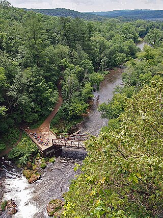
Willow River State Park is a 2,891-acre (1,170 ha) Wisconsin state park located five miles (8 km) north of Hudson. The centerpiece of the park is Willow Falls, a powerful cascade in a 200-foot (61 m) deep gorge. Another popular feature is Little Falls Lake, a shallow reservoir on the Willow River. Because of its proximity to Minneapolis-St. Paul it is one of the most visited state parks in Wisconsin. Trilobite fossils found in the lower layers of the gorge indicate the rock is around 600 million years old.

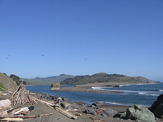
The Russian River is a southward-flowing river that drains 1,485 sq mi (3,850 km2) of Sonoma and Mendocino counties in Northern California. With an annual average discharge of approximately 1,600,000 acre feet (2.0 km3), it is the second-largest river flowing through the nine-county Greater San Francisco Bay Area, with a mainstem 115 mi (185 km) long.

The Willow River is a 61.1-mile-long (98.3 km) river in St. Croix County, Wisconsin, United States, and a tributary of the St. Croix River. Its source is in southern Polk County east of the village of Clear Lake. The river at one time flowed unobstructed into the lower St. Croix River between Hudson and North Hudson. However a dam was built to block off its mouth, a narrow channel was cut above the dam to the St. Croix River, the channel was dammed, and a mill was built to exploit the head of water that the two dams created. Subsequently, the Willow River Power Company built a hydroelectric facility to utilize the same head of water, but the head was substantially decreased when the United States built the Red Wing Dam 30 miles (48 km) downstream on the Mississippi River.
Brown's Creek is a 9.7-mile-long (15.6 km) stream which originates about 5.5 miles northwest of the city of Stillwater and flows south for about half its length then east to its confluence with the St. Croix River just north of Stillwater in Washington County, Minnesota, United States. It is one of few creeks in the Minneapolis – Saint Paul "Twin Cities" metropolitan area that supports a fishable trout population.

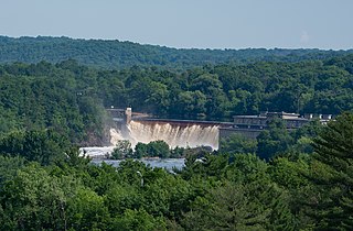
Saint Croix Falls Dam, also known as St. Croix Falls Dam, is a hydroelectric dam on the St. Croix River between St. Croix Falls, Wisconsin and Taylors Falls, Minnesota. The only hydroelectric dam on the St. Croix River, it is operated by Xcel Energy.


