The Sabine River is a river, 360 miles long, in the Southern U.S. states of Texas and Louisiana. From the 32nd parallel north and downstream, it serves as part of the boundary between the two states and empties into Sabine Lake, an estuary of the Gulf of Mexico. Over the first half of the 19th century, the river formed part of the Spanish–American, Mexican–American, and Texan–American international boundaries. The upper reaches of the river flow through the prairie country of northeast Texas. Along much of its lower reaches, it flows through the pine forests along the Texas–Louisiana border, and the bayou country near the Gulf Coast.

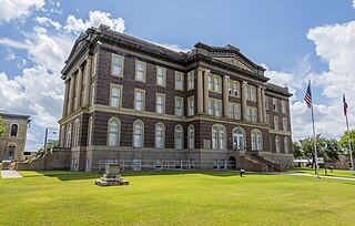
Mills County is a county located on the Edwards Plateau in Central Texas, USA. At the 2010 census, its population was 4,936. The county seat is Goldthwaite. The county is named for John T. Mills, a justice of the Texas Supreme Court.

Brown County is a county in west-central Texas. As of the 2010 census, the population was 38,106. Its county seat is Brownwood. The county was founded in 1856 and organized in 1858. It is named for Henry Stevenson Brown, a commander at the Battle of Velasco, an early conflict between Texians and Mexicans.

Brownwood is a city in and the county seat of Brown County, Texas, United States. The population was 19,288 at the 2010 census.

Goldthwaite is a small city located in Mills County in Central Texas. The population was 1,878 at the 2010 census. It is the county seat of Mills County, which is named for John T. Mills, a justice of the Supreme Court for the Third, Seventh, and Eighth districts of the former Republic of Texas. Goldthwaite is located in the western portion of the Texas Hill Country. The elevation is 1,580 feet. Goldthwaite is situated at the intersections of U.S. Highways 84 and 183, Texas State Highway 16, and Texas Farm-to-Market Roads 572 and 574.

The Colorado River is an approximately 862-mile (1,387 km) long river in the U.S. state of Texas. It is the 18th longest river in the United States and the longest river with both its source and its mouth within Texas.

The Burlington Northern Santa Fe (BNSF) Railway Company is the largest freight railroad network in North America. One of seven North American Class I railroads, BNSF has 41,000 employees, 32,500 miles (52,300 km) of track in 28 states, and more than 8,000 locomotives. It has three transcontinental routes that provide rail connections between the western and eastern United States. BNSF trains traveled over 169 million miles in 2010, more than any other North American railroad.

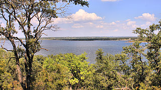
Lake Brownwood is a reservoir on Jim Ned Creek and Pecan Bayou in Brown County, Texas, United States. After a devastating flood in 1900, the citizens of Brown County created the Brown County Water Improvement District by election in 1926. The water district acquired the land necessary and built a dam to impound the waters of Pecan Bayou at its confluence with Jim Ned Creek. Dam construction started in 1930 and was completed in 1933. A large flood filled the reservoir in July 1932 but the water was released to complete construction of the dam. Deliberate impoundment of the reservoir began in July 1933. The town of Lake Brownwood, Texas formed, and the Texas Parks Board acquired land for Lake Brownwood State Park in 1933.

The Atchison, Topeka and Santa Fe Railway, often referred to as the Santa Fe or AT&SF, was one of the larger railroads in the United States. The railroad was chartered in February 1859 to serve the cities of Atchison, Kansas, Topeka, Kansas, and Santa Fe, New Mexico. The railroad reached the Kansas–Colorado border in 1873 and Pueblo, Colorado, in 1876. To create a demand for its services, the railroad set up real estate offices and sold farmland from the land grants that it was awarded by Congress.

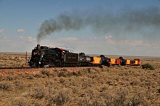
The Grand Canyon Railway, is a heritage railroad which carries passengers between Williams, Arizona and the South Rim of Grand Canyon National Park.

The Santa Fe, Prescott and Phoenix Railway (SFP&P) was a common carrier railroad that later became an operating subsidiary of the Atchison, Topeka and Santa Fe Railway in Arizona. At Ash Fork, Arizona, the SFP&P connected with Santa Fe's operating subsidiary, the Atlantic & Pacific Railroad mainline, that ran from California to Chicago. The SFP&P's 195-mile (314 km) line extended the Santa Fe Railway south into Phoenix. The SFP&P extended another 100 miles (160 km) to the east from Phoenix to Florence and Winkelman via the Phoenix and Eastern Railroad. The SFP&P also served several mines in the Prescott area through its various subsidiary railroads.

The Rio Chama, a major tributary river of the Rio Grande, is located in the U.S. states of Colorado and New Mexico. The river is about 130 miles (210 km) long altogether. From its source to El Vado Dam its length is about 50 miles (80 km), from El Vado Dam to Abiquiu Dam is about 51 miles (82 km), and from Abiquiu Dam to its confluence with the Rio Grande is about 34 miles (55 km).

Houston, the most populous city in the Southern United States, is located along the upper Texas Gulf Coast, approximately 50 miles (80 km) northwest of the Gulf of Mexico at Galveston. The city, which is the ninth-largest in the United States by area, covers 601.7 square miles (1,558 km2), of which 579.4 square miles (1,501 km2), or 96.3%, is land and 22.3 square miles (58 km2), or 3.7%, is water.

Twelve Mile Creek is a waterway located on the Niagara Peninsula in the Regional Municipality of Niagara in Southern Ontario, Canada. Its headwaters are located in the town of Pelham, encompassing some of the most unspoiled and natural areas of Niagara area. The creek's lower reaches flow through urban areas of Thorold and St. Catharines, and have been heavily altered by human activity for almost two centuries.
Pecan Bayou is a slow-moving stream in Callahan County, Texas. The stream is fed by over twenty creeks and is one of the major tributaries of the Colorado River in Texas. It may be the westernmost bayou in the United States. A dam on Pecan Bayou seven miles north of Brownwood forms Lake Brownwood. Below Lake Brownwood, the stream flows through Brownwood and Early, Texas into western Mills county before the confluence with the Colorado River about 8 miles west of Goldthwaite, Texas.

Tomichi Creek is a 71.8-mile-long (115.6 km) tributary of the Gunnison River in Gunnison County, Colorado. Tomichi Creek originates north and west of Monarch Pass and flows to the southwest along the base of Monarch Mountain. Congress Creek drains into Tomichi west of Old Monarch Pass where it flows south toward Sargents. Agate Creek flows into Tomichi just north of Sargents where Marshall Creek flows from Marshall Pass. Just below Sargents, Long Branch Creek, flowing out of Baldy Lake from the south, enters Tomichi Creek which takes a westward course where Needle Creek Reservoir drains into Tomichi east of Doyleville. Hot Springs Reservoir drains down Wanita Canyon flowing into Tomichi Creek just west of Doyleville. The Tomichi Valley is a semi-wide valley allowing Tomichi Creek to meander and split into several waterways creating an excellent livestock range and being largely private ranch lands. At Parlin, Quartz Creek flows from Pitkin and Ohio into Tomichi Creek. Tomichi continues its westward journey, slightly northwest, where the Cochetopa Creek drains into Tomichi at State Highway 114 from the south at the intersection of U.S. Highway 50 and continues west to Gunnison where it enters the Gunnison River. A map can be viewed at the BLM Colorado website here.

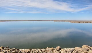
John Martin Reservoir is a reservoir on the Arkansas River in southeastern Colorado. Built and managed by the U.S. Army Corps of Engineers, it is used for flood control, irrigation, and recreation. John Martin Reservoir State Park lies on its shore.

The Atchison, Topeka and Santa Fe Railway ATSF 5011 Class locomotive, was the last class of steam locomotives to be purchased by AT&SF. The 5011 Class was introduced by Baldwin Locomotive Works in 1944.


