
Lake Monkey Business is a private park and lake not opened to the public located in northern Leon County, Florida and within the planned private community of Killearn Lakes Plantation.

Lake Monkey Business is a private park and lake not opened to the public located in northern Leon County, Florida and within the planned private community of Killearn Lakes Plantation.
Though the lake was created by Julian C. "Bull" Headley (of Kentucky) in the early to mid-1950s, as part of Bull Run Plantation, the land which Lake Monkey Business is on was originally part of Frances C. Griscom's Water Oak Plantation. The lake is within the Killearn Lakes Plantation development, north of Tallahassee, Florida. The present-day Bull Headley Road frames the western boundary of Killearn Lakes Plantation; the northern terminus of the road ends at a public boat ramp for the nearby Lake Iamonia.
Water Oak's purchase in 1951 the name change occurred with Headley making several enhancements to the property, including a dam, a new brick mansion, bathhouse, swimming pool, and Headley's own duck lake, which he called Lake Monkey Business. This was the last of Headley's land alteration projects "to monkey around with" – hence the name – which sought to attract waterfowl.
There are three other lakes which he created by damming the feeder stream further up the drainage system. These consist (in order of drainage) of Lake Petty Gulf, Lake Dianne, and Lake Blue Heron, which then drains into Monkey Business. Lake Monkey Business is fed through the prominent sweeping estuary arm to the south west. The lakes were drawn down during spring and summer months and refilled by the autumn rains and attract many migrating waterfowl. This practice is no longer employed on these lakes, but remains common on nearby hunting plantations.
A small, natural island, approximately 200 feet in diameter, within Lake Monkey Business provides a natural retreat for water fowl. The island is located about halfway between the isthmus and the western end of the lake. The island contains many large hardwood and pine trees and relatively dense underbrush.
In 1964, Headley sold Bull Run Plantation to a financial syndicate of sportsmen interested in a recreational preserve. Kinhega Lodge was established and Lake Monkey Business remained. Kinhega Lodge would eventually become Kinhega Lodge Estates, Limited. In the early 1970s the property was sold again to investors, who developed the property into Killearn Lakes Plantation, a development of over 4500 homes. [1]
Located approximately 11 miles north of Tallahassee, Florida's center, Killearn Lakes Plantation is a planned, heavily forested suburban development which fully surrounds the lake. The lands on the southern and eastern perimeter of the lake form a part of the private Golden Eagle development. The western and northern perimeter is rural property in Leon County within Killearn Lakes Plantation.
Use of the lake is exclusive to residents of Killearn Lakes Plantation. Access to the lake and its boat ramp is provided by a gated access road.
A gated entrance on Turkey Hill Trail leads to a boat ramp and park. The park is located on a grassy isthmus with ample shade provided by many Spanish moss-draped live oaks and three docks useful to residents for catching various species of panfish (genus Lepomis). A boat ramp is located at the park's north end. Until about 2000, playground equipment was provided at the park. The lake itself has a low population of juvenile American Alligators. State-licensed nuisance alligator trappers are usually called upon to remove larger alligators once they reach a length of four to six feet (2 m). Although it is reported that an 8-foot (2.46 m) specimen had matured there until captured.
The lake is considered "well stocked" in that it supports a large community of largemouth Bass and various catfish. The lake is generally green in color with photosynthetic plankton and low in weeds due to invasive grass carp. The bottom of the lake is between 6–10 feet (1.8–3.1m) in depth and strewn with small branches and trees due to beaver activity. No swimming is allowed due to alligators and rare plankton blooms that have turned the water bright orange for months.
Through 2008, on July 4, the Killearn Lakes Plantation Homeowners Association provided a fireworks display over Lake Monkey Business paid for by residents' dues. In 2009 and 2010, the homeowners association voted to suspend the display due to financial constraints.
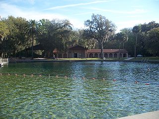
De Leon Springs State Park is a Florida State Park in Volusia County, Florida. It is located in DeLeon Springs, off CR 3.

Paynes Prairie Preserve State Park is a Florida State Park, encompassing a 21,000-acre (85 km2) savanna in Alachua County, Florida lying between Micanopy and Gainesville. It is also a U.S. National Natural Landmark. It is crossed by both I-75 and U.S. 441. It is in the center of the Paynes Prairie Basin. The basin's primary source of drainage is Alachua Sink. During occasional wet periods, the basin will become full. A notable period occurred from 1871 to 1891 when the Alachua Sink was temporarily blocked. During this period, shallow draft steamboats were a frequent sight on Alachua Lake in the center of the prairie. The region was also historically known as the Alachua Savannah. Its drainage has been modified by several canals. Since 1927, Camps Canal has linked the basin to the River Styx which leads to Orange Lake and eventually the Atlantic Ocean through the St. Johns River. That reduced the basins water intake by half. Additional changes to the prairie's environment have been detrimental to its hydrology. In 1970, the state of Florida acquired the land and has been in the process of restoring the environment to a more natural condition ever since.
The Alfred B. Maclay State Gardens is a 1,176-acre (4.76 km2) Florida State Park, botanical garden and historic site, located in Tallahassee, in northeastern Florida. The address is 3540 Thomasville Road.
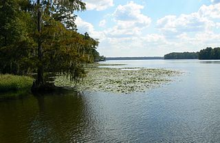
Lake Talquin is a reservoir located on the Ochlockonee River between Leon County and Gadsden County in north Florida. The lake, located about 10 miles (15 km) west of Tallahassee, is south of Interstate 10 and bordered by State Road 20 on the east and State Road 267 on the west.

Lake Jackson is a shallow, prairie lake on the north side of Leon County, Florida, United States, near Tallahassee, with two major depressions or sinkholes known as Porter Sink and Lime Sink.
Dead Lakes State Recreation Area is a Florida protected area located 1 mile (1.6 km) north of Wewahitchka off Florida State Road 71 and southwest of Tallahassee. It was formerly a Florida State Park and originally a fish hatchery operated by the Florida Fish and Wildlife Conservation Commission from 1936 until 1951. Activities include hiking, fishing, boating, camping, and wildlife viewing. Among the wildlife of the park are foxes, cotton rats, raccoons, opossums, white-tailed deer, rabbits, skunk, beavers, turtles, snakes and alligators. A variety of trees can be found in the park, including longleaf pine, magnolia and bald cypress trees. Amenities include a boat ramp, fresh water trails, nature trails, and a camping area. The recreation area is open from 8:00 am until sunset year-round.
Bradfordville is an unincorporated community in northern Leon County, Florida, United States. It is 8 miles (13 km) north of Tallahassee and south of the Florida/Georgia state line by 8 miles (13 km) at the intersection of US 319 and County Road 0342. Elevation is 237 feet.

Lake Griffin State Park is a Florida State Park located two miles (3 km) north of Leesburg, in Fruitland Park and 30 miles (48 km) south of Ocala on U.S. Highway 441. It is home to one of the state's largest live oak trees. The park is unique in connecting to Lake Griffin, the Ocklawaha River and thence to the Harris Chain of Lakes, and is made up of 577.63 acres (2.33758 km2) of swampland and hardwood upland.
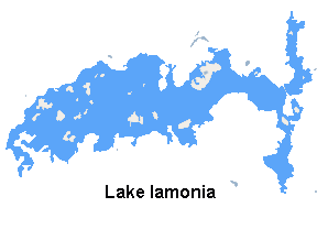
Lake Iamonia ⟨aɪ ˈmoʊ njə⟩ is a large, subtropical prairie lake in northern Leon County, Florida, United States, created during the Pleistocene epoch.
Tall Timbers Research Station and Land Conservancy is a research and learning facility located in northern Leon County, Florida, just off County Road 12 on the north side of Lake Iamonia. Tall Timbers researches the areas of fire ecology, resource management, forestry, game bird management, and vertebrate ecology.

Water Oak Plantation was a small cotton plantation of 1,840 acres (740 ha) located in northern Leon County, Florida, United States established by Richard Bradford.

Lake Lafayette is a prairie lake located in the coastal lowland in eastern Tallahassee, Leon County, Florida with US 27 / State Road 20 running close on its south side.
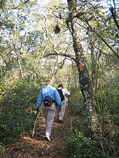
The Florida Trail is one of eleven National Scenic Trails in the United States. It currently runs 1,000 miles (1,600 km), with 300 miles (480 km) planned, from Big Cypress National Preserve to Fort Pickens at Gulf Islands National Seashore, Pensacola Beach. Also known as the Florida National Scenic Trail, the Florida Trail provides permanent non-motorized recreation opportunity for hiking and other compatible activities and is within an hour of most Floridians. The Florida National Scenic Trail is designated as a National Scenic Trail by the National Trails System Act of 1968.

Kinhega Lodge was a hunting and fishing plantation located in northern Leon County, Florida, United States on Lake Iamonia.

Bull Run Plantation was a private estate owned by Julien C. (Bull) Headley (Heed-Lee) located in Leon County, Florida, United States.
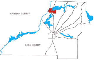
Luna Plantation was a quail hunting plantation located in northeastern Leon County, Florida, United States established by Lloyd C. Griscom.
Elinor Klapp-Phipps Park is an open natural park located in northern Tallahassee, Florida, United States and operated by the City Of Tallahassee. The property is owned by Northwest Florida Water Management District.

The Leon County paleontological sites are assemblages of Early Miocene invertebrates and vertebrates of Leon County, Florida, United States.
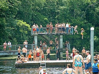
Edward Ball Wakulla Springs State Park is a Florida State Park in Wakulla County, Florida, United States. This 6,000 acre (24 km2) wildlife sanctuary, located south of Tallahassee, is listed on the National Register of Historic Places, and designated a National Natural Landmark.
Coordinates: 30°36′25″N84°13′51″W / 30.6069856°N 84.2308434°W