Lake Mugesera | |
---|---|
Location | Rwanda |
Coordinates | 2°06′29″S30°18′54″E / 2.108°S 30.315°E Coordinates: 2°06′29″S30°18′54″E / 2.108°S 30.315°E |
Primary inflows | Nyabarongo River |
Basin countries | Rwanda |
Surface area | 4,000 hectares (9,900 acres) |
Surface elevation | 1,300 metres (4,300 ft) |
Lake Mugesera is a lake in the Eastern Province, Rwanda.
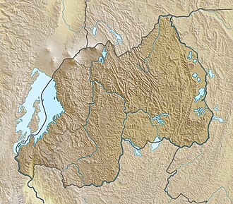
The lake is in the Central Plateau, southeast of Kigali. [1] The lake is part of a complex of lakes and wetlands in a flat valley running in a SSE direction, 35 kilometres (22 mi) wide. The Nyawarungu River meanders southward through the valley, flooding it to create a zone of permanent swamps and lakes. Lake Mugesera lies on the east bank of the river, and is the largest lake in the complex. [2]
Although close to the equator, the climate is comparatively temperate due to the elevation. The rainy seasons are from March to May and again from September to December. [1] The lake is fed by a number of rivers and minor streams originating on ridges to the north, east and south, which deliver most water during the rainy seasons. [3] The water is generally around 25 °C (77 °F). [3] Fish are abundant, and there are many species of waterbirds. Other animals include water turtles, crocodiles, monitors, snakes and otters. [4]
In the 15th century the region around the lake was settled by the Hondogo lineage of Tutsi people, pastoralists who had formed an independent state. [5] The Tutsi migrated to the Virunga region of Rwanda during the 15th and 16th centuries, settling between Lake Mugesera and Lake Muhazi. They gradually acquired power in most of the region of modern Rwanda, while intermarrying with the Hutu and becoming culturally assimilated by them. [6]
Rwanda, officially the Republic of Rwanda, is a landlocked country in the Great Rift Valley where the African Great Lakes region and East Africa converge. One of the smallest countries on the African mainland, its capital city is Kigali. Located a few degrees south of the Equator, Rwanda is bordered by Uganda, Tanzania, Burundi, and the Democratic Republic of the Congo. It is highly elevated, giving it the soubriquet "land of thousand hills", with its geography dominated by mountains in the west and savanna to the east, with numerous lakes throughout the country. The climate is temperate to subtropical, with two rainy seasons and two dry seasons each year. Rwanda has a population of over 12.6 million living on 26,338 km2 of land, and is the most densely populated mainland African country.
The Lukuga River is a tributary of the Lualaba River in the Democratic Republic of the Congo (DRC) that drains Lake Tanganyika. It is unusual in that its flow varies not just seasonally but also due to longer term climate fluctuations.
The Banyarwanda are the cultural and linguistic group of people who inhabit mainly Rwanda. Within the Banyarwanda there are three subgroups: Hutu, Tutsi and Batwa. Some Banyarwanda live in the Democratic Republic of the Congo, having migrated there from neighbouring Rwanda in waves. In the Congo, they live in the provinces of North Kivu and South Kivu. There are also 1 million Banyarwanda in Uganda, where they live in the west of the country; Umutara and Kitara are the centres of their pastoral and agricultural areas.
Hutu Power is a racist and ethnosupremacist ideology propounded by Hutu extremists in Rwanda. It led to the 1994 Rwandan genocide against the Tutsi. Hutu Power political parties and movements included the Akazu, the Coalition for the Defence of the Republic and its Impuzamugambi paramilitary militia, and the governing National Republican Movement for Democracy and Development and its Interahamwe paramilitary militia.
Lake Piso, also known as Lake Pisu and Fisherman's Lake, is an oblong tidal lagoon in Grand Cape Mount County in western Liberia, near the town of Robertsport. At an area of 103 km2 (40 sq mi), it is the largest lake in Liberia. Its name originates from a local term meaning "pigeon's hole" – a reference to the flocks of pigeons that once came to Lake Piso for water.
The Rwandan Revolution, also known as the Social Revolution or Wind of Destruction, was a period of ethnic violence in Rwanda from 1959 to 1961 between the Hutu and the Tutsi, two of the three ethnic groups in Rwanda. The revolution saw the country transition from a Belgian colony with a Tutsi monarchy to an independent Hutu-dominated republic.
The Nyabarongo is a major river in Rwanda, part of the upper headwaters of the Nile. With a total length of 351 km (218 mi) the longest river entirely in Rwanda. It is extended 421 km (262 mi) in Lake Rweru including a 69 km (43 mi) upper course of Kagera River before joining into Ruvuvu River to form the Kagera River. The river begins its course at the confluence of the rivers Mbirurume and Mwogo in the South West of the country. These two rivers themselves begin in Nyungwe Forest, and are considered by some to be the most distant source of the Nile. From its start, Nyabarongo flows northward for 85 km, and forms the border between the Western and Southern Provinces. At the confluence with the river Mukungwa, the river changes course and flows eastward for 12 km, then to a more South Eastern course for the last 200 km. For the longest stretch of this course, the river serves as the boundary between the Northern and Southern Provinces, then between the City of Kigali and the Southern Province, and lastly between the City of Kigali and the Eastern Province.
The Rukarara River is a river in western Rwanda that is a tributary of the Mwogo River, in turn a tributary of the Nyabarongo River. It is the most distant headwater of the Nile.
The Rutshuru River is a river in the eastern Democratic Republic of the Congo that drains Lake Mutanda in the foothills of the Virunga Mountains in Uganda, flowing northward into Lake Rutanzige. For most of its length it runs through the Rutshuru Territory in North Kivu province.
The Shashe Dam is a dam on the Shashe River in Botswana that was built to supply water to the industrial city of Selebi-Phikwe. The large village of Tonota lies just south of the dam.
Kabgayi is just south of Gitarama in Muhanga District, Southern Province, Rwanda, 25 miles (40 km) southwest of Kigali. It was established as a Catholic Church mission in 1905. It became the center for the Roman Catholic Church in Rwanda and is the site of the oldest cathedral in the country and of Catholic seminaries, schools and a hospital. The church at first supported the Tutsi ruling elite, but later backed the Hutu majority. During the 1994 Rwandan genocide thousands of Tutsis who had taken refuge here were killed. Some survivors admire the courage of many priests who helped them during those difficult days,like Father Evergiste RUKEBESHA and many others. Later, some Hutus including three bishops and many priests were killed by the rebels RPF soldiers. A mass grave beside the hospital is marked by a memorial. Inside the Basilica are kept the bodies of the three beshops killed by FPR rebels. Two of them were refused by the Rwandan government to be transferred in their own cathedrals.
Zaza is a community in Rwanda to the east of Lake Mugesera and about 10 miles (16 km) west of Kibungo. It is in the Ngoma District of the Eastern Province of Rwanda.
John Joseph Hirth was a Catholic Bishop in German East Africa, known as the founder of the church in Rwanda.
Nyundo is a community in the Rubavu District of Western Province, Rwanda, on the Sebeya River to the east of Gisenyi. It is the location of one of the first Catholic missions to be established in Rwanda, and today is the headquarters of the Roman Catholic Diocese of Nyundo.
The Akanyaru River is the main tributary of the Nyabarongo River. It rises in the western highlands of Rwanda and Burundi, flows east and then north along the border between those countries before joining the Nyabarongo River. The lower stretches contain important but unprotected wetlands, which are under threat from human activity.
The Mwogo River is a river in western Rwanda that is a tributary of the Nyabarongo River.
The Mbirurume is a river in western Rwanda that is a tributary of the Nyabarongo River.
The Congo-Nile Divide is the continental divide that separates the drainage basins of the Nile and Congo rivers. It is about 2,000 kilometres (1,200 mi) long.
Jebel Azao or Adrar Afao is the highest peak in the Tassili n'Ajjer range in southeastern Algeria, at 2,158 metres (7,080 ft). The range forms the northwest border of the Chad Basin.
Ibitekerezo is a form of epic hero poetry that was performed at the royal court in precolonial Rwanda. This oral tradition serves to explain the history of Rwandan dynasties in poetic form. It is one of four major royal traditions of the Kingdom of Rwanda alongside ubwiru and the oral literature forms ubucurabwenge and ibisigo. Ethnographers Jean Hiernaux and Emma Maquet recorded several major ibitekerezo.
This Rwanda location article is a stub. You can help Wikipedia by expanding it. |