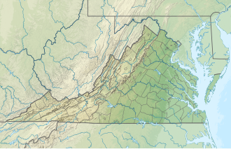
Lake Powell (Virginia)

Last updated
Lake Powell
USA Virginia relief location map.svg
Red pog.svg
Lake Powell
Location James City County, Virginia
Coordinates 37°14′16″N76°44′48″W / 37.237868°N 76.746528°W / 37.237868; -76.746528
Type man-made lake

Lake Powell is an artificial pond located in James City County, Virginia. In 2006, flood damage from Tropical Storm Ernesto caused the earthen retaining dam which formed the lake to burst and empty.

Contents

Description and history

Lake Powell is located in James City County, Virginia within three miles of the historic Jamestown site and colonial Williamsburg. The lake was formed by the damming of Mill Creek. The origins of the lake are unknown, though some sources contend it was dammed as early as the 1750s. [1] The earliest confirmed records of the lake are from the Peninsula Water Company and date to some time in the 1800s. [2] In 1924, the lake was purchased by the Powell Family for which it is now named. [3] Prior to its break, the lake covered 81 acres. All lake shore access was located on private property, though the lake itself was owned by a separate private party. The dam holding back Lake Powell has broken numerous times in the past, including four times since 1991 alone, [3] with the first major break occurring in 1999 due to Hurricane Floyd. The latest break occurred on October 7, 2006, when rains from Tropical Storm Ernesto caused a major breach that caused the dam to burst. [4] Currently, the former lake bed contains a variable amount of muddy water. Much of it has since started to grow in with brush.

Plans for repair

Plans to reconstruct the dam were considered soon after the last break, though nothing was done. It was suggested that public funds might be used to help pay for the repair costs. The destruction of Lake Powell has resulted in a massive and continuing reduction in property assessments for lakeshore property, including by 17% in 2007 alone, [5] and 10-20% each additional year. In early 2010, Lake Powell's owners submitted an application to turn the former lake into a wetlands mitigation bank, [6] credits from which could be sold to developers for up to $25,000 per acre. The plan caused immediate opposition from lake shore property owners who wanted the lake restored. The proposal then began the process of government environmental review which started with the Army Corps of Engineers. In September, the Corps of Engineers rejected the proposal, citing questions concerning property rights, the necessity to build a sill structure to control water levels (wetlands banks must be naturally self-sufficient), and the large degree of naturalization which the lake has undertaken on its own since the break. [7]

Current plans call for Lake Powell to be restored utilizing both a tax leveled on lake shore property owners and public funding. The tax had been voted for unanimously by the home owners. Since its initial break, the cost of restoring the lake has been a matter of contention with numerous estimates given, some ranging as high as $2.8 million. However, these appear to be considerable overestimations, with the actual cost closer to $750,000. [8] As part of using tax dollars to fund the repair, Lake Powell would be open to public recreation for the first time. Most recently, an additional proposal has been made to turn the lake into a nutrient bank. [9] This would function in a similar way as the failed mitigation banking scheme in that population mitigation credits would be sold to bidding companies; however, in this case, the dam would have to be rebuilt and the lake restored, thus satisfying lake shore property owners. Plans for the restoration of Lake Powell have been affected by the competing aims of involved parties. Lake shore property owners have been adamant in having the lake restored to return both the aesthetic effects and use of the lake and to reverse the steady decline in property values which have occurred since the break. [8] [10] The lake's owners, however, stood to benefit considerably from the transformation of the former lake into wetlands credits. [11] In addition to opposition from lake shore property owners who oppose any plan which does not lead to restoration of the lake, state officials opposed the wetlands bank proposal based on concerns about how property lines are affected due to the altered position of the lake banks. [12] As it currently stands, restoration of the lake with the addition of public finances seems the most likely outcome. [13]

Related Research Articles

The Landmark Trust is a British building conservation charity, founded in 1965 by Sir John and Lady Smith, that rescues buildings of historic interest or architectural merit and then makes them available for holiday rental. The Trust's headquarters is at Shottesbrooke in Berkshire.

<span class="mw-page-title-main">Mississippi River Delta</span> Delta of the Mississippi River

The Mississippi River Delta is the confluence of the Mississippi River with the Gulf of Mexico in Louisiana, southeastern United States. The river delta is a three-million-acre area of land that stretches from Vermilion Bay on the west, to the Chandeleur Islands in the east, on Louisiana's southeastern coast. It is part of the Gulf of Mexico and the Louisiana coastal plain, one of the largest areas of coastal wetlands in the United States. The Mississippi River Delta is the 7th largest river delta on Earth (USGS) and is an important coastal region for the United States, containing more than 2.7 million acres of coastal wetlands and 37% of the estuarine marsh in the conterminous U.S. The coastal area is the nation's largest drainage basin and drains about 41% of the contiguous United States into the Gulf of Mexico at an average rate of 470,000 cubic feet per second.

<span class="mw-page-title-main">Kinnickinnic River (Milwaukee River tributary)</span> River in Milwaukee, Wisconsin

The Kinnickinnic River is one of three primary rivers that flows into the harbor of Milwaukee, Wisconsin, at Lake Michigan, along with the Menomonee River and Milwaukee River. It is locally called the "KK River".

<span class="mw-page-title-main">Capitol Lake</span> Artificially created body of water at Washington State Capitol

Capitol Lake is a 3 kilometer long, 260-acre (1.1 km2) artificial lake at the mouth of Deschutes River in Tumwater/Olympia, Washington. The Olympia Brewery sits on Capitol Lake in Tumwater, just downstream from where the Tumwater Falls meet the artificial lake. The Washington State Department of Enterprise Services (DES) manages the lake, as part of The Washington State Capitol Campus.

The United States Army Corps of Engineers is involved with a wide spectrum of public works projects: environmental protection, water supply, recreation, flood damage and reduction, beach nourishment, homeland security, military construction, and support to other Governmental agencies. Through 19 Flood Control Acts since 1917, Congress has authorized the Corps of Engineers to be involved with flood protection and damage reduction in almost every state of the union.

Mitigation banking is the preservation, enhancement, restoration or creation (PERC) of a wetland, stream, or habitat conservation area which offsets, or compensates for, expected adverse impacts to similar nearby ecosystems. The goal is to replace the exact function and value of specific habitats that would be adversely affected by a proposed activity or project. The public interest is served when enforcement agencies require more habitat as mitigation, often referred to as a mitigation ratio, than is adversely impacted by management or development of nearby acreage.

<span class="mw-page-title-main">Dotson Family Marsh</span>

The Dotson Family Marsh, formerly Breuner Marsh, is a 238-acre regional park on San Pablo Bay in the East San Francisco Bay Area city of Richmond, California, In 2009 the East Bay Regional Parks District acquired the Breuner Marsh site, adding it to Point Pinole Regional Shoreline. A habitat restoration plan for 60 acres of wetlands and 90 acres of California coastal prairie was subsequently approved.

Biodiversity banking, also known as biodiversity trading or conservation banking, biodiversity mitigation banks, compensatory habitat, set-asides, biodiversity offsets, are conservation activities that compensate for the loss of biodiversity with the goal of biodiversity maintenance through a framework which allows biodiversity to be reliably measured, and market based solutions applied to improving biodiversity. Biodiversity banking provides a means to place a monetary value on ecosystem services. Typically this involves land protection, restoration, an/or enhancement. Biodiversity banking is often applied so that there is no "net loss of a particular biodiversity feature." According to the International Union for Conservation of Nature, by 2004, interest in voluntary biodiversity offsets was growing in the United States, Brazil, Australia, Canada and the EU. Experience suggested that industry, governments, local communities and conservation groups all benefit from biodiversity offsets or biodiversity banking.

<span class="mw-page-title-main">Freshwater marsh</span> Non-tidal, non-forested marsh wetland that contains fresh water

A freshwater marsh is a non-forested marsh wetland that contains shallow fresh water, and is continuously or frequently flooded. Freshwater marshes primarily consist of sedges, grasses, and emergent plants. Freshwater marshes are usually found near the mouths of rivers, along lakes, or are present in low lying areas with low drainage like abandoned oxbow lakes. Unlike its counterpart the salt marsh, which is regularly flushed with sea water, freshwater marshes receive the majority of their water from surface water.

<span class="mw-page-title-main">White Lake (Ontario)</span> Lake in Ontario, Canada

White Lake is a medium-sized lake of Ontario, Canada. It is located in Renfrew County, 60 kilometres (37 mi) west of Ottawa, Ontario near Calabogie to the west and Arnprior to the north. It may be accessed via Highway 417 from Ottawa or Renfrew Country Road 511 from Perth. The town of White Lake lies on the northern shore of the lake.

Friends of Seagate Inc. was founded in the late 1980s by Kafi Benz as a 501(c)(3) nonprofit organization in Sarasota, Florida. The historic preservation group lead local efforts protect historic property in the Sarasota-Bradenton area from commercial development. The group later expanded its scope to include environmental conservation. Its most notable project was the preservation of Seagate, the former home of Cincinnati, Ohio, industrialist Powel Crosley Jr. and his wife, Gwendolyn, and its later owners, Mabel and Freeman Horton. In 2002 the organization tried to secure Rus-in- Ur'be, an undeveloped parcel of land in the center of the Indian Beach Sapphire Shores neighborhood, as a local park; however, as of 2014, real estate developers intend to build condominium units at the site.

<span class="mw-page-title-main">Yanga National Park</span> Protected area in New South Wales, Australia

The Yanga National Park is a newly formed national park, located near the township of Balranald in south- western New South Wales. It covers an area of 66,734 hectares which includes 1,932 hectares of Yanga Nature Reserve, and has a frontage of 170 kilometres (110 mi) on the Murrumbidgee River. It is largely located in the Lower Murrumbidgee Floodplain, which is included on A Directory of Important Wetlands in Australia because of its importance as a breeding site for waterbirds when flooded.

<span class="mw-page-title-main">Weister Creek</span> River in Wisconsin, United States

Weister Creek is a stream, some 25 miles (40 km) long, in Vernon County in southwestern Wisconsin in the United States and is a tributary of the Kickapoo River. It lies in the Driftless Area which is characterized by hills and valleys apparently missed by the last glacial advance during the Pleistocene. Much of the lower half of Weister Creek is surrounded by wetlands and lies in the Kickapoo Valley Reserve.

<span class="mw-page-title-main">Hurricane recovery in North Carolina</span> Dealing with effects of hurricanes in North Carolina

Due to the common occurrence of hurricanes in the coastal state of North Carolina, hurricane recovery in North Carolina is a large component of the state's emergency management efforts. Recovery from these tremendous storms at the local and state level is a large part of the aftermath of a hurricane. Gavin Smith and Victor Flatt stated that "Disaster recovery remains the least understood aspect of hazards management, when assessed relative to preparedness, response, and hazard mitigation." Smith and Flatt also went on to state that the role of the states is even less understood. The review of the plans and policies that instruct recovery, agencies involved, funding processes and budgets, and the environmental effects of a hurricane creates a better understanding of how North Carolina recovers from a hurricane.

The Laguna Lakeshore Expressway Dike is a proposed expressway in the Philippines that will start from the coastal area of Laguna de Bay from Taguig in Metro Manila to Calamba and Los Baños in Laguna.

The Federal Drought Emergency Relief Assistance is a unit of Planning Commission under Ministry of Planning and Development to facilitate the implementation of the project in the drought-hit areas of all the provinces and territories and coordinate activities carried out in the provinces to mitigate the effects of drought.

<span class="mw-page-title-main">UW Bothell Wetland Restoration Project</span>

The UW Bothell/Cascadia College Wetland Restoration Project is a 58-acre forested floodplain restoration site at the delta of North Creek in King County, Washington, USA. The State of Washington bought the site in 1994 from the Truly family, and dedicated the land to the construction of the Bothell regional campus of the University of Washington and Cascadia College. Construction began in 1998, as did the stream and floodplain restoration. Two years later, in 2000, classes opened for students, and in 2001 the main phase of the restoration was completed. Today the site is an ongoing area of restoration education.

<span class="mw-page-title-main">San Francisco Bay Restoration Authority</span>

The San Francisco Bay Restoration Authority (SFBRA) is a government agency dedicated to preserving and restoring San Francisco Bay and its shoreline. SFBRA was created by the California legislature in 2008. It is headquartered in Oakland. In 2016, the SFBRA placed a funding measure on the June ballots in all 9 San Francisco Bay Area counties. The measure, known as the San Francisco Bay Clean Water, Pollution Prevention and Habitat Restoration Program or Measure AA, passed by the required 2/3 majority in the combined county vote. The measure provides for $500 million in funding for the authority, to be used to restore wetlands and mitigate expected sea level rise.

<span class="mw-page-title-main">Hobart Nature District</span>

The Hobart Nature District is located in the City of Hobart, Indiana and includes over 1,000 acres (400 ha) of scenic parks, wetlands and floodplains, winding rivers, peaceful lakes, open prairies, oak savannas, old-growth forests, and undulating ravines.

References

  1. Parsons, D "Grassroots group formed to refill Lake Powell" Available at: Archived 2012-03-06 at the Wayback Machine
  2. Kriss, Jay "Letter: Lake much older than decades" Available at Archived 2012-09-18 at archive.today
  3. 1 2 "Freedland, Seth "Fishing for a fix for Lake Powell dam" Available at". Archived from the original on 2012-03-06. Retrieved 2010-11-24.
  4. "Let's Return Lake Powell to its former beauty, for everyone". Archived from the original on 2010-06-20. Retrieved 2010-12-02.
  5. Carter, Rusty "Lake devolves from washout to sellout" Available at Archived 2013-02-05 at archive.today
  6. "Prospectus: Lake Powell mitigation bank" Available at: 20branch/PN/NAO-2008-0291/Lake%20Powell%20Prospectus%20(Rev.%2006-14-10).pdf [ permanent dead link ]
  7. "Department of the Army, Norfolk District, Corps of Engineers. (2010, September 7). Letter to Gregory Davis"
  8. 1 2 http://www.savelakepowell.com/Dam_Option.html%5B%5D
  9. "Archived copy". Archived from the original on 2013-02-05. Retrieved 2010-11-29.{{cite web}}: CS1 maint: archived copy as title (link)
  10. "Archived copy". Archived from the original on 2013-02-05. Retrieved 2010-12-02.{{cite web}}: CS1 maint: archived copy as title (link)
  11. "Archived copy". Archived from the original on 2012-09-18. Retrieved 2010-12-02.{{cite web}}: CS1 maint: archived copy as title (link)
  12. "Archived copy". Archived from the original on 2012-09-14. Retrieved 2010-12-02.{{cite web}}: CS1 maint: archived copy as title (link)
  13. "Planning Commission". Archived from the original on 2011-07-18. Retrieved 2010-12-02.