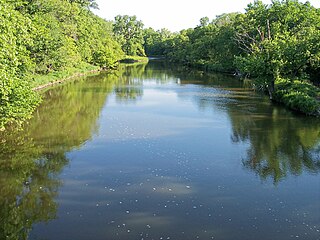
The Yellow Medicine River is a tributary of the Minnesota River, 107 miles (173 km) long, in southwestern Minnesota in the United States. Via the Minnesota River, it is part of the watershed of the Mississippi River, draining an area of 665 square miles (1,722 km²) in an agricultural region. Its name is a translation of the Dakota name for the river, pajutazee,,

The Bois de Sioux River drains Lake Traverse, the southernmost body of water in the Hudson Bay watershed of North America. It is a tributary of the Red River of the North and defines part of the western border of the U.S. state of Minnesota, and the eastern borders of North Dakota and South Dakota. It is about 41 miles (66 km) in length.

The Lester River, is a 19.3-mile-long (31.1 km) tributary of Lake Superior, in northeastern Minnesota in the United States. It drains an area of 58 square miles (150 km2).
Juni Lake is a lake in Brown County, Minnesota, in the United States. The lake is a 62.5 acre protected body of water.

The Chippewa River is a 153-mile-long (246 km) tributary of the Minnesota River in western and southwestern Minnesota in the United States. Via the Minnesota River, it is part of the watershed of the Mississippi River.

The Sand Hill River is a 101-mile-long (163 km) tributary of the Red River of the North in northwestern Minnesota in the United States. Via the Red River, Lake Winnipeg, and the Nelson River, it is part of the watershed of Hudson Bay, and drains an area of 475 square miles (1,230 km2).
The Yellow Bank River is a 12.0-mile-long (19.3 km) tributary of the Minnesota River in western Minnesota in the United States. It is formed by the confluence of two longer streams, the North Fork Yellow Bank River and the South Fork Yellow Bank River, which also flow in northeastern South Dakota. Via the Minnesota River, the Yellow Bank River is part of the watershed of the Mississippi River, draining an area of approximately 460 square miles (1,190 km²) in an agricultural region.
The Black River is a 33.7-mile-long (54.2 km) tributary of the Red Lake River of Minnesota in the United States. Via the Red Lake River, the Red River of the North, Lake Winnipeg, and the Nelson River, it is part of the Hudson Bay watershed.

The Brule River is a river of the U.S. state of Minnesota. The Brule River originates at Vista Lake in the Boundary Waters Canoe Area Wilderness and flows 40.4 miles (65.0 km) east and southeast, terminating at Lake Superior approximately 14 mi (23 km) northeast of Grand Marais, Minnesota, within the boundaries of Judge C. R. Magney State Park. A major tributary is the South Brule River, which rises at the east end of Brule Lake in the Boundary Waters Canoe Area Wilderness.
The Clearwater River is a 147-mile-long (237 km) tributary of the Red Lake River of Minnesota in the United States. Via the Red Lake River, the Red River of the North, Lake Winnipeg, and the Nelson River, it is part of the Hudson Bay watershed.

The Cloquet River is a 104-mile-long (167 km) river in Minnesota, United States. It is the main tributary of the Saint Louis River.
The Cross River is a 20.4-mile-long (32.8 km) river in northern Minnesota, the United States. It is a direct tributary of Lake Superior.
The Hill River is a 60.8-mile-long (97.8 km) tributary of the Lost River of western Minnesota in the United States. Via the Lost River, the Clearwater River, the Red Lake River, the Red River of the North, Lake Winnipeg, and the Nelson River, it is part of the Hudson Bay watershed.
Jack Creek is a 64-mile-long (103 km) stream in southern Minnesota in the United States. It is a tributary of Heron Lake, the outlet of which flows to the Des Moines River.
The Lost River is a 76.2-mile-long (122.6 km) tributary of the Clearwater River of northwestern Minnesota in the United States. Via the Clearwater River, the Red Lake River, the Red River of the North, Lake Winnipeg, and the Nelson River, it is part of the watershed of Hudson Bay.
Pipestone Creek is a 53.2-mile-long (85.6 km) river in southwestern Minnesota, having a center branch as well as branches named "North" and "South". The creek begins about 3 miles (5 km) north of Holland and flows southwesterly, roughly following MN State Highway 23 for much of its early existence. The creek approaches the town of Pipestone from the east, but turns northwesterly just before Highway 23 meets U.S. Highway 75, with the creek going under both highways in rapid succession. Flowing through Pipestone National Monument, the creek passes over Winnewissa Falls, and then enters the adjacent State DNR controlled "Pipestone Wildlike Management Area" where a small "impoundment" (dam) forms "Indian Lake". The creek continues northwesterly until turning southwesterly just east of County Road 53. On the west side of County Rd 53, and on the North side of Country Rd 5, it is joined by the North branch, and on the south side of the same road, the South branch joins. The creek continues southwesterly, and crosses the state line in South Dakota above the road known as 81st Street in Minnesota and 236th A Street in South Dakota. It does not travel far into South Dakota, but loops back into Minnesota, flowing into Split Rock Creek within a mile of the state line, this confluence about 3 miles north of Sherman, South Dakota, also being 3 miles south of Jasper, Minnesota. Split Rock Creek itself is a tributary of the Big Sioux River, which in turn flows via the Missouri River and Mississippi River to the Gulf of Mexico.
The Poplar River is a 58.4-mile-long (94.0 km) tributary of the Lost River of western Minnesota in the United States. Via the Lost River, the Clearwater River, the Red Lake River, the Red River of the North, Lake Winnipeg, and the Nelson River, it is part of the Hudson Bay watershed.
The Portage River is an 8.8-mile-long (14.2 km) tributary of the Moose Horn River in eastern Minnesota, United States. It flows west to the Moose Horn River, joining it at Moosehead Lake next to the city of Moose Lake. By the Moose Horn River, its waters flow to the Kettle River, St. Croix River, and ultimately the Mississippi River. Just to the east of the Portage River, Nemadji Creek flows east to the Nemadji River, a tributary of Lake Superior and part of the Saint Lawrence River basin.
The Rabbit River is a 31.5-mile-long (50.7 km) tributary of the Bois de Sioux River of Minnesota in the United States. Via the Bois de Sioux River, Red River of the North, Lake Winnipeg, and the Nelson River, it is part of the Hudson Bay watershed.
The Sturgeon River is a river of Minnesota, located in Koochiching County near Big Falls. It is a tributary of the Big Fork River.
