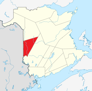
Carleton County is located in west-central New Brunswick, Canada.

Kent County is located in east-central New Brunswick, Canada. The county features a unique blend of cultures including Mi'kmaq, Acadian, and English. Some larger tourist attractions include the dune de Bouctouche, Kouchibouguac National Park, and Bonar Law Commons.

Northumberland County is located in northeastern New Brunswick, Canada.

Restigouche County is located in north-central New Brunswick, Canada. The county is named for the Restigouche River which flows through the county and is famous for its salmon pools, which have attracted wealthy American and Canadian tourists to the region's summer colonies for decades. Forestry dominates the local economy.

Sunbury County is located in central New Brunswick, Canada. A large military base is located in the western part of the county south of the town of Oromocto. The county also hosts forestry and mixed farming. Burton is the county shire town.

Victoria County is located in northwestern New Brunswick, Canada. Farming, especially of potatoes, is the major industry in the county. The area was named for Queen Victoria.

York County is located in west-central New Brunswick, Canada. The county contains the provincial capital, Fredericton. Outside the city, farming and forestry are two major industries in the county, which is bisected by the Saint John River. The Southwest Miramichi River flows through the northern section of the county.

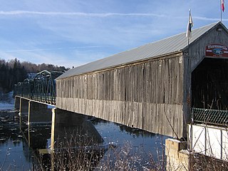
Hartland is a town in Carleton County, New Brunswick, Canada.
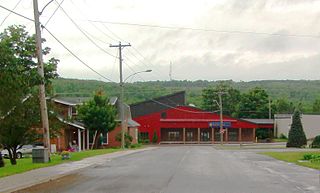
Florenceville-Bristol is a former town in the northwestern part of Carleton County, New Brunswick, Canada along the Saint John River. It held town status prior to 2023 and is now part of the town of Carleton North.
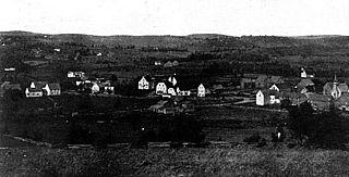
Centreville is a former village in Carleton County, New Brunswick, Canada. It held village status prior to 2023 and is now part of the town of Carleton North.
Kedgwick is a Canadian incorporated rural community in northern New Brunswick, Canada. On 1 January 2023, Kedgwick annexed a large area including the local service districts of St. Jean Baptiste – Menneval and White's Brook, with parts of two others; revised census figures have not been released.

Saint-André is community in Saint-André Parish, Madawaska County, New Brunswick, Canada. It was part of an eponymous rural community prior to 2023; the most recent census data is for the rural community. It is now part of the town of Grand Falls.
Centreville is a rural farming community in Kings County, Nova Scotia, Canada, located 10 kilometres north of Kentville on Route 359. As of 2021, the population was 1,159. Route 359 and Route 221 cross at the settlement. The village was once a junction on the Cornwallis Valley Railway branchline of the Dominion Atlantic Railway.
Somerville is a Canadian rural community in Carleton County, New Brunswick.
Bayside is a rural community in Charlotte County, New Brunswick, Canada. Bayside is located mainly on Route 127. Its shipping facilities are described under Charlotte County.

Debec is a community in Carleton County in the Canadian province of New Brunswick.
Glassville is a community in the Canadian province of New Brunswick located mainly at the intersection of Route 107 and Route 580. It is situated in Aberdeen, a parish of Carleton County.

Wilmot is a geographic parish in Carleton County, New Brunswick, Canada, located along the international border northwest of Woodstock.

Coldstream is a Canadian community in Brighton Parish, New Brunswick. It has a population of 102 people as of the 2021 census.
Benton was a local service district that was partially within Carleton County and partially within York County in the Canadian province New Brunswick. Straddling the boundaries of two parishes – Woodstock and Canterbury – the local service district was divided into two designated places by Statistics Canada.