Related Research Articles

The Java Sea is an extensive shallow sea on the Sunda Shelf, between the Indonesian islands of Borneo to the north, Java to the south, Sumatra to the west, and Sulawesi to the east. Karimata Strait to its northwest links it to the South China Sea. It is a part of the western Pacific Ocean.

Auki is the provincial capital of Malaita Province, Solomon Islands. It is situated on the northern end of Langa Langa Lagoon on the north-west coast of Malaita Island. It is one of the largest provincial towns in Solomon Islands. It was established as the administrative center for Malaita Province in 1909.
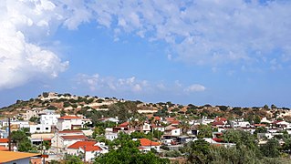
Avdimou is a small village on the south coast of Cyprus, lying partly within the British Overseas Territory of Akrotiri and Dhekelia. Up to 1974 it was inhabited by a majority of Turkish-Cypriots, but following the Turkish invasion the Turkish Cypriot residents evacuated to the North. Greek Cypriot refugees from the North, who were forcibly evacuated, replaced all the Turkish Cypriot residents.

Sentinel Island is a granite island, with an area of 10 ha, in south-eastern Australia. It is part of Tasmania’s Sentinel Island Group, lying in eastern Bass Strait off the north-west coast of Flinders Island in the Furneaux Group. Until 1985 it was used for grazing sheep.
Roydon Island is an island, with an area of 37 ha, in south-eastern Australia. It is part of Tasmania’s Pasco Island Group, lying in eastern Bass Strait off the north-west coast of Flinders Island in the Furneaux Group.
The Middle Pasco Islands comprise two similarly sized adjacent granite islands, with a combined area of 8.37 ha, in south-eastern Australia. They form part of Tasmania’s Pasco Island Group, lying in eastern Bass Strait off the north-west coast of Flinders Island in the Furneaux Group.
North Pasco Island is a granite island, with an area of 28 ha, in south-eastern Australia. It is part of Tasmania’s Pasco Island Group, lying in eastern Bass Strait off the north-west coast of Flinders Island in the Furneaux Group. It was previously used for sheep grazing.
Warrell Creek is a locality on the Mid North Coast of New South Wales, Australia. It is situated on the Pacific Highway 8 km south of the township of Macksville, 15.5 km west of the coastal village of Scotts Head and 11 km north of the Eungai locality.

The borders of the oceans are the limits of Earth's oceanic waters. The definition and number of oceans can vary depending on the adopted criteria. The principal divisions of the five oceans are the Pacific Ocean, Atlantic Ocean, Indian Ocean, Southern (Antarctic) Ocean, and Arctic Ocean. Smaller regions of the oceans are called seas, gulfs, bays, straits, and other terms. Geologically, an ocean is an area of oceanic crust covered by water.

Oku-iwa Glacier is a glacier flowing to the sea just west of Oku-iwa Rock on the coast of Queen Maud Land. Mapped from surveys and air photos by Japanese Antarctic Research Expedition (JARE), 1957–62, and named after nearby Oku-iwa Rock.
Dodman Island is an island 6.5 km (4.0 mi) long, lying 7.4 km (4.6 mi) south-east of Rabot Island and 18.5 km (11.5 mi) west of Ferin Head, off the west coast of Graham Land, Antarctica. The island was charted and named by the British Graham Land Expedition, 1934–37, under John Rymill.

Watom Island is an inhabited island in the Bismarck Sea in Papua New Guinea, located just off the mainland of the northern coast of New Britain, near Rabaul. It lies to the north-east of Urara Island. The island is almost entirely forested except for a few scattered settlements. The highest point of the island approaches 320 metres. Watom's Wall, a "classic wall dive well", located on the northern coast, is a notable diving location.
Lamassa is a village on the south-west coast of New Ireland, Papua New Guinea, south of Kabaman. Lamassa Island lies off the coast to the south in the bay of the same name. It is located in Konoagil Rural LLG.
Lambom is a village on the south-west coast of New Ireland, Papua New Guinea, south of Lamassa. Lambom Island lies off the coast. It is located in Konoagil Rural LLG.
Rosewood River, a perennial river of the Bellinger River catchment, is located in the Mid North Coast region of New South Wales, Australia.

Bobin Creek, a non–perennial stream of the Manning River catchment, is located in the Mid North Coast region of New South Wales, Australia.
Fishing Village/Kukum is a suburb of Honiara, Solomon Islands, and is located east of the main center and west of Panatina.
Awei is a small uninhabited island in Malampa Province of Vanuatu in the Pacific Ocean. It is a part of the Maskelyne Islands archipelago.
References
- ↑ United States. Hydrographic Office (1928). Pacific islands pilot. U. S. Govt. print. off. p. 537. Retrieved 31 December 2012.
4°42′S152°46′E / 4.700°S 152.767°E
| | This New Ireland Province geography article is a stub. You can help Wikipedia by expanding it. |