Landscheid (Tandel)

Last updated
Landscheid
Laaschent
Landscheid 01 Luxembourg.jpg
Skyline of Landscheid
Country Flag of Luxembourg.svg  Luxembourg
Canton Vianden
Commune Tandel
Population
  Total109
Time zone UTC+1 (CET)
  Summer (DST) UTC+2 (CEST)

Landscheid (Luxembourgish: Laaschent) is a village in northeastern Luxembourg. [1]

It is situated in the commune of Tandel and has a population of 107 as of 2024. [2]

Related Research Articles

<span class="mw-page-title-main">Kockelscheuer</span> Town in Luxembourg

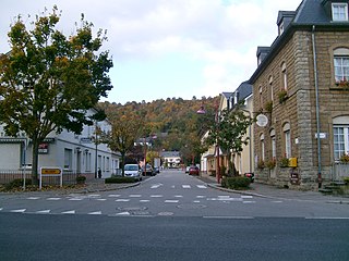
Kockelscheuer is a small town in the commune of Roeser, in southern Luxembourg. As of 2024, the town has a population of 284. The Fortis Championships Luxembourg are held at the Kockelscheuer Sport Centre, just to the north of the town. The 2014 IIHF World Championship Division III were held at the Kockelscheuer Ice Rink in April 2014. Each year Kockelscheuer held sponsored by BGL a tennis tournament, part of WTA.

<span class="mw-page-title-main">Lannen</span> Village in Redange, Luxembourg

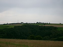
Lannen is a village in northwestern Luxembourg.

<span class="mw-page-title-main">Nagem</span> Village in Redange, Luxembourg

Nagem is a village in northwestern Luxembourg.

<span class="mw-page-title-main">Wallendorf-Pont</span>

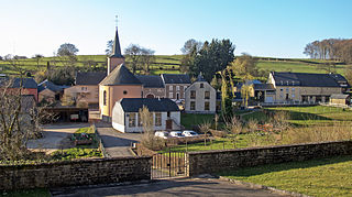
Wallendorf-Pont is a village in the commune of Reisdorf, in eastern Luxembourg. As of 2024, the town has a population of 268.

<span class="mw-page-title-main">Tao River</span> Tributary of Chinas Yellow River

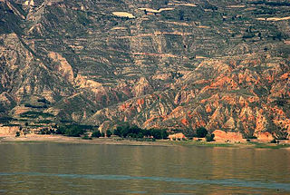
Tao River, Taohe River or Lu Chu is a right tributary of China's Yellow River. It starts in Xiqing Mountains (西倾山) near the Gansu–Qinghai border, flows eastward across Gannan Tibetan Autonomous Prefecture, and then northward more or less along the border between Dingxi Prefecture-level City in the east and Gannan and Linxia Prefectures in the west. It flows into the Yellow River near Liujiaxia Town, just upstream of Liujiaxia Dam.

Merscheid is a village in northeastern Luxembourg.

<span class="mw-page-title-main">Seltz (Tandel)</span> Village in Luxembourg

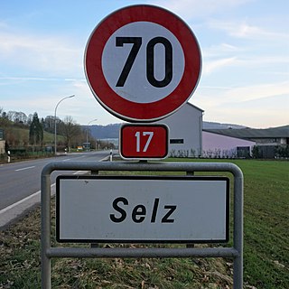
Seltz is a village in northeastern Luxembourg.

<span class="mw-page-title-main">Weiler (Putscheid)</span> Village in Luxembourg

Weiler is a village in northeastern Luxembourg.

<span class="mw-page-title-main">Brattert</span> Village in Luxembourg

Brattert is a village in northwestern Luxembourg.

<span class="mw-page-title-main">Ehner</span> Village in Luxembourg

Ehner is a village in northwestern Luxembourg.

<span class="mw-page-title-main">Eltz (Redange)</span> Village in Luxembourg

Eltz is a village in northwestern Luxembourg.

<span class="mw-page-title-main">Flatzbour</span> Village in Luxembourg

Flatzbour is a village in northwestern Luxembourg.

<span class="mw-page-title-main">Haut-Martelange</span> Village in Luxembourg

Haut-Martelange is a village in northwestern Luxembourg.

Heispelt is a village in northwestern Luxembourg.

<span class="mw-page-title-main">Huttange</span> Village in Luxembourg

Huttange is a village in northwestern Luxembourg.

<span class="mw-page-title-main">Kuborn</span> Village in Luxembourg

Kuborn is a village in northwestern Luxembourg.

<span class="mw-page-title-main">Levelange</span> Village in Luxembourg

Levelange is a hamlet in northwestern Luxembourg.

<span class="mw-page-title-main">Petit-Nobressard</span> Village in Luxembourg

Petit-Nobressard is a village in northwestern Luxembourg.

<span class="mw-page-title-main">Schwebach</span> Village in Luxembourg

Schwebach is a village in northwestern Luxembourg.

<span class="mw-page-title-main">Rindschleiden</span> Village in Luxembourg

Rindschleiden is a village in northwestern Luxembourg.

References

  1. "Geoportail". map.geoportail.lu. Retrieved 2022-05-24.
  2. "Registre national des personnes physiques RNPP : Population par localité". data.public.lu. 2024-01-07.

49°55′27″N6°07′42″E / 49.92417°N 6.12833°E / 49.92417; 6.12833