
Canso is a community in Guysborough County, on the north-eastern tip of mainland Nova Scotia, Canada, next to Chedabucto Bay. In January 2012, it ceased to be a separate town and as of July 2012 was amalgamated into the Municipality of the District of Guysborough.
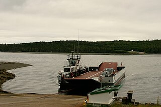
Country Harbour is a rural community in Guysborough County, Nova Scotia, Canada. The community is situated on a large deep natural harbour of the same name and is located along the province's Eastern Shore close to Canso, Nova Scotia.
Great Village is a rural community of approximately 500 people located along Trunk 2 and the north shore of Cobequid Bay in Colchester County, Nova Scotia. It is considered locally to incorporate the areas of Highland Village to the west and Scrabble Hill to the north northwest.
The Marine Drive is a designated scenic route along Nova Scotia's Eastern Shore. It closely follows the coast of the Atlantic Ocean and the Strait of Canso from the Canso Causeway to the junction of Route 322 and Highway 111 in Dartmouth.

Guysborough is an unincorporated Canadian community in Guysborough County, Nova Scotia.
Masstown, formerly Cobequid, is a farming community located approximately 17 kilometres (11 mi) from Truro, Nova Scotia.

Pomquet is a small Acadian village in Antigonish County, Nova Scotia, Canada.
Scotch Village is an unincorporated community on the Kennetcook River in the Canadian province of Nova Scotia, located in the Municipality of West Hants. This area was part of Newport Township at the time of settlement primarily by Rhode Island Planters in the early 1760s. It was referred to as “Scotchman’s Dyke” or “Scotch Village”, due to settlement of early families of Scottish descent. Prior to the arrival of the Planters, Scotch Village had been the home of Mi'kmaq and Acadians.
Aulds Cove is a community in the Canadian province of Nova Scotia, located in both Antigonish County and Guysborough County.
Mount Denson is a small community in the Canadian province of Nova Scotia, located in The Municipality of the District of West Hants in Hants County. The community is named after Mount Denson; the mid-eighteenth-century estate of Henry Denny Denson.
Cole Harbour is a community in the Canadian province of Nova Scotia, located in Guysborough County.
Port Felix is a small community in the Canadian province of Nova Scotia, located in the Municipality of the District of Guysborough in Guysborough County.
Isaac's Harbour North is a community in the Canadian province of Nova Scotia, located in the Municipality of the District of Guysborough in Guysborough County.
Pirate Harbour is a small community in the Canadian province of Nova Scotia, located in the Municipality of the District of Guysborough in Guysborough County. It is located just south of Mulgrave, Nova Scotia, on the west side of the Strait of Canso. The Mi'kmaq name for the place was Tesogwode, "the place where goods were sorted." The name Pirate Harbour was allegedly given because the space between the small island and the cove provided safe anchorage and a hiding place for pirates such as Captain Kidd and Paul Jones. A settlement was established in 1785, and early settlers included John Wilson and John Peeples, who each received a thousand-acre grant there in 1785.
Charlos Cove is a small Acadian community in the Canadian province of Nova Scotia, located in the Municipality of the District of Guysborough in Guysborough County.Charlos Cove is a fishing community. In 1760 the first Acadian settlers, came to Charlos Cove. St. Joseph's Roman Catholic Church built in 1876 is the centre of the community. In 1879 the first school house was built. In 1920 a two-room school was built which today is the parish hall.
Upper Big Tracadie is a small community in the Canadian province of Nova Scotia, located in Antigonish County. It is a rural, predominantly African Canadian community. Led by Thomas Brownspriggs, Black Nova Scotians who had settled at Chedabucto Bay behind the present-day village of Guysborough migrated to Tracadie (1787). The community is served by a community center and church, Tracadie United Baptist Church. It has close ties with the nearby community of Tracadie and Guysborough. According to one 19th century observer, this community was the most successful rural Black community in the province.
Starrs Point is a community in the Canadian province of Nova Scotia, located in Kings County two miles (3 km) northeast of Port Williams. Starrs Point faces the Minas Basin to the east and separates the mouths of the Cornwallis River and the Canard River. It is an agricultural area noted for apple orchards.
Lower River Inhabitants is a small community in the Canadian province of Nova Scotia, located in Richmond County in Cape Breton Island. The River Inhabitants is born out of tributaries from the hills of Kingsville, Inverness County. These tributaries join to first form two branches of the River Inhabitants in Kingsville, which join together at Princeville, Inverness County. The main river then flows down through the communities of Princeville, Riverside, Cleveland, Grantville, Hureauville, and Lower River Inhabitants/Evanston to join Inhabitants Bay, known locally as Basin Inhabitants or Whiteside Basin. Port Hawkesbury is the market town of Lower River Inhabitants communities.

A township in Nova Scotia, Canada, was an early form of land division and local administration during British colonial settlement in the 18th century. They were created as a means of populating the colony with people loyal to British rule. They were typically rural or wilderness areas of around 100,000 acres (400 km2) that would eventually include several villages or towns. Some townships, but not all, returned a member to the General Assembly of Nova Scotia; others were represented by the members from the county. Townships became obsolete by 1879 by which time towns and counties had become incorporated.

The Eastern Shore is a tourism region of the province of Nova Scotia, Canada. It provides two percent of the revenue for the province's tourism economy. One of its key features is an archipelago known as the 100 Wild Islands area.
