Pictures


Las Caritas ("The faces") is a collection of Indian inscriptions in a rock formation looking out over Lake Enriquillo in the Dominican Republic. The place is also called the Trono de Enriquillo ("Enriquillo's throne") because it is said the cacique Enriquillo used to camp here during his rebellion.


The Dominican Republic is a country in the West Indies that occupies the eastern five-eighths of Hispaniola. It has an area of 48,670 km2, including offshore islands. The land border shared with Haiti, which occupies the western three-eighths of the island, is 376 km long. The maximum length, east to west, is 390 km from Punta de Agua to Las Lajas, on the border with Haiti. The maximum width, north to south, is 265 km from Cape Isabela to Cape Beata. The capital, Santo Domingo, is located on the south coast.

The Arctic Archipelago, also known as the Canadian Arctic Archipelago, is an archipelago lying to the north of the Canadian continental mainland, excluding Greenland and Iceland.

This is a list of the extreme points of North America: the points that are highest and lowest, and farther north, south, east or west than any other location on the continent. Some of these points are debatable, given the varying definitions of North America.
This is a list of the extreme points of The Americas, the points that are farther north, south, east or west than any other location on the continent. The continent's southernmost point is often said to be Cape Horn, which is the southernmost point of the Chilean islands. The Americas cross 134° of longitude east to west and 124° of latitude north to south.

Jimaní is the capital and the second largest city of the Independencia Province of the Dominican Republic. It serves as one of the two main border crossings to Haiti, with a duty-free open-air marketplace operating on the border with Haiti. The town suffered damages in the flash flood of May 25, 2004, which killed many citizens during the night and washed away hundreds of homes.
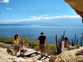
Lake Enriquillo is a hypersaline lake in the Dominican Republic located in the southwestern region of the country. Its waters are shared between the provinces of Bahoruco and Independencia, the latter of which borders Haiti. Lake Enriquillo is the largest lake in both the Dominican Republic and Hispaniola, as well as the entire Caribbean. It is also the lowest point for an island country.
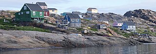
Tasiusaq is an island settlement in the Avannaata municipality in northwestern Greenland. It had 252 inhabitants in 2020. In Kalaallisut, the name means "looks like a lake".
Naajaat is a settlement in Avannaata municipality in northwestern Greenland. Former spellings include Naujât, Naujat, and Naajat. Located on a small island of the same name, the settlement has 49 inhabitants as of 2020.
Kangersuatsiaq, formerly Prøven, is an island settlement in the Avannaata municipality in northwestern Greenland. It had 130 inhabitants in 2020.

Carney Hospital was a small for-profit community teaching hospital located in the Dorchester neighborhood of Boston, Massachusetts. It was owned and operated by Dallas-based Steward Health Care.
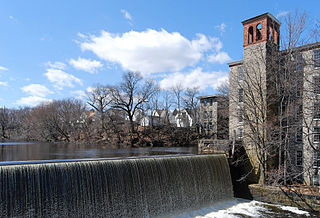
The South Branch Pawtuxet River is a river in the U.S. state of Rhode Island. It flows approximately 9.8 miles (15.8 km). There are 11 dams along the river's length.

The Bahoruco Mountain Range—Sierra de Bahoruco is a mountain range located in the far southwestern region of the Dominican Republic. It is within Pedernales, Independencia, Barahona, and Bahoruco Provinces. A large part of the area is protected within the Sierra de Bahoruco National Park, also a Biosphere reserve.
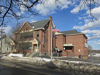
Saint John Regional School is a Roman Catholic primary school in Concord, New Hampshire serving approximately 250 students in prekindergarten through eighth grade.
Plain of the Cul-de-Sac is a fertile lowland on the island of Hispaniola. It extends from southeastern Haiti into the southwestern Dominican Republic, where it is known as the Hoya de Enriquillo.
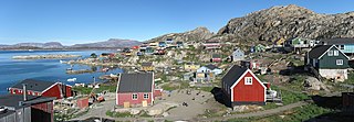
Aappilattoq is a settlement in the Avannaata municipality in northwestern Greenland, located on an island of the same name in the southern part of Upernavik Archipelago. Founded in 1805, the settlement had 149 inhabitants in 2020.

The Dominican city of Pedernales is the capital of the Pedernales Province, in the Dominican Republic. It is located in the southwest of the country, on the Dominican Republic–Haiti border, and has a crossing to the Haitian town of Anse-à-Pitres.
The Plantain Garden River is a river in the parish of St Thomas on the island of Jamaica. It is the only major river in Jamaica that does not flow in a northerly or southerly direction.
The following lists include the extreme and significant geographic points of the islands of the Caribbean Sea.
18°33′36″N71°41′16″W / 18.56°N 71.6877°W