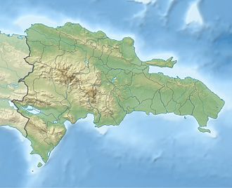
Lake Enriquillo

Last updated
Lake Enriquillo
Lake Enriquillo Dominican Republic 2.jpg
View of Lake Enriquillo from Las Caritas.
Dominican Republic relief location map.jpg
Red pog.svg
Lake Enriquillo
Lake Enriquillo sentinel-2.jpg
A satellite image of the lake (February 2023)
Location Hoya de Enriquillo
Coordinates 18°30′N71°35′W / 18.500°N 71.583°W / 18.500; -71.583
Lake type saline lake
Primary inflows Yaque del Sur
Primary outflows evaporation
Basin  countriesFlag of the Dominican Republic.svg  Dominican Republic
Surface area 375 km2 (145 sq mi) [1]
Max. depth52 m (171 ft)
Surface elevation−46 m (−151 ft)
Islands Isla Cabritos (Two former islands submerged by December 2011) [2]
SettlementsBoca de Cachón, La Descubierta, Postrer Río, Neyba, Duvergé, Jimaní
Official nameLago Enriquillo
Designated15 May 2002
Reference no.1179 [3]

Lake Enriquillo (Spanish : Lago Enriquillo) is a hypersaline lake in the Dominican Republic located in the southwestern region of the country. Its waters are shared between the provinces of Bahoruco and Independencia, the latter of which borders Haiti. Lake Enriquillo is the largest lake in both the Dominican Republic and Hispaniola, as well as the entire Caribbean. It is also the lowest point for an island country. [4]

Contents

Hydrology

Lake Enriquillo seen from Las Caritas National Park, near La Descubierta Lago Enriquillo1.jpg
Lake Enriquillo seen from Las Caritas National Park, near La Descubierta

Lake Enriquillo covers an area of 380 km2 (150 sq mi), [1] and is the lowest point for an island country, falling 46 m (151 ft) below sea level. [5] Its drainage basin includes ten minor river systems. The rivers that rise in the Neiba Mountains to the north (lower center and lower right of the image) are perennial. Those rivers that rise in the Baoruco Mountains to the south are intermittent. Lake Enriquillo has no outlet. The lake's water level varies because of a combination of storm-driven precipitation events and the region's high evaporation rate. Salinity in the lake can vary between 33 parts per thousand (comparable to seawater) and over 100 parts per thousand (hypersaline).

The region has a hot, semiarid climate. Annual rainfall is not evenly distributed, with peak precipitation occurring in May and October. The dry season is December through April when rainfall may be less than 20 mm (0.79 in). Due to the length of the lake, annual rainfall averages also vary at the eastern and western ends: 729 mm (28.7 in) on the northwest shore, and 508 mm (20.0 in) in the southeast. [6]

Flooding trend

Between 2004 and 2009, the lake doubled its surface area. Records for 2004 show the lake to be 164 km2 (63 sq mi); measurements from 2011 put the area at 350 km2 (140 sq mi). [7] [lower-alpha 1]

Reasons for the flooding are being debated, but may be a combination of several, including increases in rainfall in the region in recent years, increase of sediments going into the lake from run-off due to deforestation that are contributing to raising the lakebed, and milder temperatures, which are reducing the surface evaporation rate. [7]

Geography

The lake lies in a valley that stretches from near Port-au-Prince in Haiti to Bahia de Neiba in the Dominican Republic. The valley is known as the Hoya de Enriquillo in the Dominican Republic and as the Plain du Cul-de-Sac in Haiti. Parts of the depression are below sea level and are covered by large salt lakes, including Lake Enriquillo and Etang Saumâtre, Hispaniola's second largest lake (as well as Haiti's largest).

There historically were three islands in the lake: Barbarita, Islita, and Isla Cabritos. Once, when water levels dropped during dry spells, the islands were linked to one another by sandbars. As of December 2011, only Isla Cabritos remains; the other two islands were submerged by the rising levels of the lake. [2]

Geology

Las Caritas. LasCaritas DSCN0913.jpg
Las Caritas.

Lake Enriquillo is located within a linear depression that formed as a ramp basin between the Haiti fold and thrust belt to the north and the uplifted oceanic crust of the Massif de la Selle and Sierra de Bahoruco mountain ranges to the south. [9] The Enriquillo-Plantain Garden fault is a later strike-slip fault, cutting across the depression, which extends from Jamaica in the west to near Neiba in the Dominican Republic in the east. [lower-alpha 2] The valley, a former marine strait, was created around one million years ago when the water level fell and the strait was filled in by sediments of the Yaque del Sur River. [10] Due to this, tremors in the region are common.

Ecology

Rhinoceros iguana in Lake Enriquillo. Lizard Face (Unsplash).jpg
Rhinoceros iguana in Lake Enriquillo.

Lake Enriquillo is home to the largest population of American crocodiles ( Crocodylus acutus ) in the Caribbean. [10] Three species of native fish inhabit the lake: the blackbanded limia ( Limia melanonotata ), the Hispaniolan gambusia ( Gambusia hispaniolae ), and the Hispaniola pupfish ( Cyprinodon bondi ). [11] Two endangered iguanas endemic to Hispaniola live sympatrically on around the lake, as well as on Isla Cabritos: the Ricord's iguana (Cyclura ricordii), and the rhinoceros iguana (Cyclura cornuta). [12] The endemic Hispaniola racer (Haitiophis anomalus), a snake, is also native to the area. Among the numerous bird species found at the lake, American flamingos ( Phoenicopterus ruber ) are prominent; [13] flocks of flamingos are especially concentrated on Isla Cabritos and near the eastern end of the lake. [14]

Plants that thrive in arid places, such as cacti (especially the endemic Melocactus lemairei ), can be found here.

A national park was established in 1974 to preserve the area; in 2002 it was combined with two other parks to form the Jaragua-Bahoruco-Enriquillo Biosphere Reserve. [15]

History

The lake is named after Enriquillo, a cacique of the indigenous Taíno, who rebelled against the Spaniards in the early 16th century, and hid in the mountains south of the lake. [16] It was previously called Lake Xaragua, after the Taino chiefdom in which it was located.

Economy

South shore of Lake Enriquillo, looking northward to the Sierra de Neiba mountains; Independencia Province, Dominican Republic 07-05-11LagoEnriquilloDR.jpg
South shore of Lake Enriquillo, looking northward to the Sierra de Neiba mountains; Independencia Province, Dominican Republic

Land near Lake Enriquillo has long been used for agriculture, with crops such as bananas, sweet potatoes, and yuca being grown there, as well as pasture for cattle. The rising water levels have affected hundreds of nearby residents in townships bordering the lake, with abundant loss of agricultural land. [7] [17] [lower-alpha 3]

Important towns near the shores of Enriquillo include Neiba, the capital of Baoruco Province, on the northeast, and Jimaní, the capital of Independencia Province, at the western end of the lake near the border with Haiti. La Descubierta is the town nearest to the entrance of Lago Enriquillo and Isla Cabritos National Park. [10] The community of Boca de Cachon, near the lake and severely affected by the rising waters, has been the subject of government relocation efforts, including the construction of a new town further from the shores of Enriquillo. [17]

Lake Enriquillo has become an important tourist destination, both for national and foreign tourism. There is a group of possibly pre-Taino indigenous petroglyphs (locally named " las caritas ", "the faces"), from where there is a view of the lake. There are several small hotels in the nearby towns, usually used by travelers linked to commerce, and which are also used by tourists to see the attractions of the area. A transportation system with buses also links this community with Santo Domingo and other communities between them.

Notes

  1. In 2003 the lake was at its lowest level in more than 20 years. [8]
  2. This fault was responsible for the catastrophic 2010 Haiti earthquake.
  3. A 2014 article cites a government estimate of 40,000 acres (16,000 ha) of agricultural land lost. [17]

Related Research Articles

<span class="mw-page-title-main">Geography of the Dominican Republic</span>

The Dominican Republic is a country in the West Indies that occupies the eastern five-eighths of Hispaniola. It has an area of 48,670 km2, including offshore islands. The land border shared with Haiti, which occupies the western three-eighths of the island, is 376 km long. The maximum length, east to west, is 390 km from Punta de Agua to Las Lajas, on the border with Haiti. The maximum width, north to south, is 265 km from Cape Isabela to Cape Beata. The capital, Santo Domingo, is located on the south coast.

<span class="mw-page-title-main">Hispaniola</span> Caribbean island shared by the Dominican Republic and Haiti

Hispaniola is an island in the Caribbean that is part of the Greater Antilles and Antilles. Hispaniola is the most populous island in the West Indies, and the region's second largest in area, after the island of Cuba.

<span class="mw-page-title-main">Baoruco Province</span> Province of the Dominican Republic

Baoruco, alternatively spelt Bahoruco, is a province of the Dominican Republic located in the southwest of the country, part of the Enriquillo Region, along with the provinces of Barahona, Independencia and Pedernales. Before 1952 it included what is now Independencia Province.

<span class="mw-page-title-main">Pedernales Province</span> Province of the Dominican Republic

Pedernales is the southernmost province of the Dominican Republic, including the offshore island of Isla Beata. It was split from Barahona in 1957. Of its 2,074.53 km2, 1,374 km2 belongs to the Jaragua National Park. A third of its population is of Haitian origin, the highest ratio within the country.

<span class="mw-page-title-main">Étang Saumâtre</span> Salt lake in Plaine du Cul-de-Sac

Étang Saumâtre is the largest lake in Haiti and the second largest lake in the Dominican Republic and Hispaniola, after Lake Enriquillo. It is also known as Lake Azuéi ; its Taíno name was Yainagua.

<span class="mw-page-title-main">Jimaní</span> Place in Independencia, Dominican Republic

Jimaní is the capital and the second largest city of the Independencia Province of the Dominican Republic. It serves as one of the two main border crossings to Haiti, with a duty-free open-air marketplace operating on the border with Haiti. The town suffered damages in the flash flood of May 25, 2004, which killed many citizens during the night and washed away hundreds of homes.

<span class="mw-page-title-main">Enriquillo</span> Taíno cacique who rebelled against the Spaniards from 1519 to 1533

Enriquillo, also known as "Enrique" by the Spaniards, was a Taíno cacique who rebelled against the Spaniards between 1519 and 1533. Enriquillo's rebellion is the best known rebellion of the early Caribbean period. He was born on the shores of Lake Jaragua and was part of the royal family of Jaragua. Enriquillo's aunt Anacaona was Queen of Jaragua, and his father Magiocatex was the crown prince. He is considered a hero in the modern day Dominican Republic and Haiti for his resistance in favor of the indigenous peoples. Dominican friar Bartolomé de las Casas, who documented and rallied against Spanish abuse of the native peoples, wrote sympathetically of Enriquillo.

<span class="mw-page-title-main">Neiba</span> Place in Baoruco, Dominican Republic

Neiba is a city in the southwest of the Dominican Republic. It is the capital city of the Baoruco province, and is located 180 kilometres west of the national capital, Santo Domingo, close to the shore of Lake Enriquillo, the largest lake in the West Indies.

<span class="mw-page-title-main">Artibonite River</span> River in Dominican Republic, Haiti

The Artibonite River is the longest river in Haiti, and the longest on the island of Hispaniola. It is also the second-longest river in the Caribbean, behind the Cauto River in Cuba. Forming part of the international border between Haiti and the Dominican Republic, the river's sources are in the Cordillera Central in the Dominican Republic (68 km); however, most of its length lies in Haiti (253 km).

<span class="mw-page-title-main">Rhinoceros iguana</span> Species of iguana endemic to the Caribbean

The rhinoceros iguana is an endangered species of iguana that is endemic to the Caribbean island of Hispaniola and its surrounding islands. A large lizard, they vary in length from 60 to 136 centimetres, and skin colours range from a steely grey to a dark green and even brown. Their name derives from the bony-plated pseudo-horn or outgrowth which resembles the horn of a rhinoceros on the iguana's snout. It is known to coexist with the Ricord's iguana ; the two species are the only taxa of rock iguana to do so.

<i>Cyclura ricordii</i> Species of iguana endemic to Hispaniola

Cyclura ricordii, also known as Ricord's ground iguana or Ricord's rock iguana, is an endangered species of medium-sized rock iguana, a large herbivorous lizard. It is endemic to the island of Hispaniola. It is known to coexist with the nominate subspecies of the rhinoceros iguana ; the two species are the only taxa of rock iguana to do so. The natural habitats of its three subpopulations are hot, dry, wooded savanna on limestone with access to soil and sandy flats in southern Hispaniola. It is threatened by predation by introduced predators and habitat loss, due to overgrazing and charcoal manufacture.

<span class="mw-page-title-main">Pedernales, Dominican Republic</span> Capital of Pedernales Province, Dominican Republic

The Dominican city of Pedernales is the capital of the Pedernales Province, in the Dominican Republic. It is located in the southwest of the country, on the Dominican Republic–Haiti border, and has a crossing to the Haitian town of Anse-à-Pitres.

<span class="mw-page-title-main">Lago de Oviedo</span> Saltwater lake in Jaragua National Park, Pedernales Province

Lago de Oviedo, also known as Laguna de Oviedo, is a saltwater lake in Jaragua National Park, Pedernales Province, Dominican Republic.

Coccothrinax jimenezii is a fan palm which is endemic to the island of Hispaniola in the Caribbean. First formally described in 2013, the species is only known from two small populations, and is considered critically endangered.

<span class="mw-page-title-main">Sierra de Bahoruco National Park</span>

The Sierra de Bahoruco National Park is an environmentally protected national park located in the South-western region of Dominican Republic. It was created in 1983 by Presidential Decree during the presidency of Salvador Jorge Blanco.

<i>Melocactus lemairei</i> Species of cactus endemic to Hispaniola

Melocactus lemairei is a species of cactus endemic to the Caribbean island of Hispaniola. It is named after French botanist and cactus expert Charles Antoine Lemaire.

<span class="mw-page-title-main">Hispaniolan dry forests</span> Ecoregion on Hispaniola

The Hispaniolan dry forests are a tropical dry broadleaf forest ecoregion on the island of Hispaniola. They cover 15,123 km2 (5,839 sq mi), around 20% of the island's area.

<span class="mw-page-title-main">Enriquillo wetlands</span> Ecoregion on Hispaniola

The Enriquillo wetlands are a flooded grasslands and savannas ecoregion on the island of Hispaniola. They cover about 628 km2 (242 sq mi) around several low-lying lakes in southwestern Hispaniola in both the Dominican Republic and Haiti.

<i>Limia sulphurophila</i> Species of fish

Limia sulphurophila, also known as sulphur limia, is a livebearing fish in the family Poeciliidae. It is endemic to the Dominican Republic in the island of Hispaniola.

References

  1. 1 2 "UE otorga 200.000 euros a afectados por la crecida Lago Enriquillo" [EU gives €200,000 to people affected by the flooding of Lake Enriquillo]. Listín Diario (in Spanish). Agencia EFE. 20 October 2011. Archived from the original on 7 April 2014. Retrieved 19 July 2012. ... según el Instituto Nacional de Recursos Hidráulicos (INDHRI), su superficie ha alcanzado 37.500 hectáreas. [... according to the National Institute of Water Resources (INDHRI), the area has reached 37,500 hectares.]
  2. 1 2 Peguero, Adriana (8 December 2011). "Lago Enriquillo amenaza casas de sus alrededores" [Homes around Lake Enriquillo threatened]. Listín Diario (in Spanish). Archived from the original on 2 February 2014. Retrieved 21 December 2011. ... investigador Jorge E. Rodríguez resaltó que han encontrado que el lago Enriquillo ha aumentado en 100%, duplicando su tamaño desde el año 1984, ya que registra una superficie de 350 kilómetros cuadrados, frente a 172 kilómetros cuadrados. [... researcher Jorge E. Rodriguez stressed that he found Lake Enriquillo has increased by 100%, doubling in size since 1984 as it records an area of 350 square kilometers, compared to 172 square kilometers.]
  3. "Lago Enriquillo". Ramsar Sites Information Service. Retrieved 25 April 2018.
  4. "Highest and Lowest Points of Countries of the World".
  5. Romero Luna, Eva Joelisa; Poteau, Dina (August 2011). Water Level Fluctuations of Lake Enriquillo and Lake Saumatre in Response to Environmental Changes (PDF) (Thesis). Cornell University . Retrieved 4 December 2012.
  6. Buck, David G.; Brenner, Mark; Hodell, David A.; Curtis, Jason H.; et al. (2005). "Physical and chemical properties of hypersaline Lago Enriquillo, Dominican Republic" (PDF). Internationale Vereinigung für Theoretische und Angewandte Limnologie Verhandlungen. 29 (2): 725–731. Retrieved 18 February 2015.
  7. 1 2 3 Ramírez Mac-Lean, Mariana (16 January 2012). "La vida después del agua" [Life after water]. Diario Libre (in Spanish). Retrieved 18 February 2015.
  8. Steenhuis, T.S.; Hrnčíř, M.; Poteau, D.; Romero Luna, E.J.; et al. (2013). "A Saturated Excess Runoff Pedotransfer Function for Vegetated Watersheds" (PDF). Vadose Zone Journal. 12 (4): vzj2013.03.0060. doi:10.2136/vzj2013.03.0060.
  9. Saint Fleur N.; Feuillet N.; Grandin R.; Jacques E.; Weil-Accardo J.; Klinger Y. (2015). "Seismotectonics of southern Haiti: A new faulting model for the 12 January 2010 M7.0 earthquake" (PDF). Geophysical Research Letters. 42 (23): 10, 273–10, 281. doi: 10.1002/2015GL065505 .
  10. 1 2 3 Baker, Christopher P. (2008). National Geographic Traveler: Dominican Republic . National Geographic Society. pp. 44, 189–191. ISBN   978-1-4262-0232-2.
  11. Haney, Dennis C.; Walsh, Stephen J. (2003). "Influence of Salinity and Temperature on the Physiology of Limia melanonotata (Cyprinodontiformes: Poeciliidae): A Search for Abiotic Factors Limiting Insular Distribution in Hispaniola" (PDF). Caribbean Journal of Science. 39 (3): 327–337.
  12. Lemm, Jeffrey; Alberts, Allison C. (2011). Cyclura: Natural History, Husbandry, and Conservation of West Indian Rock Iguanas. Academic Press. pp. 60–61. ISBN   978-1-4377-3517-8.
  13. Wauer, Roland H. (2010). A Birder's West Indies: An Island-by-Island Tour. University of Texas Press. p. 57. ISBN   978-0-292-78672-1.
  14. Paulino, M. M.; Mejia, D. A.; Latta, S. C. (2013). "A new review of the status of the Caribbean Flamingo Phoenicopterus ruber in the Dominican Republic and Haiti" (PDF). Grupo Para la Conservacion del Flamenco del Caribe. Archived from the original (PDF) on 20 February 2015. Retrieved 19 February 2015.
  15. "Jaragua-Bahoruco-Enriquillo Biosphere Reserve". Grupo Jaragua. 6 July 2006. Retrieved 2015-02-21.
  16. Harvey, Sean (2009). The Rough Guide to the Dominican Republic. Rough Guides Limited. p. 307. ISBN   978-1-85828-811-6.
  17. 1 2 3 Archibold, Randal C. (11 January 2014). "Rising Tide Is a Mystery That Sinks Island Hopes". New York Times. Retrieved 19 February 2015.