Centre (French) or Sant is a central department of Haiti, located in the center of the country along the border with the Dominican Republic. As of 2015, its estimated population was 746,236. Its capital is Hinche.
Guacanagarix was one of five Taíno caciques of the Caribbean island henceforth known as Hispaniola at the arrival of the Europeans in 1492. This was contemporaneous with the first of the voyages of Christopher Columbus.

Pedernales is the southernmost province of the Dominican Republic, including the offshore island of Isla Beata. It was split from Barahona in 1957. Of its 2,074.53 km2, 1,374 km2 belongs to the Jaragua National Park. A third of its population is of Haitian origin, the highest ratio within the country.
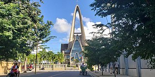
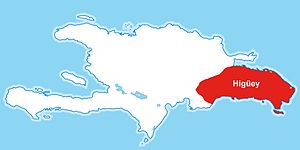
Higüey, or in full Salvaleón de Higüey, is the capital city of the eastern La Altagracia Province, in the Dominican Republic, and the eighth largest city of that country. The Yuma River flows through the urban areas of Higüey.
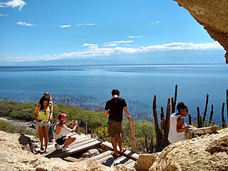
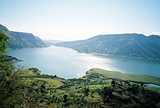
Lake Enriquillo is a hypersaline lake in the Dominican Republic located in the southwestern region of the country. Its waters are shared between the provinces of Bahoruco and Independencia, the latter of which borders Haiti. Lake Enriquillo is the largest lake in both the Dominican Republic and Hispaniola, as well as the entire Caribbean. It is also the lowest point for an island country.
At the time of first contact between Europe and the Americas, the Indigenous peoples of the Caribbean included the Taíno of the northern Lesser Antilles, most of the Greater Antilles and the Bahamas, the Kalinago of the Lesser Antilles, the Ciguayo and Macorix of parts of Hispaniola, and the Guanahatabey of western Cuba. The Kalinago have maintained an identity as an Indigenous people, with a reserved territory in Dominica.

Enriquillo, also known as "Enrique" by the Spaniards, was a Taíno cacique who rebelled against the Spaniards between 1519 and 1533. Enriquillo's rebellion is the best known rebellion of the early Caribbean period. He was born on the shores of Lake Jaragua and was part of the royal family of Jaragua. Enriquillo's aunt Anacaona was Queen of Jaragua, and his father Magiocatex was the crown prince. He is considered a hero in the modern day Dominican Republic for his resistance in favor of the indigenous peoples. Dominican friar Bartolomé de las Casas, who documented and rallied against Spanish abuse of the native peoples, wrote sympathetically of Enriquillo.
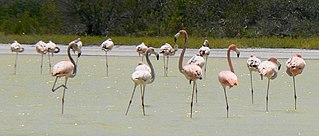
Jaragua National Park is a Dominican national park located in Pedernales Province, in the extreme southwest of the Dominican Republic. Jaragua has a total area of 1,374 km², the largest such protected area in the Caribbean.
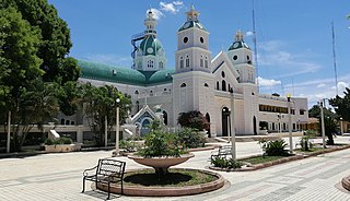
San Juan de la Maguana is a city and municipality in the western region of the Dominican Republic and capital of the San Juan province. It was one of the first cities established on the island; founded in 1503, and was given the name of San Juan de la Maguana by San Juan Bautista and the Taino name of the valley: Maguana. The term Maguana means "the first stone, the unique stone".

Anacaona (1474?–1504), or Golden Flower, was a Taíno cacica, or female cacique (chief), religious expert, poet and composer born in Xaragua. Before the arrival of Christopher Columbus in 1492, Ayiti or Quisqueya to the Taínos was divided into five kingdoms, i.e., Xaragua, Maguana, Higüey, Maguá, and Marién. Anacaona was born into a family of caciques. She was the sister of Bohechío, the ruler of Xaragua.

Guarionex was a Taíno cacique from Maguá in the island of Hispaniola at the time of the arrival of the Europeans to the Western Hemisphere in 1492. He was the son of cacique Guacanagarix, the great Taíno prophet who had the vision of the coming of the Guamikena.

Bohechío is a town in the San Juan province of the Dominican Republic. It is located northeast of the km 25 of Azua – San Juan road at a distance of 26.5 km and 43 km from San Juan Province, 205 km from Santo Domingo and 92 km of the Province Azua, nestled between mountains at the foot of the Cordillera Central. It has a land area of 428.33 km2.

The cacicazgo of Jaragua, also written as Xaragua, was one of the five chiefdoms in the island of Hispaniola, stretching across the southwest; delimited to the north by the cacicazgo of Marién, to the south by the Caribbean Sea, to the east by the cacicazgo of Maguana, and to the west by the Jamaica Channel. Jaragua emerged as the union of two previous cacicazgos, Zui and Yáquimo.

The Captaincy General of Santo Domingo was the first Capitancy in the New World, established by Spain in 1492 on the island of Hispaniola. The Capitancy, under the jurisdiction of the Real Audiencia of Santo Domingo, was granted administrative powers over the Spanish possessions in the Caribbean and most of its mainland coasts, making Santo Domingo the principal political entity of the early colonial period.
The Jaragua massacre of July 1503, was the killing of indigenous natives from the town of Xaragua on the island of Hispaniola. It was ordered by the Spanish governor of Santo Domingo, Nicolás de Ovando, and carried out by Alonso de Ojeda during a native celebration that was held in the village of Guava near present-day Léogane in the territory of Jaragua of the Cacique Anacaona.

Ciguayo (Siwayo) was the language of the Samaná Peninsula of Hispaniola at the time of the Spanish Conquest. The Ciguayos appear to have predated the agricultural Taíno who inhabited much of the island. The language appears to have been moribund at the time of Spanish contact, and within a century it was extinct.
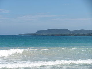
The Ciguayos were a group of Indigenous people who inhabited the Samaná Peninsula and its adjoining regions in the present-day Dominican Republic. The Ciguayos appear to have predated the agricultural Taíno who inhabited much of the island. Ciguayo was spoken on the northeastern coast of the Magua region from Nagua southward to at least the Yuna River, and throughout all of the Samana Peninsula.
Caonabo was a Taíno cacique (chieftain) of Hispaniola at the time of Christopher Columbus's arrival to the island. He was known for his fighting skills and his ferocity. He was married to Anacaona, who was the sister of another cacique named Bohechío.

Cotubanamá National Park is located on the lower southeastern coast of the Dominican Republic, spanning across the provinces of La Altagracia and La Romana with an area of 791.9 sq. kilometers which includes a range of dense humid and dry subtropical forests, mangroves, beaches, and caves.


