The Dominican Republic is a country in the West Indies that occupies the eastern five-eighths of Hispaniola. It has an area of 48,670 km2, including offshore islands. The land border shared with Haiti, which occupies the western three-eighths of the island, is 376 km long. The maximum length, east to west, is 390 km from Punta de Agua to Las Lajas, on the border with Haiti. The maximum width, north to south, is 265 km from Cape Isabela to Cape Beata. The capital, Santo Domingo, is located on the south coast.

Hispaniola is an island between Cuba and Puerto Rico in the Greater Antilles of the Caribbean. Hispaniola is the most populous island in the West Indies, and the second-largest by land area, after Cuba. The 76,192-square-kilometre (29,418 sq mi) island is divided into two separate sovereign countries: the Spanish-speaking Dominican Republic (48,445 km2 to the east and the French and Haitian Creole–speaking Haiti (27,750 km2 to the west. The only other divided island in the Caribbean is Saint Martin, which is shared between France and the Netherlands.

Baoruco, alternatively spelt Bahoruco, is a province of the Dominican Republic located in the southwest of the country, part of the Enriquillo Region, along with the provinces of Barahona, Independencia and Pedernales. Before 1952 it included what is now Independencia Province.

Pedernales is the southernmost province of the Dominican Republic, including the offshore island of Isla Beata. It was split from Barahona in 1957. Of its 2,074.53 km2, 1,374 km2 belongs to the Jaragua National Park. A third of its population is of Haitian origin, the highest ratio within the country.

Jimaní is the capital and the second largest city of the Independencia Province of the Dominican Republic. It serves as one of the two main border crossings to Haiti, with a duty-free open-air marketplace operating on the border with Haiti. The town suffered damages in the flash flood of May 25, 2004, which killed many citizens during the night and washed away hundreds of homes.
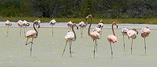
Lake Enriquillo is a hypersaline lake in the Dominican Republic located in the southwestern region of the country. Its waters are shared between the provinces of Bahoruco and Independencia, the latter of which borders Haiti. Lake Enriquillo is the largest lake in both the Dominican Republic and Hispaniola, as well as the entire Caribbean. It is also the lowest point for an island country.

Enrique (1498-1535), best known as Enriquillo, was a Taíno cacique who rebelled against the Spaniards between 1519 and 1533. Enriquillo's rebellion is the best known rebellion of the early Caribbean period. He was born on the shores of Lake Jaragua and was part of the royal family of Jaragua. Enriquillo's aunt Anacaona was Queen of Jaragua, and his father Magiocatex was the crown prince. He is considered a hero in the modern day Dominican Republic for his resistance in favor of the indigenous peoples. Dominican friar Bartolomé de las Casas, who documented and rallied against Spanish abuse of the native peoples, wrote sympathetically of Enriquillo.
Neiba is a city in the southwest of the Dominican Republic. It is the capital city of the Baoruco province, and is located 180 kilometres west of the national capital, Santo Domingo, close to the shore of Lake Enriquillo, the largest lake in the West Indies.
Jaragua National Park is a Dominican national park located in Pedernales Province, in the extreme southwest of the Dominican Republic. Jaragua has a total area of 1,374 km², the largest such protected area in the Caribbean.

Cyclura ricordii, also known as Ricord's ground iguana or Ricord's rock iguana, is an endangered species of medium-sized rock iguana, a large herbivorous lizard. It is endemic to the island of Hispaniola. It is known to coexist with the nominate subspecies of the rhinoceros iguana ; the two species are the only taxa of rock iguana to do so. The natural habitats of its three subpopulations are hot, dry, wooded savanna on limestone with access to soil and sandy flats in southern Hispaniola. It is threatened by predation by introduced predators and habitat loss, due to overgrazing and charcoal manufacture.

Villa Jaragua is a town and a municipality in the Bahoruco province of the Dominican Republic, close to the Lake Enriquillo.

The following outline is provided as an overview of and topical guide to the Dominican Republic:
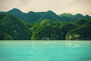
Los Haitises National Park is a national park located on the remote northeast coast of the Dominican Republic that was established in 1976. It consists of a limestone karst plateau with conical hills, sinkholes and caverns, and there is a large area of mangrove forest on the coast. Other parts of the park are clad in subtropical humid forest and the area has an annual precipitation of about 2,000 mm (79 in). The park contains a number of different habitats and consequently has a great diversity of mammals and birds, including some rare species endemic to the island. Some of the caverns contain pictograms and petroglyphs. The park has become a popular ecotourism destination but the number of tourists allowed to visit is limited.

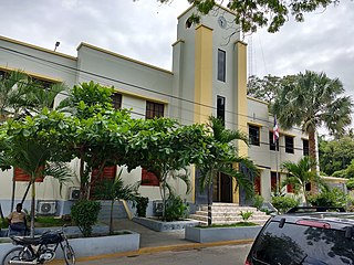
The Dominican city of Pedernales is the capital of the Pedernales Province, in the Dominican Republic. It is located in the southwest of the country, on the Dominican Republic–Haiti border, and has a crossing to the Haitian town of Anse-à-Pitres.
Under UNESCO’s Man and the Biosphere Programme, there are 125 biosphere reserves recognized as part of the World Network of Biosphere Reserves in Latin America and the Caribbean. These are distributed across 21 countries in the region.

The chiefdoms of Hispaniola were the primary political units employed by the Taíno inhabitants of Hispaniola in the early historical era. At the time of European contact in 1492, the island was divided into five chiefdoms or cacicazgos, each headed by a cacique or paramount chief. Below him were lesser caciques presiding over villages or districts and nitaínos, an elite class in Taíno society.
Coccothrinax jimenezii is a fan palm which is endemic to the island of Hispaniola in the Caribbean. First formally described in 2013, the species is only known from two small populations, and is considered critically endangered.

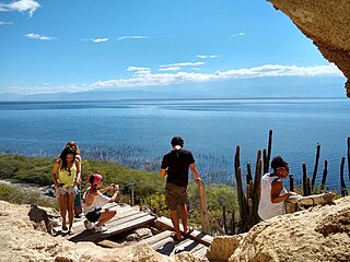
Cotubanamá National Park is located on the lower southeastern coast of the Dominican Republic, spanning across the provinces of La Altagracia and La Romana with an area of 791.9 sq. kilometers which includes a range of dense humid and dry subtropical forests, mangroves, beaches, and caves.
The Jaragua forest lizard is a species of lizard of the family Diploglossidae endemic to the Dominican Republic on the Caribbean island of Hispaniola.