List of municipalities of the Dominican Republic

Last updated

The municipalities of the Dominican Republic are, after the regions and the provinces, the third level of the political and administrative division of the Dominican Republic.

Contents

The division of provinces into municipalities ( municipios ) is established in the Constitution [1] and further regulated by Law 5220 on the Territorial Division of the Dominican Republic. [2] It was enacted in 1959 and has been frequently amended to create new provinces, municipalities and lower-level administrative units.

Municipalities may be further divided into secciones (literally: sections) and parajes (literally: places or neighborhoods). [3] Municipal districts (distritos municipales) may be formed in the case of municipalities with several urban centres. [4]

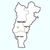
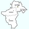
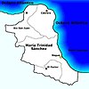
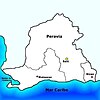
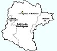
The provinces as the second level of political and administrative division contain at least two municipalities. The Distrito Nacional, which is neither a municipality nor a province, consists of only one municipality, Santo Domingo (Constitution: "the city of Santo Domingo de Guzmán is the Distrito Nacional" [5] ).

Administration

According to the Constitution [6] and the law, [7] the municipalities are administered by the municipality's Municipal Office ( ayuntamiento ), which is a legal entity in its own right consisting of two bodies: the alcadía (Mayor's Office), with the alcalde (Mayor), and the Municipal Council (concejo de regidores), with at least five members (regidores). The Municipal Council is an exclusively normative, regulatory and supervisory body, the Mayor's Office the executive one. [8] The mayor is a voting member of the Municipal Council. [9] He and his deputy, as well as the regidores and their deputies, are elected by the electorate on the occasion of elections held nationally every four years. [6]

If a municipality consists of more than one urban center, the additional centres may be elevated to the status of municipal district (distrito municipal), [4] with the remaining district of the municipality called cabecera (main municipality). [10] The administration of the municipal district is the responsibility of a municipal district office (junta municipal), which includes the director (director) and a municipal district council (junta de vocales) with at least three members (vocales). [6] The director and his deputy, as well as the vocales and their deputies, are elected by the electorate on the occasion of elections held nationally every four years. [11] They represent the municipal district to the municipality and are subordinate to it. [4]

If a municipality is further divided into secciones, the municipal council appoints an alcalde pedáneo for each of them. [12] He reports to the mayor or, if his sección is in a municipal district, to its director. If the municipality is further divided into parajes, the municipal council appoints an ayudante del alcalde pedáneo for each of them. [13]

Municipalities are often given special designations because of their number of inhabitants: ciudad (city) in the case of urban centers with over 10,000 inhabitants or the capital of a province, villas (town) in the case of towns with over 1,000 inhabitants or seats of a local government, poblados (village) in the case of villages.

Municipalities

The following is a list of the 158 [14] municipalities ( municipios ) of the Dominican Republic as of June 1, 2021. [15]

NameProvinceCreatedPopulation
Census 2010 [16]
Area (km2)DensityOld names /
Full names
Altamira Puerto Plata January 27, 189522,323179.32124/km2
Arenoso Duarte January 1, 199419,299142.20136/km2
Azua Azua March 5, 1845143,934416.30346/km2Azua de Compostela
Baitoa [17] Santiago February 27, 201623,23345.22514/km2
Bajos de Haina San Cristóbal October 27, 1980142,32338.493,698/km2
Baní Peravia March 5, 1845201,292540.40372/km2
Bánica Elías Piña March 5, 184512,123265.9846/km2
Barahona Barahona March 5, 1845183,232163.021,124/km2Santa Cruz de Barahona
Bayaguana Monte Plata March 5, 184540,912877.9947/km2
Bisonó Santiago October 20, 196175,67392.60817/km2Villa Bisonó
Boca Chica Santo Domingo January 1, 2003201,292145.671,382/km2
Bohechío San Juan March 2, 197612,332407.8230/km2
Bonao Monseñor Nouel March 5, 1845200,102664.37301/km2
Cabral Barahona September 9, 190719,293149.30129/km2
Cabrera María Trinidad Sánchez February 27, 187039,929297.58134/km2Tres Amarras
Cambita Garabitos San Cristóbal May 2, 198742,123202.52208/km2
Castañuelas Monte Cristi February 27, 197621,22380.90262/km2
Castillo Duarte September 9, 190726,455133.68198/km2
Cayetano Germosén Espaillat January 1, 19949,12017.75514/km2
Cevicos Sánchez Ramírez July 6, 188921,232305.6469/km2
Comendador Elías Piña April 25, 188050,349252.93199/km2
Constanza La Vega March 9, 185875,344848.7989/km2
Consuelo San Pedro de Macorís September 19, 199654,324131.52413/km2
Cotuí Sánchez Ramírez March 5, 1845154,234619.88249/km2
Cristóbal Independencia August 3, 20039,912151.7265/km2
Dajabón Dajabón March 5, 184569,953253.41276/km2
Duvergé Independencia July 27, 189363,874521.64122/km2
El Cercado San Juan September 9, 190730,132283.05106/km2
El Factor María Trinidad Sánchez April 25, 198832,323149.23217/km2
El Llano Elías Piña March 1, 197610,202104.4998/km2
El Peñón Barahona December 16, 20025,02329.02173/km2
El Pino Dajabón January 18, 200214,20388.35161/km2
El Seibo El Seibo March 5, 1845119,2831,344.3389/km2Santa Cruz del Seibo
El Valle Hato Mayor March 9, 197612,343161.1277/km2
Enriquillo Barahona September 9, 190719,988354.1056/km2
Esperanza Valverde September 9, 1907121,233215.24563/km2
Estebanía Azua November 20, 20019,887159.2062/km2
Fantino Sánchez Ramírez December 15, 196129,88895.97311/km2
Fundación Barahona July 16, 200312,12352.59231/km2
Galván Bahoruco July 1, 199821,019214.6698/km2
Gaspar Hernández Espaillat September 9, 190760,394366.18165/km2
Guananico Puerto Plata November 30, 19929,03357.32158/km2
Guayabal Azua August 3, 200410,003262.8738/km2
Guayacanes San Pedro de Macorís May 3, 200635,034129.78270/km2
Guaymate La Romana October 1, 195923,323309.8075/km2
Guayubín Monte Cristi May 9, 185560,934899.2668/km2
Hato Mayor del Rey Hato Mayor March 5, 1845102,039659.65155/km2
Higüey La Altagracia March 5, 1845422,9342,029.14208/km2Salvaleón de Higüey
Hondo Valle Elías Piña August 12, 195515,445120.63128/km2
Hostos Duarte March 5, 200414,53378.23186/km2Eugenio María de Hostos
Imbert Puerto Plata September 9, 190734,245170.70201/km2Blanco
Jamao al Norte Espaillat May 25, 200112,213115.48106/km2
Jánico Santiago September 9, 190733,233403.2082/km2
Jaquimeyes Barahona July 7, 20048,374178.6347/km2
Jarabacoa La Vega March 9, 185872,019665.88108/km2
Jima Abajo La Vega September 19, 199650,394132.72380/km2
Jimaní Independencia June 4, 194520,192458.4944/km2
Juan de Herrera San Juan June 10, 199216,543146.85113/km2
Juan Santiago Elías Piña May 9, 20057,472107.1570/km2
La Ciénaga Barahona July 30, 200412,334112.30110/km2
La Descubierta Independencia June 27, 193813,233206.8564/km2
La Mata Sánchez Ramírez August 7, 200250,394174.64289/km2
La Romana La Romana February 27, 1897239,987185.521,294/km2
La Vega La Vega March 5, 1845310,203639.85485/km2
Laguna Salada Valverde March 6, 197645,546184.54247/km2
Las Charcas Azua September 15, 200119,877251.2379/km2
Las Guáranas Duarte July 22, 199829,19386.49338/km2
Las Matas de Farfán San Juan March 5, 184572,303636.64114/km2
Las Matas de Santa Cruz Monte Cristi March 18, 198514,234109.51130/km2
Las Terrenas Samaná September 19, 199645,944113.10406/km2
Las Yayas de Viajama Azua May 1, 200124,573472.5452/km2
Licey al Medio Santiago July 13, 198449,43227.041,828/km2
Loma de Cabrera Dajabón June 27, 193823,234238.5197/km2
Los Alcarrizos Santo Domingo January 31, 2005345,32952.146,623/km2
Los Cacaos San Cristóbal February 2, 200415,334145.62105/km2
Los Hidalgos Puerto Plata March 10, 197617,384101.10172/km2
Los Ríos Bahoruco November 27, 200113,234149.8788/km2
Luperón Puerto Plata June 18, 194525,443272.0794/km2Bajabónico
Maimón Monseñor Nouel September 22, 198223,13390.07257/km2
Mao Valverde May 4, 1878145,309423.60343/km2Santa Cruz de Mao
Matanzas [18] Peravia August 19, 201454,234203.39267/km2
Mella Independencia March 22, 20045,233508.8110/km2
Miches El Seibo August 8, 188325,423442.4757/km2El Jovero
Moca Espaillat March 5, 1845213,244239.36891/km2
Monción Santiago Rodríguez September 9, 190739,993101.61394/km2
Monte Cristi Monte Cristi March 5, 184541,933842.9550/km2San Fernando de Monte Cristi
Monte Plata Monte Plata March 5, 184567,473623.55108/km2
Nagua María Trinidad Sánchez July 10, 1882132,394552.71240/km2San José de Matanzas
Neiba Bahoruco March 5, 1845100,987423.46238/km2
Nizao Peravia April 14, 198834,34548.54708/km2
Oviedo Pedernales March 3, 195012,345799.8615/km2
Padre Las Casas Azua June 27, 193845,394496.9891/km2
Paraíso Barahona February 29, 197623,124138.63167/km2
Partido Dajabón September 19, 199617,029157.29108/km2
Pedernales Pedernales June 27, 193894,3971,274.6774/km2
Pedro Brand Santo Domingo January 31, 2005100,192212.29472/km2
Pedro Santana Elías Piña March 3, 195212,442575.0222/km2
Pepillo Salcedo Monte Cristi August 28, 194914,244149.3295/km2Manzanillo
Peralta Azua March 7, 197620,394115.85176/km2
Peralvillo Monte Plata June 16, 200429,493153.35192/km2
Piedra Blanca Monseñor Nouel November 30, 199134,245237.95144/km2
Pimentel Duarte September 9, 190730,492124.67245/km2
Polo Barahona September 30, 200111,234200.6156/km2
Postrer Río Independencia May 4, 19829,394158.9359/km2
Pueblo Viejo Azua May 1, 200315,34445.38338/km2
Puñal Santiago April 7, 200674,24460.801,221/km2
Quisqueya San Pedro de Macorís July 1, 199825,944155.45167/km2
Ramón Santana San Pedro de Macorís April 25, 189413,493249.9254/km2
Rancho Arriba San José de Ocoa May 8, 198914,938203.5373/km2
Restauración Dajabón June 23, 189213,293283.5847/km2
Río San Juan María Trinidad Sánchez March 27, 194631,233272.19115/km2
Sabana de la Mar Hato Mayor March 5, 184528,912508.5257/km2
Sabana Grande de Boyá Monte Plata March 5, 184539,292535.0873/km2
Sabana Grande de Palenque San Cristóbal September 19, 199622,12330.13734/km2
Sabana Iglesia Santiago May 18, 200721,02358.30361/km2
Sabana Larga San José de Ocoa April 7, 199112,394167.0074/km2
Sabana Yegua Azua May 1, 200322,394101.58220/km2
Sabaneta Santiago Rodríguez March 5, 184559,833804.4774/km2San Ignacio de Sabaneta
Salcedo Hermanas Mirabal March 5, 184578,333190.60411/km2Juana Núñez
Salinas Barahona March 8, 20017,383123.4760/km2
Samaná Samaná March 5, 1845102,939412.11250/km2Santa Bárbara de Samaná
San Antonio de Guerra Santo Domingo March 24, 200497,889288.25340/km2
San Cristóbal San Cristóbal March 5, 1845294,394226.521,300/km2
San Felipe (Or Puerto Plata) Puerto Plata March 5, 1845301,344509.01592/km2San Felipe de Puerto Plata
San Francisco de Macorís Duarte March 5, 1845279,443727.15384/km2
San Gregorio de Nigua San Cristóbal January 11, 200144,33348.76909/km2
San José de las Matas Santiago March 5, 184569,8871,549.0645/km2
San José de los Llanos San Pedro de Macorís March 5, 184534,332436.4679/km2
San José de Ocoa San José de Ocoa March 5, 184595,633484.87197/km2
San Juan de la Maguana San Juan March 5, 1845233,3921,876.21124/km2
San Pedro de Macorís San Pedro de Macorís March 5, 1845272,873152.331,791/km2
San Rafael del Yuma La Altagracia August 11, 195929,2961,123.8528/km2
San Víctor [19] Espaillat August 29, 201478,38399.85785/km2
Sánchez Samaná September 9, 190729,303328.5389/km2
Santiago de los Caballeros Santiago March 5, 18451,000,009428.882,332/km2
Santo Domingo Distrito Nacional March 5, 18451,443,384104.4413,820/km2
Santo Domingo Este Santo Domingo October 8, 2001773,628106.297,278/km2
Santo Domingo Norte Santo Domingo October 8, 2001685,037388.962,107/km2
Santo Domingo Oeste Santo Domingo October 8, 2001468,28454.108,656/km2
Sosúa Puerto Plata March 4, 197682,093276.89296/km2
Tábara Arriba Azua January 20, 200423,123209.84110/km2
Tamayo Bahoruco June 27, 193840,293374.01108/km2
Tamboril Santiago September 9, 190791,38470.631,294/km2Peña
Tenares Hermanas Mirabal June 27, 193840,293159.71252/km2
Vallejuelo San Juan March 8, 197615,898218.8273/km2
Vicente Noble Barahona March 3, 197628,583225.63127/km2
Villa Altagracia San Cristóbal September 9, 1907129,394482.05268/km2
Villa González Santiago October 19, 199170,494100.78699/km2
Villa Hermosa La Romana July 28, 2004159,544158.631,006/km2
Villa Isabela Puerto Plata May 16, 198924,392212.60115/km2
Villa Jaragua Bahoruco February 28, 197614,843120.23123/km2
Villa Los Almácigos Santiago Rodríguez September 19, 199618,392205.0690/km2
Villa Montellano Puerto Plata January 21, 200626,34573.89357/km2
Villa Riva Duarte March 5, 184542,343309.93137/km2San Antonio del Yuna
Villa Tapia Hermanas Mirabal March 5, 184542,12390.12467/km2La Jagua
Villa Vásquez Monte Cristi June 27, 193824,293229.86106/km2Santa Ana, Villa Isabel
Yaguate San Cristóbal March 5, 197654,663121.81449/km2
Yamasá Monte Plata September 9, 190790,129441.61204/km2

Provincial maps with their municipalities

Municipalities of the Dominican Republic Dominican Republic municipalities (2014).PNG
Municipalities of the Dominican Republic

Bibliography

See also

Related Research Articles

<span class="mw-page-title-main">Provinces of the Dominican Republic</span> First-level administrative divisions of the Dominican Republic

The Dominican Republic is divided into thirty–one provincias, while the national capital, Santo Domingo, is contained within its own Distrito Nacional.

<span class="mw-page-title-main">Baoruco Province</span> Province of the Dominican Republic

Baoruco, alternatively spelt Bahoruco, is a province of the Dominican Republic located in the southwest of the country, part of the Enriquillo Region, along with the provinces of Barahona, Independencia and Pedernales. Before 1952 it included what is now Independencia Province.

<span class="mw-page-title-main">Barahona Province</span> Province of the Dominican Republic

Barahona is a province of the Dominican Republic. The Barahona Coast is located on the southwestern part of the Dominican Republic approximately three hours drive from Santo Domingo the capital of the Dominican Republic. In 2019, volunteers from Amigos de las Americas visited to facilitate projects within the various municipalities of Barahona.

<span class="mw-page-title-main">Dajabón Province</span> Province of the Dominican Republic

Dajabón is a northwestern province which currently comprises one of the 32 provinces of the Dominican Republic. It is divided into 5 municipalities and its capital city with the same name. It is bordered by the provinces of Monte Cristi to the north, Santiago Rodríguez to the south, Elías Piña to the south and the Nord-Est department of Haiti to the west.

<span class="mw-page-title-main">El Seibo Province</span> Province of the Dominican Republic

El Seibo, alternatively spelt El Seybo, is a province of the Dominican Republic. Before 1992 it included what is now Hato Mayor province.

<span class="mw-page-title-main">Espaillat Province</span> Province of the Dominican Republic

Espaillat is one of the 32 provinces of the Dominican Republic. It is divided into 5 municipalities and its capital city is Moca. Located in north-central Dominican Republic (Cibao), it is bordered by the provinces of La Vega to the south, Santiago and Puerto Plata to the west, and María Trinidad Sánchez to the north-east. The province has a coastline to the north with the Atlantic Ocean. It is named for Ulises Francisco Espaillat (1823–1878), the 19th-century author who was briefly President of the Republic in 1876.

<span class="mw-page-title-main">Hato Mayor Province</span> Province of the Dominican Republic

Hato Mayor is a province of the Dominican Republic. The province was split from El Seibo in 1984.

<span class="mw-page-title-main">La Vega Province</span> Province of the Dominican Republic

La Vega is a province of the Dominican Republic. Until 1992 it included what is now Monseñor Nouel province.

<span class="mw-page-title-main">María Trinidad Sánchez Province</span> Province of the Dominican Republic

María Trinidad Sánchez is a province of the Dominican Republic. It was split from Samaná Province in September 1959 as Julia Molina Province; in November 1961, it got its current name. The name commemorates a distinguished female soldier in the wars of independence. María Trinidad Sánchez was the first woman incarcerated and executed by Pedro Santana, a Dominican annexionist president.

<span class="mw-page-title-main">Monseñor Nouel Province</span> Province of the Dominican Republic

Monseñor Nouel is a province in the central region of the Dominican Republic. It was split from La Vega province in 1982.

<span class="mw-page-title-main">Monte Plata Province</span> Province of the Dominican Republic

Monte Plata is an eastern province of the Dominican Republic, and also the name of its capital city. It was split from San Cristóbal in 1992.

<span class="mw-page-title-main">Puerto Plata Province</span> Province of the Dominican Republic

Puerto Plata is one of the northern provinces of the Dominican Republic. The area has become an increasingly popular tourist attraction since the late 1990s mainly due to its fine beaches. It borders the Septentrional mountain range to the north.

<span class="mw-page-title-main">San José de Ocoa Province</span> Province of the Dominican Republic

San José de Ocoa is a province in the southern region of the Dominican Republic, and also the name of the province's capital city. It was split from Peravia on January 1, 2000. Published statistics and maps generally include this province in the old, larger, Peravia.

<span class="mw-page-title-main">Santo Domingo Province</span> Province of the Dominican Republic

Santo Domingo is a province of the Dominican Republic. It was split from the Distrito Nacional on October 16, 2001.

<span class="mw-page-title-main">Distrito Nacional</span> Subdivision of the Dominican Republic

The Distrito Nacional is a subdivision of the Dominican Republic enclosing the capital Santo Domingo. It is not in any of the provinces, but in practice, it acts as a province on its own. Before October 16, 2001, the Distrito Nacional was much larger, including what is now known as Santo Domingo Province. Published statistics and maps generally show the former, larger, Distrito Nacional. The Distrito Nacional has no rural or underdeveloped areas.

<span class="mw-page-title-main">Santo Domingo Este</span> Municipality in Santo Domingo, Dominican Republic

Santo Domingo Este is a municipality and the provincial capital of the Santo Domingo province in the Dominican Republic. It has one municipal district, San Luis.

Santo Domingo Norte is a municipality of the Santo Domingo Province in the Dominican Republic. There is one municipal district within the municipality: La Victoria.

Santo Domingo Oeste is a municipality of the Santo Domingo province in the Dominican Republic. It is part of the greater Santo Domingo metropolitan area, which is the de facto co-capital of the Dominican Republic as seat of the Constitutional Court and the Central Electoral Commission.

<span class="mw-page-title-main">2020 Dominican Republic municipal elections</span> Election in the Dominican Republic

Municipal elections were held in the Dominican Republic on February 16, 2020, to elect all local governments officials in the country, including mayors, deputy mayors, aldermen, directors, deputy directors, and voices in municipalities. However, due to countless electoral polling places reporting problems with the electronic voting system within the first few hours of opening the polls, the Central Electoral Board decided to suspend the elections. The elections were rescheduled to March 15, 2020.

References

  1. "Constitución 2015. Tít. I Cap. III Secc. III Art. 12" (PDF). p. 5.
  2. "Ley Nº 5220 sobre división territorial de la República Dominicana" (PDF). Observatorio Político Dominicano. September 30, 1959.
  3. "Constitución 2015. Tít. IX Cap. II Secc. I Art. 196 f." (PDF). p. 60.
  4. 1 2 3 "Ley 176-07. Tít. V Cap. II (Distritos municipales) Art. 77–83" (PDF). p. 39–42. Law 176-07 replaced Law Nº 3455 de Organización Municipal from January, 29, 1953; that had long served as the basis for municipal administration, see "Ley Nº 3455 de Organización Municipal. Tít. I Cap. II Secc. I Art. 5 ff." (PDF). p. 1 ff.
  5. "Constitución 2015. Tít. I Cap. III Secc. III Art. 13" (PDF). p. 5.
  6. 1 2 3 "Constitución 2015. Tít. IX Cap. II Secc. I Art. 201" (PDF). p. 61.
  7. "Ley 176-07" (PDF). 2007.
  8. "Constitución 2015. Tít. IX Cap. II Secc. I Art. 201" (PDF). The 2007 law, unlike the 2015 Constitution, uses the terms Sindicatura, Síndico, and (by majority) Concejo municipal.
  9. "Ley 176-07. Tít. III Cap. I Art. 35. 2007" (PDF). p. 19.
  10. "Cabecera municipal". Diccionario panhispánico del español jurídico.
  11. Ley 176-07. Tít. V Cap. II Art. 81. 2007, S. 40. The 2007 law uses the term Junta de distrito municipal. Results 2020 see "Ganadores Elecciones Extraordinarias Municipales 2020". Junta Central Electoral (JCE). 2020. (XLSX).
  12. "Ley 176-07. Tít. XI Cap. IV, Art. 163" (PDF). 2007. p. 75.
  13. "Ley 176-07. Tít. XI Cap. IV Art. 164" (PDF). 2007. p. 75.
  14. "JCE presenta resultados definitivos del cómputo electoral de Elecciones Extraordinarias Municipales". Junta Central Electoral (JCE). March 25, 2020.
  15. "Municipios de la República Dominicana". Municipedia.org. Retrieved 10 June 2021.
  16. "IX Censo Nacional de Población y Vivienda 2010". Vol. I: Informe General.: Oficina Nacional de Estadística ONE, Santo Domingo. 2012. p. 35–45. Archived from the original on 2014-07-08.
  17. "Ley que eleva el Distrito municipal Baitoa, del municipio Santiago, provincia Santiago, a la categoría de municipio" (PDF). Congreso Nacional. January 2, 2016. Archived from the original (PDF) on 2021-06-09.
  18. "Ley N° 111-13 mediante el cual se eleva a la categría de Municipio, el Distrito Municipal Matanzas, del Municipo Baní, Provincia Peravia". Santo Ynilcio Ramírez. August 6, 2013.
  19. Congreso Nacional de la República Dominicana (2013-06-28). "Ley que eleva el Distrito Municipal San Victor, Municipio de Moca, Provincia Espaillat a la categoría de Municipio. Ley No. 85-13" (PDF). Ministerio de Interior Policía (in Spanish). Retrieved 2021-06-02.