Related Research Articles

Antigua and Barbuda is a sovereign island country in the Caribbean. It lies at the conjuncture of the Caribbean Sea and the Atlantic Ocean in the Leeward Islands part of the Lesser Antilles.

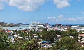
St. John's is the capital and largest city of Antigua and Barbuda, part of the West Indies in the Caribbean Sea. With a population of 22,219, St. John's is the commercial centre of the nation and the chief port of the island of Antigua.
Antigua and Barbuda's transport systems include both public and privately run services. Roads in the country are paved and follow a winding and gently sloping course connecting parishes to villages and communities. Driving is on the left-hand side. The speed limit is set at 40 mph, Traffic signs posted throughout main roads in Antigua and Barbuda allow for ease of commute, and with GPS coordinates posted throughout the country, the process of navigation has become even easier.

Antigua and Barbuda is an island nation made up of: Antigua island, which is divided into six parishes; and of the two dependencies of Barbuda island and Redonda island.

Saint George, officially the Parish of Saint George, is a parish of Antigua and Barbuda on the island of Antigua. Saint George borders Saint Peter to the southeast, and Saint John to the west and south. Saint George is mostly farmland and savanna in the south, dense forest in the Blackman's Peninsula area, marshland in the Fitches Creek area, and dense forest in the northwest. It is the smallest parish in Antigua and Barbuda, and the parish capital is Fitches Creek. The largest city in the parish is Piggotts. Saint George is the newest parish, splitting from the parish of Saint Peter in 1725. It had an estimated population of 8,817 in 2018.

Saint Philip, officially the Parish of Saint Philip, is a civil parish of Antigua and Barbuda, on the easternmost portion of Antigua island. Its capital is the village of St. Philip's. Saint Philip borders Saint Peter and Saint Paul. Saint Philip faces the Atlantic Ocean. Saint Philip is surrounded by various islands and islets. It had an estimated population of 3,689 in 2018, which makes it the least populous parish of Antigua and Barbuda.

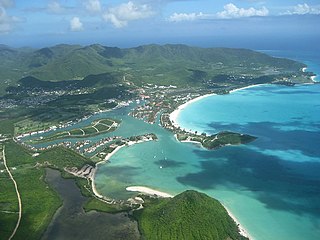
Saint Mary, officially the Parish of Saint Mary, is a parish of Antigua and Barbuda on the island of Antigua. Saint Mary borders Saint John to the north, and Saint Paul to the east. Saint Mary is dominated by the Shekerley Mountains, and its northern border is largely defined by the mountains, and by Cooks Creek. The largest city in the parish is Bolans, home to the Jolly Harbour neighbourhood, and the parish church is located in Old Road. Saint Mary was permanently established with the other four original parishes in 1692. It had an estimated population of 8,141 in 2018.

Saint Paul, officially the Parish of Saint Paul, is a parish of Antigua and Barbuda on the island of Antigua. It had an estimated population of 9,004 in 2018. The parish capital, and the location of the parish church, is Falmouth. The main economic and tourism hub of the parish is English Harbour.

Saint Peter, officially the Parish of Saint Peter, is a parish of Antigua and Barbuda on the island of Antigua. Saint Peter borders Saint Paul to the south, Saint Philip to the east, and Saint George and Saint John to the west. Saint Peter is dominated by farmland, savanna, and undeveloped fields, and its borders are not well-defined. The largest city fully within the parish is Parham, which is also the capital. However, the portion of the city of All Saints in Saint Peter is significantly larger than Parham. Saint Peter was created with the other four original parishes in 1692. It had an estimated population of 5,706 in 2018.

Saint John, officially the Parish of Saint John, is a civil parish of Antigua and Barbuda, on the northwestern portion of Antigua island. Its capital is the city of St. John's. Saint John borders Saint Mary, Saint Peter, Saint George, and Saint Paul. Saint John faces the Caribbean Sea. Saint John is surrounded by some of Antigua's most premier beaches. Saint John had a population of 56,736 in a 2018 estimate, making it home to the majority of the population in Antigua and Barbuda.
The Antigua and Barbuda Premier Division, currently known as the Digicel/Red Stripe Premier Division for sponsorship purposes, is the top football league in Antigua and Barbuda.

All Saints is the second largest settlement in Antigua and Barbuda, with a population of 3,412. It is located in the middle of Antigua, at 17°3′N61°47′W. Just 5 miles NW of here is the capital, St. John's. It had a population of 3,900 in 2001.

Old Road, officially known as the Town of Old Road, is a town located on a roadstead in the parish of Saint Mary, Antigua and Barbuda. It is overlooked by Boggy Peak, which lies to its northwest. Old Road was founded in the 1700s, and in the 1850s was still a tiny settlement of 96, smaller than its neighbour to the west, Urlings. Old Road has since grown to a population of 1,251 in 2011, and is now the tenth largest settlement in the country. Old Road is smaller than Willikies, but is larger than Montclear, Skyline, and Potters Village. Old Road is separated from the rest of Antigua by the Shekerley Mountains. The village is located on Andy Roberts Drive which to the east, merges onto Fig Tree Drive leading to John Hughes, and to the west, continues through Urlings, Crabs Hill, and Johnsons Point before merging onto Valley Road in Ffryes village.
Piggotts, also known as St Mark's Village, is a village in Saint George Parish on Antigua island in Antigua and Barbuda. It had a population of 1,478 in 2001.

Bethesda is a village in Saint Paul Parish on the island of Antigua, in Antigua and Barbuda.

The Royal Police Force of Antigua and Barbuda is the law enforcement agency for Antigua and Barbuda. The Commissioner in 2017 was Atlee Rodney. The force has 350 officers.

Five Islands Village is a village located on the northwest coast of Antigua, within Saint John Parish in Antigua and Barbuda.

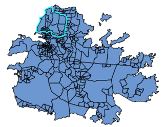
North Coast is a major division/area in Saint John Parish, Antigua and Barbuda.