Mao, Dominican Republic

Last updated
Santa Cruz de Mao
Mao
Mao Dominican Republic.jpg
Sign in Mao, Dominican Republic
Escudo del Municipio Mao.svg
Dominican Republic relief location map.jpg
Red pog.svg
Santa Cruz de Mao
Mao in the Dominican Republic
Coordinates: 19°34′0″N71°05′0″W / 19.56667°N 71.08333°W / 19.56667; -71.08333
CountryFlag of the Dominican Republic.svg  Dominican Republic
Province Valverde
Founded1875
Municipality since1882
Area
[1]
  Total423.60 km2 (163.55 sq mi)
Elevation
[2]
78 m (256 ft)
Population
 (2019) [3]
  Total207,818
  Density490/km2 (1,300/sq mi)
  Demonym
Maeño(a)
Distance to
 Santo Domingo

210 km
Municipal Districts
3
Climate BSh

The Dominican city of Santa Cruz de Mao, or simply Mao, is the head municipality of the Valverde province, in the northwest of the country.

Contents

It is the largest city of the Dominican northwest and the centre of the region. Its name, a Taíno word, comes from the River Mao, near the city. Its nickname is Ciudad de los Bellos Atardeceres (English, "City of the Beautiful Sunsets"); this was given by Juan De Jesus Reyes, renowned poet and Dominican literary icon. There are no mountains to the west of the city and it is common to see a "red" sky at sunset; it is a very dry region and there is much dust in the air which gives the sky a red color.

History

For most of its history, the region was called "El Despoblado"; that means a region without any population, because it is a very dry region and agriculture was not possible.

When the governor of the Spanish colony gave the order in 1606 that everybody living on the northern coast had to move inland, some people came to live around the present Mao. They had cattle that were raised in hatos. "Hato" means a large farm for raising cattle (a ranch), and so the names of many places around Mao derive from the word: Hatico, Hato del Yaque, Hato Nuevo, Hato Viejo, Hato del Medio. [4]

The town of Mao was built close to where the River Mao flows into the River Yaque del Norte. The first Catholic church was built in 1869.

The town was made a Puesto Cantonal (an old category similar to the present Municipal District under a military government). Mao was elevated to the category of municipality in 1882, and in 1904 its official name was changed to "Valverde" after José Desiderio Valverde, former President of the Dominican Republic. [4] Because the name Mao was known by everybody and Valverde was a new name, people called the city "Valverde (Mao)", and it is still common to say so.

When the province was created in 1959, Mao was made its head municipality and provincial capital. [4]

Santa Cruz de Mao city

Climate

Hotel in Mao, Dominican Republic city. Mao Dominican Republic city 2.jpg
Hotel in Mao, Dominican Republic city.

Unlike the humid northern coast of the Dominican Republic, Mao is located in a sheltered valley and like the southern coastal fringe of Hispaniola, has a hot semi-arid climate (Köppen BSh), with the temperature being warm year-round and some months being wetter than others. Mao receives 699.6 millimetres (27.54 in) of rainfall annually over 60.8 precipitation days. The driest month is January, which receives 21.3 millimetres (0.84 in) of rain on average, and the wettest month is May, which receives 119.1 millimetres (4.69 in) of rainfall on average. May also has the most precipitation days of any month (9.3) and July has the least (2.5). On 31 August 1954, Mao recorded a temperature of 43.0 °C (109.4 °F), which is the highest temperature to have ever been recorded in the Dominican Republic. [5]

Climate data for Mao, Dominican Republic (1961-1990)
MonthJanFebMarAprMayJunJulAugSepOctNovDecYear
Record high °C (°F)36.8
(98.2)
38.8
(101.8)
39.8
(103.6)
38.0
(100.4)
40.2
(104.4)
40.4
(104.7)
39.0
(102.2)
43.0
(109.4)
40.0
(104.0)
39.8
(103.6)
40.0
(104.0)
37.6
(99.7)
40.4
(104.7)
Average high °C (°F)30.2
(86.4)
30.9
(87.6)
32.1
(89.8)
33.0
(91.4)
33.7
(92.7)
34.7
(94.5)
35.1
(95.2)
35.5
(95.9)
35.2
(95.4)
34.1
(93.4)
31.7
(89.1)
30.1
(86.2)
33.0
(91.4)
Average low °C (°F)18.7
(65.7)
19.1
(66.4)
19.9
(67.8)
20.9
(69.6)
21.9
(71.4)
22.7
(72.9)
23.1
(73.6)
23.0
(73.4)
22.5
(72.5)
21.9
(71.4)
20.7
(69.3)
19.2
(66.6)
21.1
(70.0)
Record low °C (°F)13.2
(55.8)
12.2
(54.0)
14.0
(57.2)
13.6
(56.5)
17.0
(62.6)
19.0
(66.2)
19.0
(66.2)
19.0
(66.2)
18.8
(65.8)
18.0
(64.4)
14.8
(58.6)
12.6
(54.7)
12.2
(54.0)
Average rainfall mm (inches)21.6
(0.85)
34.4
(1.35)
38.5
(1.52)
71.4
(2.81)
119.1
(4.69)
72.0
(2.83)
27.3
(1.07)
42.9
(1.69)
75.3
(2.96)
81.9
(3.22)
74.9
(2.95)
40.3
(1.59)
699.6
(27.53)
Average rainy days (≥ 1.0 mm)3.03.33.35.69.36.02.54.16.07.16.34.360.8
Source: NOAA [6]

Economy

The main economic activity of the province is agriculture; the main products in the municipality are rice, bananas and plantain.

Notable people

Related Research Articles

<span class="mw-page-title-main">Provinces of the Dominican Republic</span> First-level administrative divisions of the Dominican Republic

The Dominican Republic is divided into thirty–one provincias, while the national capital, Santo Domingo, is contained within its own Distrito Nacional.

<span class="mw-page-title-main">Dajabón Province</span> Province of the Dominican Republic

Dajabón is a northwestern province which currently comprises one of the 32 provinces of the Dominican Republic. It is divided into 5 municipalities and its capital city with the same name. It is bordered by the provinces of Monte Cristi to the north, Santiago Rodríguez to the south, Elías Piña to the south and the Nord-Est department of Haiti to the west.

<span class="mw-page-title-main">Hato Mayor Province</span> Province of the Dominican Republic

Hato Mayor is a province of the Dominican Republic. The province was split from El Seibo in 1984.

<span class="mw-page-title-main">Monte Cristi Province</span> Province of the Dominican Republic

Monte Cristi is a province in the northwest of the Dominican Republic. The capital city is San Fernando de Monte Cristi. The spelling Montecristi is also seen. The Montecristi province is located in the Cibao frontier region, on the north coast of the country and borders the nation of Haiti. The land area of the Montecristi province is 1,924.35 km2. It is divided into six municipalities and four municipal districts.

<span class="mw-page-title-main">Monte Plata Province</span> Province of the Dominican Republic

Monte Plata is an eastern province of the Dominican Republic, and also the name of its capital city. It was split from San Cristóbal in 1992.

<span class="mw-page-title-main">San Pedro de Macorís Province</span> Province of the Dominican Republic

San Pedro de Macorís is a province of the Dominican Republic, also the name of its capital city. The city is fairly active due to its proximity to the national capital of Santo Domingo and also its role in the sugar industry. The province is informally known as San Pedro, SPM or Serie 23 for the first two numbers of their Dominican identification or Cedula.

<span class="mw-page-title-main">Santiago Province (Dominican Republic)</span> Province of the Dominican Republic

Santiago is a province which currently comprises one of the 32 provinces of the Dominican Republic. It is divided into 10 municipalities and its capital city is Santiago de los Caballeros. Located in north-central Dominican Republic, in the Cibao region, it is bordered by the provinces of Valverde to the north-west, Puerto Plata to the north, Espaillat and La Vega to the east, San Juan to the south and Santiago Rodríguez to the west.

<span class="mw-page-title-main">Valverde Province</span> Province of the Dominican Republic

Valverde is a province of the Dominican Republic. It was split from Santiago Province in 1959. It is in the northwestern part of the country. Its capital city is Santa Cruz de Mao.

<span class="mw-page-title-main">Santo Domingo Province</span> Province of the Dominican Republic

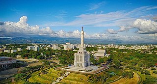
Santo Domingo is a province of the Dominican Republic. It was split from the Distrito Nacional on October 16, 2001.

<span class="mw-page-title-main">Barahona, Dominican Republic</span> Place in Barahona, Dominican Republic

Barahona, also known as Santa Cruz de Barahona, is the main city of the Barahona Province, in the southwest of the Dominican Republic. It has one of the most active ports in the region, as well as many ecotourism attractions. The city is a centre of sugar production and industry. Barahona is also known for being the only place where the rare Larimar stone can be found.

<span class="mw-page-title-main">Jarabacoa</span> Place in La Vega, Dominican Republic

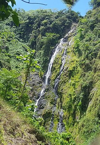
Jarabacoa is a town located in the central region of the Dominican Republic. It is the second largest municipality in La Vega Province.

<span class="mw-page-title-main">Hato Mayor del Rey</span> City in the Dominican Republic

Hato Mayor del Rey is the capital of Hato Mayor Province, Dominican Republic. It is bordered on the North by the municipalities of El Valle and Sabana de la Mar, on the South by the San Pedro de Macorís Province, on the East by the El Seibo Province and on the West by the municipality of Bayaguana, Monte Plata. It is located 27 kilometers from the San Pedro de Macorís Province and 110 kilometers from the capital city of Santo Domingo. Hato Mayor del Rey has a population of 70,141 inhabitants, and is divided into three municipal districts: Yerba Buena, Guayabo Dulce and Mata Palacio.

<span class="mw-page-title-main">Monte Cristi, Dominican Republic</span> Place in Monte Cristi, Dominican Republic

San Fernando de Monte Cristi, also known as Montecristi, is the capital town of Monte Cristi Province in the Dominican Republic. It is located in the northwest region of the country in a coastal area above the border with Haiti.

Laguna Salada is a municipality (municipio) of the Valverde province in the Dominican Republic. Within the municipality there are three municipal districts : Cruce de Guayacanes, Jaibón and La Caya.

Esperanza is a municipality (municipio) of the Valverde province in the Dominican Republic. Within the municipality there are four municipal districts : Boca de Mao, Jicomé, Maizal and Paradero.

Villa Altagracia is a municipality (municipio) of the San Cristóbal province in the Dominican Republic. Within the municipality there are three municipal districts : La Cuchilla, Medina and San José del Puerto.

Navarrete is a municipality in northwestern Dominican Republic, created in 1961. It lies approximately 25 kilometres (16 mi) from Santiago de los Caballeros, Dominican Republic's second largest city. The administrative centre is in the town of Villa Bisonó.

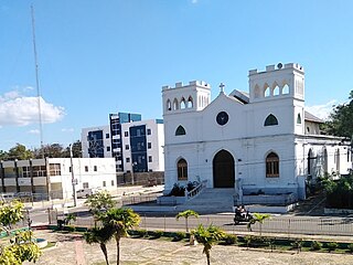
Tamayo is a city and a municipality in the Baoruco province of the Dominican Republic. Tamayo is the driest location in the Dominican Republic and the only-one with a desertic climate.

<span class="mw-page-title-main">San Juan Province (Dominican Republic)</span> Province of the Dominican Republic

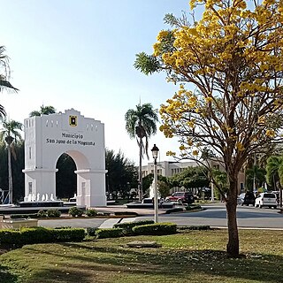
San Juan is a province of the Dominican Republic. Before 1961 it was known as Benefactor. San Juan is the Republic's largest province, bearing a size of 3,569 square kilometers, and it is landlocked.

<span class="mw-page-title-main">San Pedro de Macorís</span> City in Dominican Republic

San Pedro de Macorís is a city and municipality (municipio) in the Dominican Republic and the capital of the San Pedro de Macorís province in the east region of the country; it is among the 10 largest cities of the Dominican Republic. The city has approximately 195,000 inhabitants, when including the metro area. As a provincial capital, it houses the Universidad Central del Este university.

References

  1. Superficies a nivel de municipios, Oficina Nacional de Estadistica Archived 2009-04-17 at the Wayback Machine
  2. De la Fuente, Santiago (1976). Geografía Dominicana (in Spanish). Santo Domingo, Dominican Republic: Editora Colegial Quisqueyana.
  3. Censo 2012 de Población y Vivienda, Oficina Nacional de Estadistica
  4. 1 2 3 Brea Tió, Héctor (1997). Mao y su gente (in Spanish). Santo Domingo: Librería La Trinitaria.
  5. Mejía, Mariela (7 January 2011). "Frío extremo, calor agobiante" (in Spanish). Diario Libre. Archived from the original on 4 November 2013. Retrieved 2 May 2017.
  6. "Mao Climate Normals 1961-1990". National Oceanic and Atmospheric Administration. Retrieved September 18, 2016.