
Baoruco, alternatively spelt Bahoruco, is a province of the Dominican Republic located in the southwest of the country, part of the Enriquillo Region, along with the provinces of Barahona, Independencia and Pedernales. Before 1952 it included what is now Independencia Province.

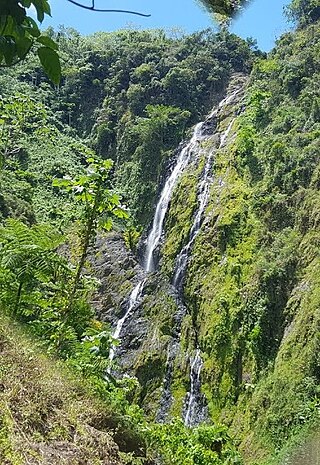
Barahona is a province of the Dominican Republic. The Barahona Coast is located on the southwestern part of the Dominican Republic approximately three hours drive from Santo Domingo the capital of the Dominican Republic. In 2019, volunteers from Amigos de las Americas visited to facilitate projects within the various municipalities of Barahona.

Duarte is a northeastern province which comprises one of the 32 provinces of the Dominican Republic. It is divided into 7 municipalities and its capital city is San Francisco de Macorís. It is bordered by the provinces of María Trinidad Sánchez and Samaná to the east, Monte Plata and Sánchez Ramírez to the south, La Vega and Hermanas Mirabal to the west and Espaillat to the north. It is named after Juan Pablo Duarte, the founder of the Dominican Republic.

El Seibo, alternatively spelt El Seybo, is a province of the Dominican Republic. Before 1992 it included what is now Hato Mayor province.

Espaillat is one of the 32 provinces of the Dominican Republic. It is divided into 5 municipalities and its capital city is Moca. Located in north-central Dominican Republic (Cibao), it is bordered by the provinces of La Vega to the south, Santiago and Puerto Plata to the west, and María Trinidad Sánchez to the north-east. The province has a coastline to the north with the Atlantic Ocean. It is named for Ulises Francisco Espaillat (1823–1878), the 19th-century author who was briefly President of the Republic in 1876.
Hato Mayor is a province of the Dominican Republic. The province was split from El Seibo in 1984.

Independencia is a province of the Dominican Republic, located in the west, on the border with Haiti. Its capital is Jimani. The province was created in 1948 but was made official in 1950. Before its creation, it was part of the Baoruco Province. The name was given in remembrance of the National Independence of February 27, 1844.

Puerto Plata is one of the northern provinces of the Dominican Republic. The area has become an increasingly popular tourist attraction since the late 1990s mainly due to its fine beaches. It borders the Septentrional mountain range to the north.

San José de Ocoa is a province in the southern region of the Dominican Republic, and also the name of the province's capital city. It was split from Peravia on January 1, 2000. Published statistics and maps generally include this province in the old, larger, Peravia.

San Pedro de Macorís is a province of the Dominican Republic, also the name of its capital city. The city is fairly active due to its proximity to the national capital of Santo Domingo and also its role in the sugar industry. The province is informally known as San Pedro, SPM or Serie 23 for the first two numbers of their Dominican identification or Cedula.

Valverde is a province of the Dominican Republic. It was split from Santiago Province in 1959. It is in the northwestern part of the country. Its capital city is Santa Cruz de Mao.
Santo Domingo is a province of the Dominican Republic. It was split from the Distrito Nacional on October 16, 2001.

Cambita Garabitos is a municipality (municipio) of the San Cristóbal province in the Dominican Republic.
Santo Domingo Norte is a municipality of the Santo Domingo Province in the Dominican Republic. There is one municipal district within the municipality: La Victoria.
Los Alcarrizos is a municipality (municipio) of the Santo Domingo province in the Dominican Republic. Within the municipality there are the following municipal districts : Palmarejo-Villa Linda and Pantoja.
Pedro Brand is a municipality (municipio) of the Santo Domingo province in the Dominican Republic. Within the municipality there are two municipal districts : La Cuaba and La Guáyiga.
Los Cacaos is a municipality (municipio) of the San Cristóbal province in the Dominican Republic.
San José de los Llanos is a municipality (municipio) of the San Pedro de Macorís province in the Dominican Republic. Within the municipality there are two municipal districts : Gautier and El Puerto.
Quisqueya is a municipality (municipio) of the San Pedro de Macorís province in the Dominican Republic.

Consuelo is a municipality (municipio) of the San Pedro de Macorís Province in the Dominican Republic.
