Monte Cristi, Dominican Republic

Last updated
San Fernando de Monte Cristi
Monte Cristi Dominican Republic beach town.jpg
Monte Cristi, Dominican Republic in downtown area.
Escudo del Municipio San Fernando de Monte Cristi.png
Dominican Republic relief location map.jpg
Red pog.svg
San Fernando de Monte Cristi
Coordinates: 19°51′0″N71°39′0″W / 19.85000°N 71.65000°W / 19.85000; -71.65000
CountryFlag of the Dominican Republic.svg  Dominican Republic
Province Monte Cristi
Founded1506
Municipality since1822
Area
[1]
  Total455.5 km2 (175.9 sq mi)
Elevation
[2]
16 m (52 ft)
Population
 (2012) [3]
  Total42,657
  Density94/km2 (240/sq mi)
  Demonym
Montecristeño(a)
Distance to
 Santo Domingo

270 km
Municipal Districts
0
Climate BSh

San Fernando de Monte Cristi, also known as Montecristi, is the capital town of Monte Cristi Province in the Dominican Republic. It is located in the northwest region of the country in a coastal area above the border with Haiti.

Contents

The town was at the forefront in many of the advances including the first aqueduct, first railroad and telephone in the island. In 1895, it was the site of the signing of the Manifesto of Montecristi by Máximo Gómez and José Martí, at the Gómez home on Mella St. They sailed from "La Granja" beach, also in Montecristi, to Cuba to fight for its independence. [4]

History

Monte Cristi was officially founded by Nicolás de Ovando in 1506 and populated in 1533 by Juan de Bolaños and 63 families from the Canary Islands. The existence of mineral wealth was the incentive to the increase of the Spanish settlement. Years later, in 1545, another family contingent joined and expanded the town. Agriculture and cattle raising were the two main activities of these first settlers of Montecristi. Despite the fact that that town was located in the middle of two sugarcane-producing villages, such as Puerto Plata and Puerto Real, that activity had no significance in Montecristi. [5]

Montecristi town museum. Downtown Monte Cristi Dominican Republic.jpg
Montecristi town museum.

During the 17th century Montecristi was a hotbed of pirate activity in the Caribbean. In 1756 the city became a prosperous trading center, until the early 20th century. [6] Towards 1740 the island of Santo Domingo had undergone a substantial change. In the western part of the island, the French had established a separate colony. This signaled the beginnings of a development process for the Spanish colony, which had remained outside the commercial currents for little more than a century.

In this vein, the Spanish authorities had begun around 1684 a settlement program with families of Canarian origin, with which they gradually repopulated certain places considered strategic to contain the French advance on the island. One of those was Montecristi, and its new foundation began in 1751. On this occasion, they thought not only about the convenience of establishing a living border, but also about taking advantage of the facilities offered by its port for the development of international trade.

Clocktower of Monte Cristi, Dominican Republic in downtown area. Montecristi Dominican Republic El Morro.jpg
Clocktower of Monte Cristi, Dominican Republic in downtown area.

In 1756 the ports of Montecristi and Puerto Plata were declared free for ten years, which had a positive impact on community development. By 1785 the population of the town had expanded considerably, if data noted by Antonio Sánchez Valverde in his book Idea about the value of the Spanish island are taken into account, which establishes some 5,550 inhabitants distributed between Puerto Plata and Montecristi.

In 1895, it was the site of the signing of the Manifesto of Montecristi by Máximo Gómez and José Martí, at the Gómez home on Mella St. They sailed from "La Granja" beach, also in Monte Cristi, to Cuba to fight for its independence.

Santiago-born educator and feminist Rosa Smester Marrero moved to Monte Cristi in 1913, [7] becoming a teacher of the Higher Normal School of Montecristi and directing the Higher School of Ladies of Montecristi. [8]

Climate

Monte Cristi has a hot semi-arid climate (Köppen: BShs [9] ) with a pronounced dry season in the summer, and a wet season in the winter. It has an average temperature of 26.5 °C (80 °F) and an average annual rainfall of 650 millimetres (26 in). The average evaporation is 1,800 millimetres (71 in). Precipitation is highest in the eastern part of the park where the winds collide with the Northern Range and discharge their waters. The same applies to the area of Manzanillo. The same winds hit the Central Cordillera and its extension, the Massif du Nord in Haiti. The effect is felt mainly in the foothills near Loma de Cabrera and Dajabón, and to a lesser extent in Manzanillo.

Hurricanes and tropical storms have little effect on the area of Monte Cristi; however, they can cause increased rains and flooding in the Yaque del Norte River, which brings sediment that affects reefs in the area. During the winter, some cold fronts come from North America, with low temperatures and strong northerly winds. It is also common that cold currents coming down from the Arctic seabed emerge when they hit the island shelf.

Climate data for Monte Cristi (1971-2000)
MonthJanFebMarAprMayJunJulAugSepOctNovDecYear
Record high °C (°F)34.2
(93.6)
35.5
(95.9)
34.8
(94.6)
34.2
(93.6)
36.0
(96.8)
37.3
(99.1)
37.3
(99.1)
38.0
(100.4)
38.4
(101.1)
36.6
(97.9)
35.7
(96.3)
34.5
(94.1)
38.4
(101.1)
Mean daily maximum °C (°F)29.4
(84.9)
29.5
(85.1)
30.2
(86.4)
30.5
(86.9)
31.7
(89.1)
33.3
(91.9)
33.6
(92.5)
33.7
(92.7)
33.4
(92.1)
32.7
(90.9)
31.1
(88.0)
29.7
(85.5)
31.6
(88.8)
Daily mean °C (°F)24.2
(75.6)
24.4
(75.9)
25.0
(77.0)
25.7
(78.3)
26.8
(80.2)
28.1
(82.6)
28.3
(82.9)
28.3
(82.9)
28.0
(82.4)
27.4
(81.3)
26.1
(79.0)
24.6
(76.3)
26.4
(79.5)
Mean daily minimum °C (°F)19.0
(66.2)
19.4
(66.9)
20.0
(68.0)
20.9
(69.6)
22.0
(71.6)
22.9
(73.2)
23.0
(73.4)
23.0
(73.4)
22.7
(72.9)
22.2
(72.0)
21.1
(70.0)
19.5
(67.1)
21.3
(70.4)
Record low °C (°F)14.5
(58.1)
15.0
(59.0)
14.7
(58.5)
16.2
(61.2)
17.0
(62.6)
19.0
(66.2)
20.0
(68.0)
19.8
(67.6)
18.0
(64.4)
18.0
(64.4)
16.2
(61.2)
14.0
(57.2)
14.0
(57.2)
Average rainfall mm (inches)67.8
(2.67)
47.2
(1.86)
53.5
(2.11)
70.9
(2.79)
52.7
(2.07)
31.0
(1.22)
15.4
(0.61)
27.0
(1.06)
33.4
(1.31)
59.9
(2.36)
66.4
(2.61)
70.0
(2.76)
595.2
(23.43)
Average rainy days (≥ 1.0 mm)4.74.33.95.55.72.91.82.73.65.55.65.952.1
Average relative humidity (%)79.177.876.977.278.575.473.173.875.176.777.378.976.6
Source: ONAMET [10]
Climate data for Monte Cristi (1961-1990)
MonthJanFebMarAprMayJunJulAugSepOctNovDecYear
Record high °C (°F)34.2
(93.6)
35.5
(95.9)
36.0
(96.8)
38.0
(100.4)
36.0
(96.8)
38.0
(100.4)
39.0
(102.2)
38.5
(101.3)
39.0
(102.2)
37.0
(98.6)
37.0
(98.6)
35.0
(95.0)
39.0
(102.2)
Mean daily maximum °C (°F)28.9
(84.0)
29.4
(84.9)
30.2
(86.4)
30.5
(86.9)
31.8
(89.2)
33.3
(91.9)
33.6
(92.5)
33.8
(92.8)
33.7
(92.7)
32.7
(90.9)
30.7
(87.3)
29.2
(84.6)
31.5
(88.7)
Daily mean °C (°F)24.1
(75.4)
24.5
(76.1)
25.1
(77.2)
25.8
(78.4)
27.0
(80.6)
28.2
(82.8)
28.4
(83.1)
28.5
(83.3)
28.3
(82.9)
27.5
(81.5)
25.9
(78.6)
24.5
(76.1)
26.5
(79.7)
Mean daily minimum °C (°F)19.2
(66.6)
19.6
(67.3)
20.1
(68.2)
21.1
(70.0)
22.2
(72.0)
23.0
(73.4)
23.2
(73.8)
23.3
(73.9)
22.9
(73.2)
22.4
(72.3)
21.3
(70.3)
19.8
(67.6)
21.5
(70.7)
Record low °C (°F)14.0
(57.2)
15.0
(59.0)
14.7
(58.5)
16.0
(60.8)
17.0
(62.6)
19.0
(66.2)
20.0
(68.0)
19.8
(67.6)
18.0
(64.4)
18.0
(64.4)
16.2
(61.2)
14.0
(57.2)
14.0
(57.2)
Average rainfall mm (inches)73.8
(2.91)
47.3
(1.86)
47.7
(1.88)
59.0
(2.32)
59.8
(2.35)
40.1
(1.58)
21.5
(0.85)
28.1
(1.11)
34.8
(1.37)
67.7
(2.67)
108.2
(4.26)
84.1
(3.31)
672.1
(26.46)
Average rainy days (≥ 1.0 mm)5.03.73.24.45.43.22.12.83.75.76.66.552.3
Average relative humidity (%)79.378.076.777.478.775.973.173.674.876.777.379.276.7
Source: NOAA [11]

Airport

Osvaldo Virgil Airport is an airport in the Dominican Republic. It serves the city and province of Monte Cristi, in the north of the country. It was out of service for a long time and was put into operation in 2007 after being remodeled by the DA (Airport Department). He was named Osvaldo Virgil, the first Dominican baseball player in the Major Leagues, born in Monte Cristi. Its track and facilities were built under the direction of Montecristeño engineer Manuel Isidor.

Culture

Within the traditions of the province, the patron saint festivities of San Fernando stand out, which are celebrated every May 30 with religious acts, as well as sporting events, dances, bag runs, a fishing tournament, etc.

Also the celebration of the day of San Juan Bautista, on June 24 and the Carnival of the Bulls, events that are very crowded. One of its main cultural heritages is the first pyramid of territorial division between the Dominican Republic and Haiti.

See also

Related Research Articles

<span class="mw-page-title-main">Provinces of the Dominican Republic</span> First-level administrative divisions of the Dominican Republic

The Dominican Republic is divided into thirty–one provincias, while the national capital, Santo Domingo, is contained within its own Distrito Nacional.

<span class="mw-page-title-main">Dajabón Province</span> Province of the Dominican Republic

Dajabón is a northwestern province which currently comprises one of the 32 provinces of the Dominican Republic. It is divided into 5 municipalities and its capital city with the same name. It is bordered by the provinces of Monte Cristi to the north, Santiago Rodríguez to the south, Elías Piña to the south and the Nord-Est department of Haiti to the west.

<span class="mw-page-title-main">Monte Cristi Province</span> Province of the Dominican Republic

Monte Cristi is a province in the northwest of the Dominican Republic. The capital city is San Fernando de Monte Cristi. The spelling Montecristi is also seen. The Montecristi province is located in the Cibao frontier region, on the north coast of the country and borders the nation of Haiti. The land area of the Montecristi province is 1,924.35 km2. It is divided into six municipalities and four municipal districts.

<span class="mw-page-title-main">Monte Plata Province</span> Province of the Dominican Republic

Monte Plata is an eastern province of the Dominican Republic, and also the name of its capital city. It was split from San Cristóbal in 1992.

<span class="mw-page-title-main">Puerto Plata Province</span> Province of the Dominican Republic

Puerto Plata is a province in northern Dominican Republic. It is divided into 9 municipalities, 12 municipal districts and its capital is the resort city of the same name. Neighboring provinces clockwise: Monte Cristi to the southwest, Valverde and Santiago to the south and Espailat to the east, along with the Septentrional mountain range to the north, and has a coastline with the Atlantic Ocean. The area has become an increasingly popular tourist attraction since the late 1990s mainly due to its fine beaches.

<span class="mw-page-title-main">Valverde Province</span> Province of the Dominican Republic

Valverde is a province of the Dominican Republic. It was split from Santiago Province in 1959. It is in the northwestern part of the country. Its capital city is Santa Cruz de Mao.
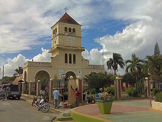
<span class="mw-page-title-main">Puerto Plata, Dominican Republic</span> City in Puerto Plata, Dominican Republic

Puerto Plata, officially known as San Felipe de Puerto Plata, is a major coastal city in the Dominican Republic, and capital of the province of Puerto Plata. The city is a major trading port. Puerto Plata has resorts such as Playa Dorada and Costa Dorada, which are located east of the city proper. There are 100,000 hotel beds in the city. The first aerial tramway of the Caribbean is located in Puerto Plata, in which visitors can ride up to the Pico Isabel de Torres, a 793-meter (2600-foot) high mountain within the city.

<span class="mw-page-title-main">Monte Plata</span> Municipality in Dominican Republic

Monte Plata is a town and municipality (municipio) and the capital of the Monte Plata province in the Dominican Republic. It includes the municipal districts of Boyá, Chirino, and Don Juan.

DR-1 is a dual carriageway highway that forms part of the five designated national highways of the Dominican Republic. DR-1 provides a fast connection between Santo Domingo, the capital, on the southern coast, and the second city Santiago and the rest of the northerly Cibao region, one of the country's main regions.

Laguna Salada is a municipality (municipio) of the Valverde province in the Dominican Republic. Within the municipality there are three municipal districts : Cruce de Guayacanes, Jaibón and La Caya.

Aeronaves Dominicanas is an air charter airline established in 1980 with facilities in Samaná El Catey International Airport, and main offices in the La Isabela International Airport, Santo Domingo, Dominican Republic.

Osvaldo Virgil National Airport is an airport in the province of Monte Cristi on the north coast of the Dominican Republic. The airport was opened in 2006 for tourism with flights from other Dominican airports. The runway is just north of the city of Monte Cristi. The airport is named after baseball player Ozzie Virgil Sr.

<span class="mw-page-title-main">Dominican Restoration War</span> 1863–1865 war between the Dominican Republic and Spain

The Dominican Restoration War or the Dominican War of Restoration was a guerrilla war between 1863 and 1865 in the Dominican Republic between nationalists and Spain, the latter of which had recolonized the country 17 years after its independence. The war resulted in the restoration of Dominican sovereignty, the withdrawal of Spanish forces, the separation of the Captaincy General of Santo Domingo from Spain, and the establishment of a second republic in the Dominican Republic.

Aerolíneas Mas was an airline with its corporate headquarters in the Ciudad Universitaria in Santo Domingo, Dominican Republic. It offered flights to several domestic destinations. Its flight operations were based at La Isabela International Airport in Santo Domingo.

<span class="mw-page-title-main">Restauración</span> Place in Dajabón, Dominican Republic

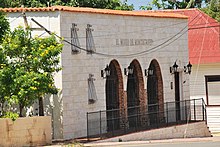
Restauración is the third largest city in the province of Dajabon, Dominican Republic. It is located in the northwest portion of the island, in the Cibao region.

<span class="mw-page-title-main">Villa Vásquez</span> Place in Monte Cristi, Dominican Republic

Villa Vásquez is a town in the Monte Cristi province of the Dominican Republic.

<span class="mw-page-title-main">Spanish occupation of the Dominican Republic</span> Reintegration of Santo Domingo (1861–1865)

The Reintegration of Santo Domingo was a brief period of Spanish reintegration of the Dominican Republic. In 1861, Dominican general Pedro Santana suggested retaking control of the Dominican Republic to Queen Isabella II of Spain, after a period of 17 years of Dominican sovereignty. The newly independent Dominican Republic was recovering economically from the recently ended Dominican War of Independence (1844–1856), when the Dominican Republic had won its independence against Haiti. The Spanish Crown and authorities, which scorned and rejected the peace treaties signed after the dismantling of some of its colonies in the Spanish West Indies some 50 years prior, welcomed his proposal and set to reestablish the Capitancy.

Pepillo Salcedo is a municipality in the Monte Cristi Province of the Dominican Republic, located next to the border with Haiti. Pepillo Salcedo is frequently named Manzanillo due to the bay of manzanillo Bahia De Manzanillo which is approximately 2 miles from playa el coquito coquito beach. the city received its name from José Antonio Salcedo Ramírez who was a combatant in the long war days of the consolidation of national independence day in the Dominican Republic. General Salcedo Ramírez was also an outstanding military leader in the intense restorative war from 1863 to 1865. Pepillo Salcedo is a coastal town. It is built on the shores of the Bay of Manzanillo. In the westernmost part of the Dominican Northwest.

<span class="mw-page-title-main">Rosa Smester Marrero</span> Dominican feminist, teacher, writer (1874–1945)

Rosa Smester Marrero was an educator and writer from the Dominican Republic. She became prominent for her feminist writings and opposition to the United States' occupation of the Dominican Republic. Her career as a teacher rendered her a prominent figure in her home city of Santiago de los Caballeros, where she founded a school and the St Vincent de Paul Hospice.

References

  1. Superficies a nivel de municipios, Oficina Nacional de Estadistica Archived 2009-04-17 at the Wayback Machine
  2. De la Fuente, Santiago (1976). Geografía Dominicana (in Spanish). Santo Domingo, Dominican Republic: Editora Colegial Quisqueyana.
  3. Censo 2012 de Población y Vivienda,Oficina Nacional de Estadistica Archived 2009-09-19 at the Wayback Machine
  4. "Publicaciones/Division-Territorial-2015.pdf" (PDF).
  5. Nacional, El (2022-02-12). "Conoce el origen de tu pueblo: Montecristi". El Nacional (in Spanish). Retrieved 2024-05-03.
  6. "Montecristi". Encyclopædia Britannica. Retrieved 2007-08-02.
  7. Espinal Hernández, Edwin Rafael (2010-10-23). "Un establón encontrado en los Smester" [A link found in the Smesters]. Instituto Dominicano de Genealogía, Inc. (in Spanish). Retrieved 2023-02-10.
  8. "Rosa Smester (Maestra de Maestras)" (PDF). Instituto Montecristeño de Antropología e Historia. Retrieved 2023-02-09.
  9. "Monte Cristi Climate & Temperature". Climatemps.com. Retrieved 27 December 2014.
  10. "Datos climatológicos normales y extremos 71-2000 estaciones Sinópticas - tercer trimestre 2019" (in Spanish). Oficina Nacional de Meteorología. Retrieved 20 October 2020.
  11. "Monte Cristi Climate Normals 1961–1990". National Oceanic and Atmospheric Administration . Retrieved March 23, 2015.

19°52′N71°39′W / 19.867°N 71.650°W / 19.867; -71.650