Zug is the largest town and capital of the Swiss canton of Zug. Its name, translating from German as "pull" or "tug", originates from the fishing vocabulary; in the Middle Ages it referred to the right to pull up fishing nets and hence to the right to fish. Zug is renowned as a hub for some of the wealthiest individuals in the world and is known for its high concentration of wealth.

Davos is an Alpine resort town and municipality in the Prättigau/Davos Region in the canton of Graubünden, Switzerland. It has a permanent population of 10,832 (2020). Davos is located on the river Landwasser, in the Rhaetian Alps, between the Plessur and Albula Ranges.

St. Moritz is a high Alpine resort town in the Engadine in Switzerland, at an elevation of about 1,800 metres (5,910 ft) above sea level. It is Upper Engadine's major town and a municipality in the administrative region of Maloja in the Swiss canton of the Grisons.

Sarnen is a small historic town, a municipality, and the capital of the canton of Obwalden situated on the northern shores of Lake Sarnen in Switzerland. It has a population of just over 10,000 and is surrounded by countryside and mountains. Sarnen is located 20 km south of Lucerne.

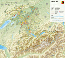
Lake Brienz is a lake just north of the Alps, in the canton of Bern in Switzerland. It has a length of about 14 kilometres (8.7 mi), a width of 2.8 kilometres (1.7 mi) and a maximum depth of 260 metres (850 ft). Its area is 29.8 square kilometres (11.5 sq mi); the surface is 564 metres (1,850 ft) above the sea-level. It is fed, among others, by the upper reaches of the Aare at its eastern end, the Giessbach at its southern shore from steep, forested and rocky hills of the high Faulhorn and Schwarzhoren more than 2,000 metres (6,600 ft) above the lake, as well as by both headwaters of the Lütschine, the Schwarze Lütschine flowing from Grindelwald, and the Weisse Lütschine from the Lauterbrunnen Valley, at its southwestern corner. Not far north from Lütschine's inflow, the lake drains into a further stretch of the Aare at its western end. The culminating point of the lake's drainage basin is the Finsteraarhorn at 4,274 metres above sea level.

Sempach is a municipality in the district of Sursee in the canton of Lucerne in Switzerland.

Küssnacht am Rigi is a village and a district and a municipality in the canton of Schwyz in Switzerland. The municipality consists of three villages Küssnacht, Immensee, and Merlischachen, the hamlet Haltikon, the industrial area Fänn, and the alp Seeboden. It is situated at the north shore of Lake Lucerne and at the south shore of Lake Zug below mount Rigi.

Flüelen is a municipality in the canton of Uri in Switzerland.

Burgäschisee is a lake near Aeschi in Switzerland, on the border of the cantons of Bern and Solothurn. The lake has a surface of 21 ha and a maximum depth of 36 m.

Tannensee is a reservoir in Obwalden, Switzerland. In 1958, Tannenbach and few other creeks were dammed with an earth-fill dam. The reservoir has a volume of 3.8 mio m³ and its surface area is 33 ha. The reservoir is used to generate electricity at Kraftwerk Hugschwendi in Kerns.

Lago del Narèt is a lake in Val Sambuco, Ticino, Switzerland. Its surface area is 86 ha. It is located in the municipality of Lavizzara. The closest village is Fusio.

Hasensee is a lake in the canton of Thurgau, Switzerland. It is located in the same valley as Nussbaumersee and Hüttwilersee. Its surface area is 11.1 ha and the surface elevation is 434.16 m, after being lowered by 1.5 m in World War II.

Lützelsee is a lake north of Hombrechtikon, Canton of Zurich, Switzerland. Its surface area is 13 ha.

Egelsee or Egelmösli is a lake in the City of Bern, Switzerland. Its surface area is 1.52 ha. The lake is part of a park that stretches to the Paul Klee Zentrum. In some years, it freezes sufficiently to allow ice skating.

The Wildhorn is a mountain of the Alps, straddling the border between the Swiss cantons of Bern and Valais. At 3,250 metres (10,663 ft) above sea level, it is the highest summit of the Bernese Alps west of the Gemmi Pass. It forms a large glaciated massif, about 10 km wide, extending between the Sanetsch Pass and the Rawil Pass. Along with the Muverans, the Diablerets and the Wildstrubel, the Wildhorn is one of the four distinct mountain massifs of the Bernese Alps that lie west of the Gemmi Pass. The massif of the Wildhorn is at the centre between the valleys of the Saane, Simme and the Rhone (Valais). It comprises several distinct summits, including the Arpelistock, Le Sérac, the Geltenhorn, the Sex Noir, the Sex Rouge, the Schnidehorn and the Six des Eaux Froides. The main crest is between the glaciers named Tungelgletscher and Glacier du Wildhorn. South of the main summit is the almost equally high summit of Mont Pucel. The Wildhorn is surrounded by several large mountain lakes: the Lac de Sénin, the Lauenensee, the Iffigsee, the Lac de Tseuzier and the Lac des Audannes. The Tungelgletscher, on the north-east face, was measured as 1.9 km in length in 1973.

Bellacher Weiher is a small lake at Bellach in the Canton of Solothurn, Switzerland. Its surface area is 3.3 ha. The pond was formed in 1548. Lake and surroundings are a nature preserve.

Husemersee is a lake at Ossingen in the Canton of Zurich, Switzerland. Its surface area is 8 ha. The lake has four small islands.
Chüebodensee is a lake above Elm in the Canton of Glarus, Switzerland. Its surface area is 1.4 ha. There are about 8 km of well established trails around the lake. The lake is within the Glarner Freiberg wildlife preserve.