
Brownell Talbot College Preparatory School is an independent, co-educational, college preparatory day school located in Omaha, Nebraska, United States. It serves students from preschool through grade 12.

North Omaha is a community area in Omaha, Nebraska, in the United States. It is bordered by Cuming and Dodge Streets on the south, Interstate 680 on the north, North 72nd Street on the west and the Missouri River and Carter Lake, Iowa on the east, as defined by the University of Nebraska at Omaha and the Omaha Chamber of Commerce.
Florence is a neighborhood in Omaha, Nebraska, United States on the city's north end and originally one of the oldest cities in Nebraska. It was incorporated by the Nebraska Territorial Legislature on March 10, 1857. The site of Winter Quarters for Mormon migrants traveling west, it has the oldest cemetery for people of European descent and oldest standing gristmill in Nebraska. Florence was the site of an illegal territorial legislature in 1858. Given the high concentration of National Register of Historic Places in the neighborhood, it is regarded as "the historic front door to Omaha as well as the state."

The Prospect Hill Cemetery, located at 3202 Parker Street in the Prospect Hill neighborhood of North Omaha, Nebraska, United States, is believed to be the oldest pioneer cemetery in Omaha. It is between 31st and 33rd Streets and Parker and Grant Streets.
Technical High School (Tech) was a public high school that was located at 3215 Cuming Street in Omaha, Nebraska, United States. Opened in 1923, the school was said to be the largest high school west of Chicago. It was the largest in the Omaha area before it was closed in 1984. Today the building serves as the headquarters of Omaha Public Schools.
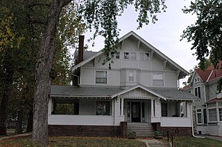
The Kountze Place neighborhood of Omaha, Nebraska is a historically significant community on the city's north end. Today the neighborhood is home to several buildings and homes listed on the National Register of Historic Places. It is located between North 16th Avenue on the east to North 30th Street on the west; Locust Street on the south to Pratt Street on the north. Kountze Place was annexed into Omaha in 1887. The neighborhood was built as a suburban middle and upper middle class enclave for doctors, lawyers, successful businessmen and other professional workers.
Scriptown was the name of the first subdivision in the history of Omaha, which at the time was located in Nebraska Territory. It was called "Scriptown" because scrip was used as payment, similar to how a company would pay employees when regular money was unavailable. Its original survey placed the location from the Missouri River to North 30th Street, Cuming to Fort Street.

Little Bohemia, or Bohemian Town, is a historic neighborhood in Omaha, Nebraska. Starting in the 1880s, Czech immigrants settled in this highly concentrated area, also called "Praha" (Prague) or "Bohemian Town", bounded by South 10th Street on the east, South 16th Street on the west, Pierce Street on the north, and Martha Street on the south, with a commercial area went along South 13th and South 14th Streets, centered on William Street. It was located south of downtown, and directly west of Little Italy. A portion of the neighborhood along South 13th Street was listed on the National Register of Historic Places in 2020.
Spring Lake is a historic neighborhood in Omaha, Nebraska. It is bounded by I-80 on the north, Missouri Avenue on the south, Highway 75 on the west and the Missouri River on the east. Spring Lake Park is also the name of an area park originally established as Syndicate Park. Spring Lake is bordered by the Deer Park neighborhood on the north and the city of Bellevue on the south.
Walnut Hill is a historic neighborhood located in north Omaha, Nebraska. It is bounded by North 40th Street on the east, Cuming Street on the south, Northwest Radial Highway and Saddle Creek Road on the west and Hamilton Street on the north.
The Potter's Field Cemetery in Omaha, Nebraska, United States, is located on a 5-acre (20,000 m2) plot of land at 5000 Young Street near the intersections of Young Street and Mormon Bridge Road. Like all Potter's Fields, it was used to bury poor people or people with no known identity from across the Omaha area. The cemetery was active from 1887 to 1957.
Forest Lawn Memorial Park, also known as Forest Lawn Cemetery, is located at 7909 Mormon Bridge Road in North Omaha, Nebraska. It was established in 1885 when the mutual Forest Lawn Cemetery Association was donated 100 acres (0.40 km2) in northwest of the city. In 1886, the first interment in the cemetery was the donor of the land, John H. Brackin. Forest Lawn is Omaha's largest cemetery and the burial location of many of Omaha's second generation of leadership.
Fisher Farm Cemetery, including the B'nai Abraham Cemetery, the Hrabik Cemetery, the Beth Hamedrosh Hagadol Cemetery, and Bnai Abraham Cemetery, is located at 8600 South 42 Street in Bellevue, Nebraska.
Zion Baptist Church is located at 2215 Grant Street in the Near North Side neighborhood of Omaha, Nebraska. The congregation is among the oldest in Nebraska, and has been instrumental for responding to much of the racial tension in Omaha.
The Orchard Hill is a neighborhood in North Omaha, Nebraska. One of the oldest neighborhoods in the city, Orchard Hill is home to some of the city's oldest homes. The neighborhood's boundaries are Hamilton Street on the south, Blondo Street on the north, 36th Street on the east and the Omaha Belt Line on the west. The John A. Creighton Boulevard runs through the eastern part of the neighborhood.

Old Gold Coast is the name of a historic district in south Omaha, Nebraska. With South 10th Street as the central artery, the area was home to neighborhoods such as Little Italy and Forest Hill. The area is referred to as "old" because it was replaced in prominence in the late 19th century when a new district usurped its importance. This area south of downtown was generally bounded by Leavenworth Street on the north, Bancroft Street on the south, the Missouri River on the east, and South 16th Street on the west.
The Prospect Hill neighborhood in North Omaha, Nebraska is one of the oldest neighborhoods in the city. In addition to being home to some of the city's oldest structures, the neighborhood is also the site of the Prospect Hill Cemetery which is located between North 31st and 33rd Streets and Parker and Grant Streets. The neighborhood's boundaries are North 30th Street from Hamilton Street to Lake and up to Creighton Boulevard; then over to Blondo and up to North 38th Street to Hamilton. The Omaha Belt Line ran near the northwest corner of the neighborhood. The neighborhood is also home to the historic Franklin Elementary School.

Westlawn-Hillcrest Funeral Home and Memorial Park is a funeral home, cemetery and crematory located at 5701 Center Street in Omaha, Nebraska.
Purple Cane is an unincorporated community in Dodge County, Nebraska, United States.
