
The Chilcotin Group, also called the Chilcotin Plateau Basalts, is a large area of basaltic lava that forms a volcanic plateau running parallel with the Garibaldi Volcanic Belt in south-central British Columbia, Canada.

The Fraser Canyon is a major landform of the Fraser River where it descends rapidly through narrow rock gorges in the Coast Mountains en route from the Interior Plateau of British Columbia to the Fraser Valley. Colloquially, the term "Fraser Canyon" is often used to include the Thompson Canyon from Lytton to Ashcroft, since they form the same highway route which most people are familiar with, although it is actually reckoned to begin above Williams Lake, British Columbia at Soda Creek Canyon near the town of the same name.

The Chilcotin River is a 241-kilometre (150 mi) long tributary of the Fraser River in southern British Columbia, Canada. It drains the Chilcotin Plateau, which lies between the Fraser River and the Coast Mountains. It starts northeast of Itcha Mountain and flows generally southeast to join the Fraser about 22 km upstream from Gang Ranch.
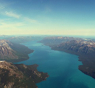
Tŝilhqox Biny, formerly known as Chilko Lake, is a 180 km2 lake in west-central British Columbia, at the head of the Chilko River on the Chilcotin Plateau. The lake is about 65 km long, with a southwest arm 10 km long. It is one of the largest lakes by volume in the province because of its great depth, and the largest above 1,000 m in elevation. It and Harrison Lake are the largest lakes in the southern Coast Mountains.

The Niut Range is 3600 km² in area. It is a subrange of the Pacific Ranges of the Coast Mountains of British Columbia, although in some classifications it is considered part of the Chilcotin Ranges. The Niut is located in the angle of the Homathko River and its main west fork, Mosley Creek. It is isolated, island-like, by those rivers from its neighbour ranges, as both streams have their source on the Chilcotin Plateau in behind the range. Razorback Mountain is its highest peak.
Bull Canyon Provincial Park is a provincial park in British Columbia, Canada, protecting Bull Canyon on the Chilcotin River, which is 7 km (4 mi) below the confluence of the Chilko River with the Chilcotin. The canyon and park are located just west of the community of Alexis Creek. Bull Canyon is part of a large volcanic plateau called the Chilcotin Group.
Satah Mountain is a cinder cone located 35 km (22 mi) east-northeast of Nimpo Lake in central British Columbia, Canada. It areas to the south form a N-S-trending chain of cinder cones of Pleistocene and Holocene age. It lies on the Chilcotin Plateau.

The Itcha Range, also known as the Itchas, is a small isolated mountain range in the West-Central Interior of British Columbia, Canada. It is located 40 km (25 mi) northeast of the community of Anahim Lake. With a maximum elevation of 2,375 m (7,792 ft), it is the lowest of three mountain ranges on the Chilcotin Plateau extending east from the Coast Mountains. Two mountains are named in the Itcha Range; Mount Downton and Itcha Mountain. A large provincial park surrounds the Itcha Range and other features in its vicinity. More than 15 animal species are known to exist in the Itcha Range area, as well as a grassland community that is limited only to this location of British Columbia. The Itcha Range is within territory which has been occupied by aboriginal peoples for millennia. This area has a relatively dry environment compared to the Coast Mountains in the west.
Toosey is a Tsilhqot'in First Nations community located west of the Fraser Canyon in the Chilcotin region of the Canadian province of British Columbia. It is a member of the Carrier-Chilcotin Tribal Council, which includes both Tsilhqot'in and Carrier (Dakelh) communities.
The Stone First Nation or Yunesit'in First Nation is a band government of the Yunesit'in subgroup of the Tsilhqot'in people, whose territory is the Chilcotin District in the western Central Interior region of the Canadian province of British Columbia. It is a member of the Tsilhqot'in Tribal Council. The people of the Stone First Nation are known as the Yunesit'in in the Chilcotin language.
The Tl'etinqox-t'in Government Office is a First Nations government located in the Chilcotin District in the western Central Interior region of the Canadian province of British Columbia. Governing a reserve communities near Alexis Creek known as Anaham Reserve First Nations or Anaham, it is a member of the Tsilhqot'in Tribal Council aka known as the Tsilhqot'in National Government. The main reserve is officially known as Anahim's Flat No. 1, and is more commonly as Anaham. Other reserves are Anahim's Meadow No. 2 and 2A, and Anahim Indian Reserves Nos. 3 through 18. Anaham, or Anahim and Alexis were chiefs of the Tsilhqot'in during the Chilcotin War of 1864, although they and their people did not take part in the hostilities.

The Ilgachuz Range is a name given to an extinct shield volcano in British Columbia, Canada. It is not a mountain range in the normal sense, because it was formed as a single volcano that has been eroded for the past 5 million years. It lies on the Chilcotin Plateau, located some 350 kilometres (220 mi) north-northwest of Vancouver and 30 km north of Anahim Lake. The highest peak of the range is Far Mountain. The range supports a unique grassland ecosystem. This type of grassland has not been seen anywhere else in central and southern British Columbia. The climate is cool and dry; typical of higher elevations of the Interior Plateau.

The Anahim hotspot is a volcanic hotspot located in the West-Central Interior of British Columbia, Canada. One of the few hotspots in North America, the Anahim plume is responsible for the creation of the Anahim Volcanic Belt. This is a 300 km (190 mi) long chain of volcanoes and other magmatic features that have undergone erosion. The chain extends from the community of Bella Bella in the west to near the small city of Quesnel in the east. While most volcanoes are created by geological activity at tectonic plate boundaries, the Anahim hotspot is located hundreds of kilometres away from the nearest plate boundary.

The Canim River is a river in the South Cariboo region of the Interior of British Columbia, Canada. It begins at the outlet of Canim Lake and runs approximately 1.8 km to Canim Falls, the river then continues approximately 9 kilometres via a canyon cut into a lava plateau, to Mahood Lake.
Great Canyon is the official name of a stretch of the Homathko River as it pierces the heart of the Pacific Ranges of the Coast Mountains between the Chilcotin District of the British Columbia Interior and the Central Coast region at Bute Inlet. Also known unofficially as the Grand Canyon of the Homathko, it is located above the confluence of Mosley Creek. The canyon is the largest on the Homathko and lies on the west side of the Waddington Range massif containing Mount Waddington, the range's highest, and like other parts of the Homathko has been proposed as the site of dams in a region-wide hydroelectric development involving the Homathko, Southgate, Chilko and Taseko Rivers.
Big Creek Canyon is a canyon on the Chilcotin River, located around the confluence of Big Creek in the Chilcotin District of British Columbia, Canada.

The Taseko Lakes are a pair of lakes, Upper Taseko Lake and Lower Taseko Lake, which are expansions of the upper Taseko River in the southern Chilcotin District of the Central Interior of British Columbia, Canada. Their name is based on the original in the Chilcotin language, Dasiqox Biny, where "Desiqox" means "Mosquito River" and is cognate to the name of the river as in English; the Chilcotin name refers to both lakes as one lake, which was also originally the case with the English usage until official designation of the separate lakes in 1954. The lakes are separated by the short Taseko Narrows, the name of which in Chilcotin is nanats'akash, and is an important crossing place for deer. The Tchaikazan River flows the area between the upper & lower lake from the southwest, while the Taseko River feeds it from the southeast, while the equally large Lord River joins it from the south, at the head of the lake.

Volcanism of Western Canada has produced lava flows, lava plateaus, lava domes, cinder cones, stratovolcanoes, shield volcanoes, greenstone belts, submarine volcanoes, calderas, diatremes and maars, along with examples of more less common volcanic forms such as tuyas and subglacial mounds.
The Satah Mountain volcanic field (SMVF) is an extensive north-south trending volcanic chain in the Central Interior of British Columbia that stretches south of the Itcha Range shield volcano to northeast of Nimpo Lake. The chain is located on the Chilcotin Plateau, a major subdivision of the Interior Plateau that includes other nearby volcanic features. It forms a segment of the east-west trending Anahim Volcanic Belt, whose volcanic activity ranges in age from Miocene-to-Holocene. Volcanic features in the Satah Mountain field include lava domes, cinder cones and lava flows. Its name originates from Satah Mountain, the highest volcano, located 35 km (22 mi) northeast of Nimpo Lake.
Mosely Creek is a large creek in the Pacific Ranges of the Coast Mountains in British Columbia, Canada, flowing southwest to join the Homathko River in its canyon downstream from Tatlayoko Lake, and a short distance above Murderers Bar at 51°16′00″N124°54′00″W, which is the site of the opening events of the Chilcotin War of 1864.
