
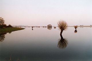
The Elbe is one of the major rivers of Central Europe. It rises in the Giant Mountains of the northern Czech Republic before traversing much of Bohemia, then Germany and flowing into the North Sea at Cuxhaven, 110 kilometres northwest of Hamburg. Its total length is 1,094 km (680 mi).

The Aller is a 215-kilometre-long (134 mi) river in the states of Saxony-Anhalt and Lower Saxony in Germany. It is a right-hand, and hence eastern, tributary of the Weser and is also its largest tributary. Its last 117 kilometres (73 mi) form the Lower Aller federal waterway. The Aller was extensively straightened, widened and, in places, dyked during the 1960s to provide flood control of the river. In a 20-kilometre-long (12 mi) section near Gifhorn, the river meanders in its natural river bed.

The Oker is a river in Lower Saxony, Germany, that has historically formed an important political boundary. It is a left tributary of the River Aller, 128 kilometres (80 mi) in length and runs in a generally northerly direction.

The Saale, also known as the Saxon Saale and Thuringian Saale, is a river in Germany and a left-bank tributary of the Elbe. It is not to be confused with the smaller Franconian Saale, a right-bank tributary of the Main, or the Saale in Lower Saxony, a tributary of the Leine.
The Kyffhäuserkreis is a district in the northern part of Thuringia, Germany. Neighboring districts are the districts Mansfeld-Südharz, Saalekreis and Burgenlandkreis in Saxony-Anhalt, and the districts Sömmerda, Unstrut-Hainich-Kreis and Eichsfeld.
Weimarer Land is a Landkreis (district) in the east of Thuringia, Germany. Neighboring districts are the district Burgenlandkreis in Saxony-Anhalt, the district Saale-Holzland and the district-free city Jena, the district Saalfeld-Rudolstadt, Ilm-Kreis, and the district-free city Erfurt. The district-free city Weimar is completely enclosed by the district.

The Bode is a river in the German state of Saxony-Anhalt, a left tributary of the Saale. It rises in the Harz mountains and drains them in a northerly direction. After 169 kilometres (105 mi) it discharges into the Saale at Nienburg. The river is named after a legendary giant, the wild, rampaging, Bohemian, Prince Bodo, who, according to the Rosstrappe legend, changed into a marauding dog that guarded the crown of Princess Brunhilde in the Kronensumpf in the present-day Bode Gorge. The gorge is the narrow section of the Bode valley between Treseburg and Thale.
The river Jeetzel, which begins in the Altmark under the name Jeetze, flows from Saxony-Anhalt through Lower Saxony, in Germany. From its source near the village of Dönitz, it flows north through Beetzendorf, Salzwedel, Wustrow, Lüchow and Dannenberg, before joining the Elbe in Hitzacker. Its total length is 73 kilometres (45 mi).

The Ise is a 43 km (27 mi) long, almost natural river of East Lower Saxony and Saxony-Anhalt, Germany. It crosses the district of Gifhorn from north to south and discharges into the Aller at Gifhorn itself.
The Ilse is a river of Saxony-Anhalt and Lower Saxony, Germany.
An urstromtal is a type of broad glacial valley, for example, in northern Central Europe, that appeared during the ice ages, or individual glacial periods of an ice age, at the edge of the Scandinavian ice sheet and was formed by meltwaters that flowed more or less parallel to the ice margin. Urstromtäler are an element of the glacial series. The term is German and means "ancient stream valley". Although often translated as "glacial valley", it should not be confused with a valley carved out by a glacier. More accurately some sources call them "meltwater valleys" or "ice-marginal valleys".

The Ecker is a 28-kilometre (17 mi), right-hand, southeast tributary of the Oker which runs mainly through the Harz mountains in the German states of Saxony-Anhalt and Lower Saxony.
The Goldbach is a river of Saxony-Anhalt, Germany. It is a left tributary of the River Bode, about 30 kilometres (19 mi) long, in the Harz Mountains.

The Selke is a river of Saxony-Anhalt, Germany.

The Thyra is a 20-kilometre-long (12 mi) river of Saxony-Anhalt, Germany, in the district of Mansfeld-Südharz in the Harz Mountains.

The Salza is a river of Saxony-Anhalt state, in Germany. It is a left tributary of the Saale in Salzmünde.

Würde is a river of Saxony-Anhalt, Germany. It flows into the Salza near Zappendorf.

A longitudinal valley is an elongated valley found between two almost-parallel mountain chains in geologically young fold mountains, such as the Alps, Carpathians, Andes, or the highlands of Central Asia. They are often occupied and shaped by a subsequent stream. The term is frequently used if a mountain range also has prominent transverse valleys, where rivers cut through the mountain chains in so-called water gaps.

