
The Lawrence Cabin is a log cabin located on Cobbs Creek in Powder Mill Valley Park in Havertown, Pennsylvania, near Nitre Hall.

The Lawrence Cabin is a log cabin located on Cobbs Creek in Powder Mill Valley Park in Havertown, Pennsylvania, near Nitre Hall.
Lawrence Cabin was built by Henry Lawrence and his family sometime around 1710 on land purchased from William Penn in 1709. [1] It was originally modelled based on log cabins of Swedish settlers to the area. [2]
A small log house, it is typical of the first homes originally built on the bank of Darby Creek at Old West Chester Pike by four early settlers, including David Lawrence. One of the early Welsh settlers in Haverford Township, David Lawrence emigrated with his wife Elinor Ellis and her family in 1684, and took up part of his father-in-law's land grant. His son Henry Lawrence then purchased 209 acres (0.85 km2) along Darby Creek in 1709. It has not been determined whether the log house pre-dates this purchase but a 2½ story stone addition was built circa 1730, and later a clapboard summer kitchen was added. It became known as the Three Generation House, [1] and remained in Lawrence family ownership until 1942. [2]
A large fireplace dominates the first floor room of Henry Lawrence's structure (Lawrence Cabin), with a ladder leading to the sleeping loft.
Originally located on Darby Creek, it was moved and rebuilt at Karakung Drive (Powder Mill Valley [3] ) 1961 by the Haverford Township Park Commission when threatened with destruction. [4] The building was officially dedicated and reopened on 7 October 1961. [1] Various tours and fundraising events occurred throughout the 1960s in order to raise funds to continue renovation and restoration of the building. [5] [6] 1966 saw the donation of a colonial wool-spinning wheel to the Cabin by the Pennsylvania Historical and Museum Commission, courtesy of the Landis Valley Museum. [7]
Lawrence Cabin, along with Nitre Hall, are both utilized for the Colonial Living Experience provided by The Haverford Township Historical Society for elementary school students; [8] the house is furnished appropriately in the period before 1750. [9] Both sites are also available to be viewed by locals during the Haverford Heritage Festival (est. 1965), [10] where local vendors sell food and trinkets.

New Sweden was a Swedish colony along the lower reaches of the Delaware River from 1638 to 1655 in North America, established during the Thirty Years' War when Sweden was a great military power. New Sweden formed part of the Swedish efforts to colonize the Americas. Settlements were established on both sides of the Delaware Valley in the region of Delaware, New Jersey, Maryland, and Pennsylvania, often in places where Swedish traders had been visiting since about 1610. Fort Christina in Wilmington, Delaware, was the first settlement, named after the reigning Swedish monarch. The settlers were Swedes, Finns, and a number of Dutch. New Sweden was conquered by the Dutch Republic in 1655 during the Second Northern War and incorporated into the Dutch colony of New Netherland.
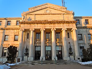
Delaware County, colloquially referred to as Delco, is a county in the Commonwealth of Pennsylvania. With a population of 576,830 as of the 2020 census, it is the fifth-most populous county in Pennsylvania and the third-smallest in area. The county was created on September 26, 1789, from part of Chester County and named for the Delaware River.

Drexel Hill is a neighborhood and census-designated place (CDP) located in Upper Darby, Pennsylvania, United States. The population was 29,181 at the 2020 census, an increase over the figure of 28,043 tabulated in 2010, and accounting for over one-third of Upper Darby's population.
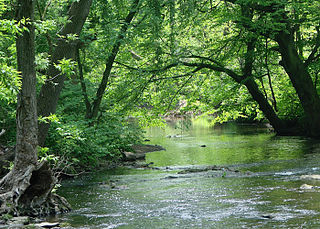
Haverford Township is a home rule municipality township in Delaware County, Pennsylvania, United States. Haverford is named after the town of Haverfordwest in Wales, United Kingdom. It is a commuting suburb located due west of Philadelphia and is officially known as the Township of Haverford. Despite being under a home rule charter since 1977, it continues to operate under a Board of Commissioners divided into wards, as do "First Class" townships that are still under the Pennsylvania Township Code. Haverford Township was founded in 1682 and incorporated in 1911.
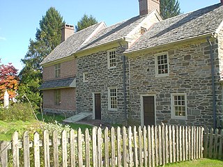
Marple Township is a township in Delaware County, Pennsylvania, United States. It contains the census designated place of Broomall. The population was estimated at 23,743 as of 2015. ZIP codes include mainly 19008, as well as 19064 and 19063. The township is run by Marple Township board of commissioners.

Millbourne is a self-governing municipal borough in Delaware County, Pennsylvania, United States. As of the 2020 census, the population is 1,212. Millbourne borders Philadelphia along Cobbs Creek. The borough was the former site of Millbourne Mills, which it is named after. The name "Millbourne" comes from the word Mill and "bourne" meaning creek. Millbourne, at over 17,000 people per square mile, is the most densely populated incorporated place in Pennsylvania, and 24th in the entire United States. The borough is a former financially distressed municipality.
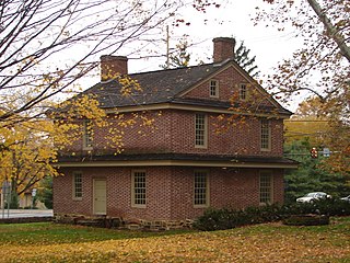
Newtown Township, also referred to by the name of its post office of Newtown Square, is a township in Delaware County, Pennsylvania, United States. Prior to 1789, it was part of Chester County. As of the 2020 census, the population was 15,002.
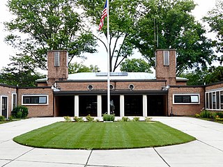
Springfield Township, or simply Springfield, is a township in Delaware County in the U.S. state of Pennsylvania. The population was 25,070 at the 2020 census. Springfield is a suburb of Philadelphia, located about 4 miles (6.4 km) west of the city.

Upper Darby Township, often shortened to Upper Darby, is a home rule township in Delaware County, Pennsylvania, United States..

The Hagley Museum and Library is a nonprofit educational institution in unincorporated New Castle County, Delaware, near Wilmington. Covering more than 235 acres (95 ha) along the banks of the Brandywine Creek, the museum and grounds include the first du Pont family home and garden in the United States, the powder yards, and a 19th-century machine shop. On the hillside below the mansion lies a Renaissance Revival garden, with terraces and statuary, created in the 1920s by Louise Evelina du Pont Crowninshield (1877–1958).

Darby Creek is a tributary of the Delaware River in Chester, Delaware and Philadelphia counties, in the U.S. Commonwealth of Pennsylvania. It is approximately 26 miles (42 km) long. The watershed of the creek has an area of 77.2 square miles (200 km2). It has twelve named direct tributaries, including Cobbs Creek, Little Darby Creek, Ithan Creek, and Muckinipattis Creek. The creek has a low level of water quality for most of its length. The lower Darby Creek area was deemed a Superfund site by the U.S. Environmental Protection Agency (EPA) due to contamination with dangerous chemicals from two landfills.
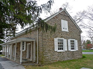
Havertown is a residential suburban unincorporated community in Haverford Township, Pennsylvania, United States. It is located approximately 9 miles west of the center of Philadelphia. Havertown's ZIP Code is 19083 and "Havertown" is a postal address. The name "Havertown" was coined by the U.S. Post Office and came into use on January 1, 1946. Before then, each constituent community was known by its local name: Bon Air, Brookline, Penfield, Beechwood, Llanerch, Manoa, Oakmont, Coopertown, and Ardmore. Under William Penn's land divisions these communities were part of the Welsh Tract and comprised the area known as Harford, a Welsh contraction of Haverford.

Cobbs Creek is an 11.8-mile-long (19.0 km) tributary of Darby Creek in Delaware County, Pennsylvania, in the United States. It forms an approximate border between Montgomery County and Delaware County. After Cobbs Creek passes underneath Township Line Road, it forms the border between Philadelphia County and Delaware County. It runs directly through the two sides of Mount Moriah Cemetery which spans the border of Southwest Philadelphia and Yeadon, Pennsylvania. It later joins Darby Creek before flowing into the Delaware River.
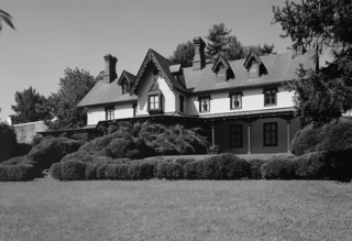
The Grange Estate, also known as Maen-Coch and Clifton Hall, is a historic mansion built by Henry Lewis Jr. (1671–1730) in Havertown, Pennsylvania, near Philadelphia, in Delaware County, Pennsylvania. Parts of a c. 1700 residence may be incorporated in the carriage house.

Nitre Hall is a nineteenth-century, American building that is located in Haverford Township, Delaware County, Pennsylvania.

Ithan Creek is a tributary of Darby Creek in Delaware County, Pennsylvania, in the United States. It is approximately 4.2 miles (6.8 km) long and flows through Radnor Township and Haverford Township. The creek's watershed has an area of 7.39 square miles (19.1 km2) and is highly developed. It has three named tributaries: Browns Run, Kirks Run, and Meadowbrook Run.

State Route 2005 is a major 9.3 mile (15 km) long road, running in a southeast–northwest direction in Delaware County, Pennsylvania. The western terminus is at Pennsylvania Route 320 in Haverford Township, Pennsylvania. Its eastern terminus is at a Cobbs Creek bridge in Darby, Pennsylvania. Past this bridge is State Route 3023, which continues into Philadelphia. SR 2005 is known as Darby Road in Haverford Township, Lansdowne Avenue from U.S. Route 1 to Darby, and Main Street in Darby.

The Lower Swedish Cabin is a historic Swedish-style log cabin which is located on Creek Road in the Drexel Hill section of Upper Darby, Pennsylvania, along Darby Creek. The cabin may be one of the oldest log cabins in the United States and is one of the last cabins built by the Swedish settlers that remains intact.
The New Sweden Farmstead Museum was an open-air museum in Bridgeton, New Jersey, United States. A recreation of a 17th-century Swedish farmstead, it was located in City Park, and served as a historical remembrance of the history of the Swedish and Finnish people who arrived as part of the colony of New Sweden in early America. Originally opened in 1988, it operated as a living museum for many years. As funding and attendance declined, the log buildings at the complex fell into disrepair, requiring it to close.
Avola is an unincorporated community in the Thompson region of eastern British Columbia. The former ferry site is on the west shore of the North Thompson River immediately north of the mouth of Avola Creek. Off BC Highway 5, the locality is by road about 190 kilometres (118 mi) northeast of the Kamloops and 40 kilometres (25 mi) south of Blue River.