Related Research Articles

Savannah is the oldest city in the U.S. state of Georgia and is the county seat of Chatham County. Established in 1733 on the Savannah River, the city of Savannah became the British colonial capital of the Province of Georgia and later the first state capital of Georgia. A strategic port city in the American Revolution and during the American Civil War, Savannah is today an industrial center and an important Atlantic seaport. It is Georgia's fifth-largest city, with a 2019 estimated population of 144,464. The Savannah metropolitan area, Georgia's third-largest, had an estimated population of 393,353 in 2019.

Macon, officially Macon–Bibb County, is a consolidated city-county in the U.S. state of Georgia. Macon lies near the state's geographic center, about 85 miles (137 km) southeast of Atlanta—hence the city's nickname, "The Heart of Georgia".

Tybee Island is a city and a barrier island located in Chatham County, Georgia, 18 miles (29 km) east of Savannah, United States. Though the name "Tybee Island" is used for both the island and the city, geographically they are not identical: only part of the island's territory lies within the city.

Darien is a city in McIntosh County, Georgia, United States. It lies on Georgia's coast at the mouth of the Altamaha River, approximately 50 miles south of Savannah, and is part of the Brunswick, Georgia Metropolitan Statistical Area. The population of Darien was 1,975 at the 2010 census. The city is the county seat of McIntosh County. It is the second oldest planned city in Georgia and was originally called New Inverness.

The Province of Georgia was one of the Southern colonies in British America. It was the last of the thirteen original American colonies established by Great Britain in what later became the United States. In the original grant, a narrow strip of the province extended to the Pacific Ocean.

Springer Mountain is a mountain located in the Chattahoochee National Forest on the border of Fannin and Gilmer counties. Located in the Blue Ridge Mountains in northern Georgia, the mountain has an elevation of about 3,782 feet (1,153 m). Springer Mountain serves as the southern terminus for the Appalachian and Benton MacKaye trails.

Jekyll Island is located off the coast of the U.S. state of Georgia, in Glynn County. It is one of the Sea Islands and one of the Golden Isles of Georgia barrier islands. The island is owned by the State of Georgia and run by a self-sustaining, self-governing body.

A lazaretto or lazaret is a quarantine station for maritime travellers. Lazarets can be ships permanently at anchor, isolated islands, or mainland buildings. In some lazarets, postal items were also disinfected, usually by fumigation. This practice was still being done as late as 1936, albeit in rare cases. A leper colony administered by a Christian religious order was often called a lazar house, after the parable of Lazarus the beggar.

The Battle of Bloody Marsh took place on 7 July 1742 between Spanish and British forces on St. Simons Island, part of the Province of Georgia, resulting in a victory for the British. Part of the War of Jenkins' Ear, the battle was for the British fortifications of Fort Frederica and Fort St. Simons, with the strategic goal the sea routes and inland waters they controlled. With the victory, the Province of Georgia established undisputed claim to the island. It is now part of the U.S. state of Georgia. The British also won the Battle of Gully Hole Creek, which took place on the island the same day.

Brookhaven is a city in the northeastern suburbs of Atlanta and is located in western DeKalb County, Georgia, United States, directly northeast of Atlanta. On July 31, 2012, Brookhaven was approved in a referendum to become DeKalb County's 11th city. Incorporation officially took place on December 17, 2012, on which date municipal operations commenced. With a population of around 55,554 as of 2019, it is the largest city in DeKalb County. The new city stretches over 12 square miles (31 km2).

The Battle of Gully Hole Creek was a battle that took place on July 18, 1742 between Spanish and British forces in the Province of Georgia, resulting in a victory for the British. Part of a much larger conflict, known as the War of Jenkins' Ear, the battle was for control of St. Simons Island, the British fortifications of Fort Frederica and Fort St. Simons, and the strategic sea routes and inland waters they controlled. After the victory, the Province of Georgia established undisputed claim to the island, which is now part of the U.S. state of Georgia. The better-known Battle of Bloody Marsh, a skirmish also won by the British, took place on the island the same day.

Manoel Island, formerly known as Bishop's Island or the Isolotto, is a small island which forms part of the municipality of Gżira in Marsamxett Harbour, Malta. It is named after the Portuguese Grand Master António Manoel de Vilhena, who built a fort on the island in the 1720s.

Cockspur Island is an island in the south channel of the Savannah River near Lazaretto Creek, northwest of Tybee Island, Georgia, United States. Most of the island is within the boundaries of Fort Pulaski National Monument. The island was so named on account of its bent shape. It was originally called Pepper Island and is also called Long Island.

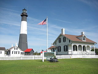
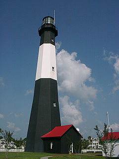
Tybee Island Light is a lighthouse next to the Savannah River Entrance, on the northeast end of Tybee Island, Georgia. It is one of seven surviving colonial era lighthouse towers, though highly modified in the mid 1800s.
The city of Savannah, Georgia, the largest city and the county seat of Chatham County, Georgia, was established in 1733 and was the first colonial and state capital of Georgia. It is known as Georgia's first planned city and attracts millions of visitors, who enjoy the city's architecture and historic structures such as the birthplace of Juliette Gordon Low, the Telfair Academy of Arts and Sciences, the First African Baptist Church, Congregation Mickve Israel, and the Central of Georgia Railway roundhouse complex. Today, Savannah's downtown area is one of the largest National Historic Landmark Districts in the United States.
U.S. Route 80 (US 80) is a 296-mile-long (476 km) U.S. Highway in the U.S. state of Georgia. It travels west-to-east from the Alabama state line in Columbus across the central portion of the state through cities such as Macon, Dublin, Statesboro, and Savannah to connect to its eastern terminus at an intersection with Tybrisa Street and Inlet Avenue in Tybee Island, near the Atlantic Ocean. Here, the roadway continues as Butler Avenue.

The Philadelphia Lazaretto was the first quarantine hospital in the United States, built in 1799, in Tinicum Township, Delaware County, Pennsylvania. The site was originally inhabited by the Lenni Lenape, and then the first Swedish settlers in America. Nearby Province Island was the site of the confinement of the Christian Moravian Indians who were brought there under protective custody from Lancaster, PA in 1763 when their lives were threatened by the Paxton Boys. The facility predates similar national landmarks such as Ellis Island Immigrant Hospital and Angel Island and is considered both the oldest surviving quarantine hospital and the last surviving example of its type in the United States.

Dungeness on Cumberland Island, Georgia, is a ruined mansion that is part of a historic district that was the home of several families significant in American history. James Oglethorpe first built on Cumberland Island in 1736, building a hunting lodge that he named Dungeness. Oglethorpe named the place after Dungeness, in England. The next Dungeness was the legacy of Revolutionary War hero Nathanael Greene, who had acquired 11,000 acres (45 km2) of island land in exchange for a bad debt. In 1803, his widow Catharine Littlefield Greene built a four-story tabby mansion over a Timucuan shell mound. During the War of 1812 the island was occupied by the British, who used the house as a headquarters.
Trustee Georgia is the name of the period covering the first twenty years of Georgia history, from 1732–1752, because during that time the English Province of Georgia was governed by a Board of Trustees. England's King George II, for whom the colony was named, signed a charter establishing the colony and creating its governing board on July 7, 1732. His action culminated a lengthy process. Tomochichi was a Native American that resides along the Savannah River that allowed Oglethorpe to settle on the Yamacraw Bluff.
Hayes Crossing is an unincorporated community in Stephens County, in the U.S. state of Georgia, at an elevation of 944 feet (288 m) above mean sea level.
References
- ↑ U.S. Geological Survey Geographic Names Information System: Lazaretto Creek
- ↑ Krakow, Kenneth K. (1975). Georgia Place-Names: Their History and Origins (PDF). Macon, GA: Winship Press. p. 130. ISBN 0-915430-00-2.
- 1 2 3 4 5 6 Lenz, Richard J. Longstreet Highroad Guide to the Georgia Coast & Okefenokee. Longstreet.
- ↑ Boyd, Kenneth (1991). Georgia Historical Markers. Atlanta, GA.: Cherokee Publishing Company. p. 85. ISBN 0-87797-215-X.
| This article related to a river in the US state of Georgia is a stub. You can help Wikipedia by expanding it. |