Related Research Articles

Leelanau County is a county located in the U.S. state of Michigan. As of the 2020 census, the population was 22,301. Since 2008, the county seat has been located within Suttons Bay Township, one mile east of the unincorporated village of Lake Leelanau. Before 2008, Leelanau County's seat was Leland. Leelanau County is included in the Traverse City metropolitan area of Northern Michigan. The largest settlement in Leelanau County by population is Greilickville, itself a suburb of Traverse City.

Grand Traverse County is a county located in the U.S. state of Michigan. As of the 2020 census, the population was 95,238, making it the largest county in Northern Michigan. Its county seat is Traverse City. The county is part of the Traverse City metropolitan area, which also includes neighboring Benzie, Kalkaska, and Leelanau counties.
Benzie County is a county in the U.S. state of Michigan. As of the 2020 census, the population was 17,970. The county seat is Beulah. The county was initially set off in 1863 and organized in 1869. At 321 square miles (830 km2), Benzie County is the smallest of the 83 counties in Michigan in terms of land area.

Peninsula Township is a civil township of Grand Traverse County in the U.S. state of Michigan. The township had a population of 6,068 at the 2020 census, an increase from 5,433 at the 2010 census.

Empire Township is a civil township of Leelanau County in the U.S. state of Michigan. The population was 764 at the 2020 census. On the shores of Lake Michigan, Empire Township contains a substantial amount of land within the Sleeping Bear Dunes National Lakeshore.

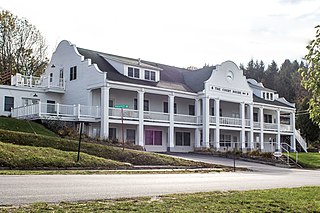
Leland Township is a civil township of Leelanau County in the U.S. state of Michigan. As of the early 2000s, the unincorporated community of Leland, which lies totally within the township, was the county seat of Leelanau County. However, county voters on August 3, 2004, approved a proposal to build a new governmental center in adjacent Suttons Bay Township; the move to the new facility was completed in 2008. As of the 2020 census, Leland Township population was 2,126.

Northport is a village in Leelanau County in the U.S. state of Michigan. Located near the northern tip of the Leelanau Peninsula, Northport is located within Leelanau Township, and lies on the shore of Grand Traverse Bay, a bay of Lake Michigan. Northport had a population of 496 at the 2020 census. The village is located about 29 miles (47 km) north of Traverse City, and is part of that city's metropolitan area. From 1863 to 1883, Northport served as the county seat of Leelanau County.
A Pure Michigan Byway is the designation for a segment of the State Trunkline Highway System in the US state of Michigan that is a "scenic, recreational, or historic route that is representative of Michigan's natural and cultural heritage." The designation was created with the name Michigan Heritage Route by the state legislature on June 22, 1993, and since then six historic, seven recreational and seven scenic byways have been designated by the Michigan Department of Transportation (MDOT), and another two have been proposed. These byways have been designated in both the Upper and Lower peninsulas of the state. The current name was adopted on December 30, 2014, and it references the Pure Michigan tourism marketing campaign.

M-37 is a north–south state trunkline highway in the US state of Michigan. The southern terminus is near the border between Kalamazoo and Calhoun counties at exit 92 of Interstate 94 (I-94) southwest of Battle Creek. The northern terminus is at the Mission Point Light on Old Mission Point in Grand Traverse County. In between, the highway connects Battle Creek, Grand Rapids and Traverse City. Motorists will travel through agricultural land, forests, suburbs and large cities along the way. The section of M-37 on the Old Mission Peninsula was designated what is now a Pure Michigan Scenic Byway in 2008.

Sleeping Bear Dunes National Lakeshore is a U.S. national lakeshore in the northwestern Lower Peninsula of Michigan. Located within Benzie and Leelanau counties, the park extends along a 35-mile (56 km) stretch of Lake Michigan's eastern coastline, as well as North and South Manitou islands, preserving a total of 71,199 acres. The park is known for its outstanding natural features, including dune formations, forests, beaches, and ancient glacial phenomena. The lakeshore also contains many cultural features, including the 1871 South Manitou Island Lighthouse, three former stations of the Coast Guard, and an extensive rural historic farm district.
Leelanau may refer to a number of articles relating to the region of the northwestern Lower Peninsula of Michigan:
The Leelanau Peninsula is a peninsula of the U.S. state of Michigan that extends about 30 miles (50 km) from the western side of the Lower Peninsula of Michigan into Lake Michigan, forming Grand Traverse Bay. It is often referred to as the "little finger" of the mitten-shaped lower peninsula. The peninsula is a tourist hotspot, especially due to the popularity of Sleeping Bear Dunes National Lakeshore, which adorns the southwestern coast of the peninsula. The peninsula is also largely agricultural, and is a production hotspot for cherries and wine.

M-22 is a state trunkline highway in the US state of Michigan. It is 116.7 miles (187.8 km) long and follows the Lake Michigan shoreline of the Leelanau Peninsula, making up a portion of the Lake Michigan Circle Tour. It also passes through the Sleeping Bear Dunes National Lakeshore. The highway is U-shaped as it rounds the peninsula running through tourist areas in Leland and Suttons Bay in addition to the national lakeshore.

M-209 was a state trunkline highway in the Lower Peninsula of the US state of Michigan. It was located in Leelanau County in the Sleeping Bear Dunes National Lakeshore. Until it was decommissioned, it was Michigan's shortest state highway. M-209 started at M-109 and went just over 1⁄2 mile to Glen Haven. In 1995, M-209's designation was "abandoned", and the road was turned over to the jurisdiction of the Leelanau County Road Commission.

M-204 is a state trunkline highway that runs across the Leelanau Peninsula between Leland and Suttons Bay in the northwestern Lower Peninsula of the US state of Michigan. The trunkline runs through a rural section of Leelanau County, connecting two villages with the county seat. Originally a gravel road in 1933, it was later paved within the first three years of existence. Segments were realigned to straighten curves in the late 1930s and early 1970s near the villages of Lake Leelanau and Suttons Bay.
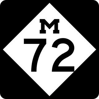
M-72 is a state trunkline highway in the US state of Michigan, running from Lake Huron to Lake Michigan across the northern part of the Lower Peninsula. The highway connects M-22 in Empire with US Highway 23 (US 23) in Harrisville. It is one of only three Michigan state trunklines that cross the Lower Peninsula, shore to shore. In between, M-72 runs across Northern Michigan woodland, agricultural areas of the Leelanau Peninsula near Traverse City, and the Au Sable River watershed. The trunkline also provides access to Camp Grayling, a National Guard training facility near the city of the same name. Traffic levels along the highway vary from approximately 800 vehicles a day on the east end to over 32,000 vehicles near Traverse City.

M-123 is a state trunkline highway in the eastern Upper Peninsula of the US state of Michigan. It is one of only a few highways in Michigan that curve around and form a U-shape. In fact, M-123 has three intersections with only two state trunklines; it meets M-28 twice as a result of its U-shaped routing. M-123 also has a rare signed concurrency with a County-Designated Highway in Michigan; in Trout Lake, there is a concurrency with H-40. All of M-123 north of M-28 is a Scenic Heritage Route within the Michigan Heritage Route system.

M-109 is the designation of a state trunkline highway in the Lower Peninsula of the US state of Michigan that runs between Empire and Glen Arbor. The highway is a loop connected to M-22 at both ends that allows tourists access to Sleeping Bear Dunes National Lakeshore and the Pierce Stocking Scenic Drive located on a section of sandy forest land between Lake Michigan and Glen Lake. The trunkline traverses an area named the "Most Beautiful Place in America" by Good Morning America, the morning show on ABC. The highway was designated by 1929 and fully paved in 1939.

M-201 is a state trunkline highway in the US state of Michigan that serves as a spur route for the village of Northport near the northern tip of Leelanau County. The trunkline zig-zags through to provide a path through the village, connecting with the county road that provides access to Leelanau State Park. The highway was first shown on state maps in the late 1940s, and remains unchanged since.
The Leelanau Trail is part of U.S. Bicycle Route 35, but also an all paved non-motorized recreational rail trail of 17-mile (27 km) in length that extends from the west side of Traverse City, Michigan to Suttons Bay, Michigan.
References
- ↑ Leelanau Scenic Heritage Route Committee. "The Leelanau Scenic Heritage Route" (PDF). Northwest Michigan Council of Governments. p. 6. Retrieved July 14, 2012.
If an internal link led you here, you may wish to change the link to point directly to the intended article.