Related Research Articles

California is a state in the Pacific Coast region of the United States. With over 39.3 million residents across a total area of approximately 163,696 square miles (423,970 km2), it is the most populous U.S. state and the third-largest by area, as well as the world's thirty-fourth-most-populous subnational entity. California is also the most populated subnational entity in North America, and has its state capital in Sacramento. The Greater Los Angeles area and the San Francisco Bay Area are the nation's second- and fifth-most-populous urban regions, with more than 18.7 million and 9.6 million residents respectively. Los Angeles is California's most populous city, and the country's second-most-populous, after New York City. California also has the nation's most populous county, Los Angeles County, and its largest county by area, San Bernardino County. The City and County of San Francisco is both the country's second most densely populated major city after New York City and the fifth-most-densely populated county, behind only four of the five New York City boroughs.

Sacramento is the capital city of the U.S. state of California and the seat and largest city of Sacramento County. Located at the confluence of the Sacramento River and the American River in Northern California's Sacramento Valley, Sacramento's estimated 2019 population of 513,625 makes it the sixth-largest city in California and the ninth-largest capital in the United States. Sacramento is the seat of the California Legislature and the Governor of California, making it the state's political center and a hub for lobbying and think tanks. Sacramento is also the cultural and economic core of the Sacramento metropolitan area, which at the 2010 census had a population of 2,414,783, making it the fifth-largest in California.

Sacramento County is a county located in the U.S. state of California. As of the 2010 census, the population was 1,418,788. Its county seat is Sacramento, which has been the state capital of California since 1854.
Interstate 5 (I-5) is the main north–south Interstate Highway on the West Coast of the United States, running largely parallel to the Pacific coast of the contiguous U.S. from Mexico to Canada. It travels through the states of California, Oregon, and Washington, serving several large cities on the U.S. West Coast, including San Diego, Los Angeles, Sacramento, Portland, and Seattle. It is the only continuous Interstate highway to touch both the Mexican and the Canadian borders. Upon crossing the Mexican border at its southern terminus, I-5 continues to Tijuana, Baja California, as Mexico Federal Highway 1 (Fed. 1). Upon crossing the Canadian border at its northern terminus, it continues to Vancouver as British Columbia Highway 99 (BC 99).

Northern California is a geographic and cultural region that generally comprises the northern portion of the U.S. state of California. Spanning the state's northernmost 48 counties, its main population centers include the San Francisco Bay Area, the Greater Sacramento area, and the Metropolitan Fresno area. Northern California also contains redwood forests, along with the Sierra Nevada, including Yosemite Valley and part of Lake Tahoe, Mount Shasta, and most of the Central Valley, one of the world's most productive agricultural regions.

The Capitol Corridor is a 168-mile (270 km) passenger train route operated by Amtrak between San Jose and Auburn, California. Most trains operate between San Jose and Sacramento, roughly parallel to Interstate 880 and Interstate 80. One round trip per day runs from Oakland through the eastern Sacramento suburbs to Auburn, in the foothills of the Sierra Nevada, while a single weekend round trip runs all the way from San Jose to Auburn. Capitol Corridor trains started in 1991.

State Route 140 is a state highway in the U.S. state of California, 102 miles (164 km) in length. It begins in the San Joaquin Valley at Interstate 5 near Gustine, and runs east into Sierra Nevada, terminating in Yosemite National Park.

Area codes 415 and 628 are telephone area codes in the North American Numbering Plan (NANP) for the city of San Francisco and its northern suburbs in Marin County, and the northeast corner of San Mateo County.

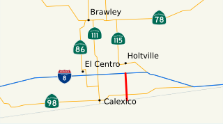
State Route 7 is a state highway in the U.S. state of California, running from the Calexico East Port of Entry on the U.S.-Mexico border east of Calexico north to its terminus at Interstate 8 (I-8), where Orchard Road continues the route north towards Holtville. The route provides convenient access to the country of Mexico from I-8. The southern portion of the route opened in 1996, and the rest of the route connecting to I-8 opened in 2005.

Central California is generally thought of as the middle third of the state, north of Southern California. It includes the northern portion of the San Joaquin Valley, part of the Central Coast, the central hills of the California Coast Ranges and the foothills and mountain areas of the central Sierra Nevada.

The Western Railway Museum, in Solano County, California is located on Highway 12 between Rio Vista and Suisun. The museum is built along the former mainline of the Sacramento Northern Railway. Their collection focuses on trolleys, as it is primarily a museum of interurban transit equipment.

California's transportation system is complex and dynamic. Although known for its car culture and extensive network of freeways and roads, the state also has a vast array of rail, sea, and air transport. Several subway, light rail, and commuter rail networks are found in many of the state's largest population centers. In addition, with the state's location on the West Coast of the United States, several important ports in California handle freight shipments from the Pacific Rim and beyond. A number of airports are also spread out across the state, ranging from small general aviation airports to large international hubs like Los Angeles International Airport and San Francisco International Airport.
Interstate 5 (I-5) is a major north–south route of the Interstate Highway System in the United States, stretching from the Mexican border at the San Ysidro crossing to the Canadian border near Blaine, Washington. From San Ysidro, the segment of I-5 in California runs north across the length of the state, and crosses into Oregon south of the Medford-Ashland metropolitan area. It is the more important and most-used of the two major north–south routes on the Pacific Coast, the other being U.S. Route 101 (US 101), which is primarily coastal. I-5 is known colloquially as "the 5" to Southern California residents, "5" to Northern California residents.
The Golden Empire Council (GEC-BSA) is a California-based 501(c)(3) nonprofit affiliated with the Boy Scouts of America and its Western Region, Area 4. The council serves a large section of Northern California, primarily the Sacramento Valley and the northern Sierra Nevada. Its boundaries range north to south from Redding to Elk Grove and west to east from Vacaville to Pollock Pines and include 16 Northern California Counties. Its council headquarters and service center is located in Sacramento. The council also operates Scout Shops selling BSA merchandise are located in both Sacramento and Chico.

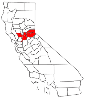
The Greater Sacramento area, or officially Sacramento–Roseville, CA Combined Statistical Area, is a combined statistical area consisting of several metropolitan statistical areas and seven counties in Northern California, namely Sacramento, Yolo, El Dorado, Placer, Sutter, Yuba, and Nevada counties.

Tahoe Park is a neighborhood located within the city of Sacramento, California.

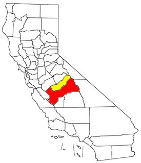
Metropolitan Fresno, officially Fresno–Madera, CA CSA, is a metropolitan area in the San Joaquin Valley, in the United States, consisting of Fresno and Madera counties. It is the third-largest metropolitan region in Northern California, behind the San Francisco Bay Area and Greater Sacramento. It is also the 49th-largest CSA in the U.S. as of 2010 census.

The Northern California Megaregion, distinct from Northern California, is an urbanized region of California consisting of many large cities including San Jose, San Francisco, Sacramento, and Oakland. There are varying definitions of the megaregion, but it is generally seen as encompassing the San Francisco Bay Area, the Sacramento area, northern San Joaquin Valley, and the Monterey Bay Area.
The Sacramento County Public Law Library (SCPLL) is a “public” law library in the capital city of the State of California. In 1891 the state of California enacted statutes mandating an independent law library in every county. Since its inception SCPLL has provided free public access to legal information.

Transportation in the Sacramento metropolitan area consists of a variety of different modes of travel in El Dorado County, Placer County, Sacramento County, and Yolo County, which are the four counties that comprise the Sacramento metropolitan area.
References
- ↑ 2019 LSNC Annual Report (PDF). Sacramento, CA: Legal Services of Northern California. Retrieved 17 February 2021.
- ↑ "Contact Us" . Retrieved 31 October 2019.
| | This article relating to law in the United States or its constituent jurisdictions is a stub. You can help Wikipedia by expanding it. |