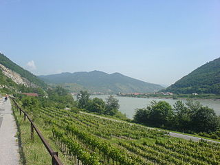
Württemberg, a hilly rather than a mountainous region, forms part of the South German tableland, also referred to as the Swiss plateau. The undulating fertile terraces of Upper and Lower Swabia typify this agricultural region. Estimates of land form proportions count a quarter of the entire area as plain, less than one-third as mountainous, and nearly one-half as hill-country.
Alb-Donau-Kreis is a Landkreis (district) in Baden-Württemberg, Germany. It is bounded by the districts of Biberach, Reutlingen, Göppingen and Heidenheim, the two Bavarian districts Günzburg and Neu-Ulm, and the city of Ulm.

The Upper Palatinate is one of the seven administrative districts of Bavaria, Germany, located in the east of Bavaria.

The Iller (help·info) is a river in Bavaria and Baden-Württemberg in Germany. It is a right tributary of the Danube, 146 kilometres (91 mi) long.

The Bavarian Forest is a wooded, low-mountain region in Bavaria, Germany that is about 100 kilometres long. It runs along the Czech border and is continued on the Czech side by the Bohemian Forest. Most of the Bavarian Forest lies within the province of Lower Bavaria, but the northern part lies within Upper Palatinate. In the south it reaches the border with Upper Austria.

Günzburg is a Landkreis (district) in Swabia, Bavaria, Germany. It is bounded by the districts of Dillingen, Augsburg, Unterallgäu and Neu-Ulm, and by the state of Baden-Württemberg.

Unterallgäu is a Landkreis (district) in Swabia, Bavaria, Germany. Neighboring districts are Neu-Ulm, Günzburg, Augsburg, Ostallgäu, Oberallgäu, and the districts Ravensburg und Biberach in Baden-Württemberg. The district-free city Memmingen in the west of the district is nearly surrounded by the district. The capital of the district is Mindelheim.

Nersingen is a municipality in the District of Neu-Ulm in Bavaria, Germany. The neighbours are Neu-Ulm, Elchingen, Bibertal and Pfaffenhofen an der Roth.
The Biber is a right tributary of the Danube in Bavaria, Germany. The source of the Biber is in the south of the hamlet Matzenhofen in Unterroth. The river is 37.3 km long.

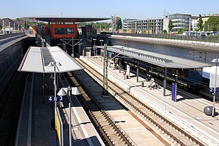
Ulm Hauptbahnhof is the main station in the city of Ulm, which lies on the Danube, on the border of the German states of Baden-Württemberg and Bavaria in the Danube-Iller region.
The Ulm–Augsburg line is a German railway line. It was constructed as part of the Bavarian Maximilian's Railway. It was built for the Royal Bavarian State Railways as part of the east-west connection between Neu-Ulm in the west via Augsburg, Munich and Rosenheim to the Austrian border at Kufstein and Salzburg in the east.
EuroVelo 6 (EV6), named The Rivers Route, is a EuroVelo long-distance cycling route running along 3,653 km (2,270 mi) some of Europe's major rivers, including much of the Loire, some of the Saône, a short section of the upper Rhine and almost the entire length of Europe’s second longest river, the Danube — from the Atlantic coast of France to the city of Constanța on the Black Sea.

The Bavarian Maximilian’s Railway was as an east-west line built between the Bavarian border with Württemberg at Neu-Ulm in the west via Augsburg, Munich and Rosenheim to the Austrian border at Kufstein and Salzburg in the east as part of the Royal Bavarian State Railways. The Munich–Augsburg section of the line had already been built by the Munich-Augsburg Railway Company and opened in 1840. The line was named after the reigning King of Bavaria from 1848 to 1864 Maximilian II.
The Danube Valley Railway in Bavaria in southern Germany is the railway line that runs from Regensburg via Ingolstadt and Donauwörth to Ulm, just over the Bavarian border in Baden-Württemberg.
The Neu-Ulm–Kempten railway is a mostly single track and non-electrified main line from Neu-Ulm via Memmingen to Kempten in the German state of Bavaria. It follows the Iller river for its entire length and is therefore also called the Iller Valley Railway. The line from Neu-Ulm to Kellmünz is integrated in the Donau-Iller-Nahverkehrsverbund. It is listed in the timetable under the number of 975; between New Ulm and Memmingen it is also served by services running on route 756.

The Lower Bavarian Upland, Lower Bavarian Hill Country or Lower Bavarian Hills, are part of the tertiary Hügelland or hill country south of the River Danube and cover much of the land within the Bavarian province of Lower Bavaria in southern Germany. To the north it is bordered by the Gäuboden region and the Bavarian Forest; to the south by Upper Bavaria, to the east by the Lower Inn Valley and to the west by the Franconian Jura. In the western part of the Lower Bavarian Hills lies the Hallertau, the world's largest hop-growing region. It belongs to two of officially defined natural regions in Germany: the eponymous Lower Bavarian hills and the Isar-Inn Gravel Beds (Isar-Inn-Schotterplatten) and is sub-divided into the Danube-Isar Hills (Donau-Isar-Hügelland) and the Isar-Inn Upland (Isar-Inn-Hügelland) with the River Isar as the boundary. The hills continue over the border into Austria as the Upper Austrian Hills.
Mittelschwaben is a part of the Bavarian administrative region Swabia. It consists of the districts Günzburg, Neu-Ulm, Unterallgäu and the district-free town Memmingen.
Neu-Ulm station is the largest railway station of the Bavarian Große Kreisstadt of Neu-Ulm. Other station in Neu-Ulm are Gerlenhofen and Finninger Straße, both on the Neu-Ulm–Kempten railway, and the disused Burlafingen station on the Ulm–Augsburg railway.