Related Research Articles

The Main is the longest tributary of the Rhine. It rises as the White Main in the Fichtel Mountains of northeastern Bavaria and flows west through central Germany for 525 kilometres (326 mi) to meet the Rhine below Rüsselsheim, Hesse. The cities of Mainz and Wiesbaden are close to the confluence.

The Lahn is a 245.6-kilometre-long (152.6 mi), right tributary of the Rhine in Germany. Its course passes through the federal states of North Rhine-Westphalia (23.0 km), Hesse (165.6 km), and Rhineland-Palatinate (57.0 km).

The Rhön Mountains are a group of low mountains in central Germany, located around the border area where the states of Hesse, Bavaria and Thuringia come together. These mountains, which are at the extreme southeast end of the East Hesse Highlands, are partly a result of ancient volcanic activity. They are separated from the Vogelsberg Mountains by the river Fulda and its valley. The highest mountain in the Rhön is the Wasserkuppe, which is in Hesse. The Rhön Mountains are a popular tourist destination and walking area.

The Sihl is a Swiss river that rises near the Druesberg mountain in the canton of Schwyz, and eventually flows into the Limmat in the centre of the city of Zürich, after crossing the Zürich–Winterthur railway at Zürich HB. It has a length of 73 km (45 mi), including the Sihlsee reservoir, through which the river flows. Water is abstracted from the river at the Sihlsee, leading to decreased downstream water flows and a consequent reduction in water quality.
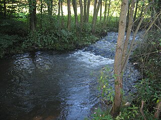
Leimbach may refer to:

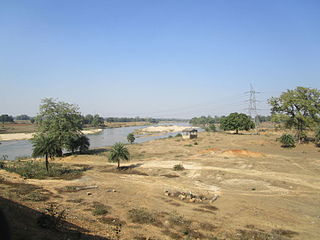
The Barakar River is the main tributary of the Damodar River in eastern India. Originating near Padma in Hazaribagh district of Jharkhand it flows for 225 kilometres (140 mi) across the northern part of the Chota Nagpur Plateau, mostly in a west to east direction, before joining the Damodar near Dishergarh in Asansol, Bardhaman district of West Bengal. It has a catchment area of 6,159 square kilometres (2,378 sq mi). Its main tributaries Barsoti and Usri flow in from the south and north, respectively. Apart from the two main tributaries, some 15 medium or small streams also join it.
The East Hesse Highlands describes a heavily wooded range of hills lying mainly in the German state of Hesse, but also extending a little way into Lower Saxony to the north, Thuringia to the east and Bavaria to the southeast. The region is sandwiched between the West Hesse Depression to the west, the Weser Uplands to the north, the Thuringian Basin to the northeast, the northwestern edge of the Thuringian Forest to the east, the Spessart to the south and the Wetterau to the southwest.

The Kakisa River is a major tributary of the Mackenzie River in the Northwest Territories of Canada.
The Puskwaskau River is a short river in Northern Alberta, Canada. It is a tributary of the Smoky River flowing westwards in the Peace River Country. Its waters flow through the Smoky River, Peace River, Slave River, Great Slave Lake and Mackenzie River into the Arctic Ocean.

The Weschnitz is a 59.4-kilometre-long (36.9 mi) right tributary of the Rhine running through the German states of Hesse and Baden-Württemberg. The name of the river traces to the Celtic god Visucius, who was worshiped in the region.

The Zorge is a tributary of the Helme in central Germany. It is about 40 km (25 mi) long and flows from the state of Lower Saxony into Thuringia. In many sources the name Zorge is translated as "wild river".

Gauangelbach is a river of Baden-Württemberg, Germany. It flows into the Leimbach in Dielheim. enpferch.[2] It soon emerges from the forest, crosses the Rodungsinsel to the south, intersects the L 600 that runs through it and then follows the edge of the Gauangellocher Teich forest area, before turning south-east through this forest in the direction of Gauangelloch.

The Rhünda, also called the Rhündabach, is a 12.9 kilometres (8.0 mi) long, eastern tributary of the River Schwalm in the Schwalm-Eder-Kreis, North Hesse, Germany.
Sontra is a river of Hesse, Germany. It passes through the town Sontra, and flows into the Wehre in Oetmannshausen.

The Pfrimm is a 42.7-kilometre-long (26.5 mi), left or western tributary of the Rhine in the Rhineland-Palatinate (Germany).
Schemmerbach is a river of Hesse, Germany. It flows into the Wehre in Waldkappel.
Wehre is a river in Hesse, Germany. Its source is in the Kaufungen Forest, near the village Rommerode. It flows into the Werra near Eschwege.

The Weiß is a river of North Rhine-Westphalia, Germany, which is 18.1 kilometers (11.2 mi) in length. Its source is near the mountain Kalteiche, at a height of 493 meters (1,617 ft) above sea level. Then it flows through the villages Wilgersdorf, Rudersdorf, Anzhausen, Niederdielfen, Kaan-Marienborn, and the city Siegen. The Weiß flows into the Sieg in Siegen, at 247 meters elevation.
The Söhre is a forested hill range of the German Central Uplands and a subordinate natural region of the Fulda-Werra Uplands in North Hesse, Germany.
References
- ↑ Hessisches Ministerium für Umwelt, Klimaschutz, Landwirtschaft und Verbraucherschutz (ed.), [Online Steckbrief Oberflächenwasserkörper] (Wasserkörper: Leimbach), retrieved 2010-11-12
{{citation}}: Check|url=value (help)CS1 maint: multiple names: editors list (link) Archived (Date missing) at wrrl.hessen.de (Error: unknown archive URL)