Tropojë District was one of the thirty-six districts of Albania that is now part of Kukës County. It had a population of 16,260, and an area of 1,043 km². It is in the north of the country, and its capital is Bajram Curri. The area is also known for its massive chestnuts forests and the Valbonë river, as well a rich folk culture.

Sartaguda is a town and municipality located in the province and autonomous community of Navarre, northern Spain.

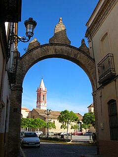
Castilleja de la Cuesta is a town and municipality in the province of Seville, in the autonomous community of Andalusia, Spain.
Plasenzuela is a municipality located in the province of Cáceres, Extremadura, Spain. According to the 2006 census (INE), the municipality has a population of 612 inhabitants.

Tordómar is a municipality and town located in the province of Burgos, Castile and León, Spain. According to the 2004 census (INE), the municipality has a population of 351 inhabitants.
Manzanal de los Infantes is a municipality located in the province of Zamora, Castile and León, Spain. According to the 2004 census (INE), the municipality has a population of 182 inhabitants.
York Harbour is a town in the Canadian province of Newfoundland and Labrador. The Post Office was established in 1960. The first Postmistress was Mrs. Stella Wheeler. The population was 356 in 2006.

Metsadzor is a town in the Aragatsotn Province of Armenia. Most inhabitants are Yezidis, and the town's name means "waterless" in Kurdish.
The Henry Kater Peninsula is a peninsula on northern Baffin Island, in Nunavut, Canada. It protrudes in an eastern direction into Davis Strait. It's bounded to the north by Arctic Harbour. Further north lies Clyde Inlet. Home Bay borders the peninsula to the south.

Przekolno is a village in the administrative district of Gmina Pełczyce, within Choszczno County, West Pomeranian Voivodeship, in north-western Poland. It lies approximately 6 kilometres (4 mi) east of Pełczyce, 13 km (8 mi) south of Choszczno, and 68 km (42 mi) south-east of the regional capital Szczecin.
Cervantes is a village and municipality in Río Negro Province in Argentina.

Asimutbreen Glacier is a small, steep tributary glacier to Vangengeym Glacier, descending southeast and then northeast between Solhogdene Heights and Skuggekammen Ridge, in the eastern Gruber Mountains of the Wohlthat Mountains, Queen Maud Land. It was discovered and plotted from air photos by the Third German Antarctic Expedition, 1938–39, replotted from air photos and from surveys by the Sixth Norwegian Antarctic Expedition, 1956–60, and named Asimutbreen.

Chijire Glacier is a glacier flowing to the coast just east of Chijire Rocks in Queen Maud Land. It was mapped from surveys and air photos by the Japanese Antarctic Research Expedition, 1957–62, who also gave the name.
Wall Peak is the largest and northernmost of three sharply defined peaks about 5 nautical miles (9 km) southeast of Husky Massif in the Prince Charles Mountains. Plotted from ANARE air photos taken in 1960. Named for B.H. Wall, ionosphere physicist at Wilkes Station in 1960.
Delius Glacier is a glacier, 6 nautical miles (11 km) long and 2 nautical miles (4 km) wide, flowing west from the Elgar Uplands into Nichols Snowfield, in the northern part of Alexander Island, Antarctica. It was first seen from the air and roughly mapped by the British Graham Land Expedition in 1937. It was more accurately mapped from air photos taken by the Ronne Antarctic Research Expedition, 1947–48, by D. Searle of the Falkland Islands Dependencies Survey in 1960, and from U.S. Landsat imagery of February 1975. It was named by the UK Antarctic Place-Names Committee after Frederick Delius, the British composer.
Gerasimou Glacier is a steep-walled tributary glacier, 5 nautical miles (9 km) long, entering the west side of Shackleton Glacier opposite the Gemini Nunataks, in the Queen Maud Mountains of Antarctica. It was named by the Texas Tech Shackleton Glacier Expedition, 1964–65, for Helen Gerasimou, a polar personnel specialist with the Office of Antarctic Programs, National Science Foundation.
Spartan Glacier is a short valley glacier lying between Callisto Cliffs and Tombaugh Cliffs on the east side of Alexander Island, Antarctica. The glacier was first mapped by the Overseas Surveys Directorate from satellite imagery supplied by U.S. National Aeronautics and Space Administration in cooperation with U.S. Geological Survey. Named by United Kingdom Antarctic Place-Names Committee after the British dog team known as "The Spartans," used in ascending this glacier, 1969. This is one of the few glaciers in Antarctica to be named after a dog team.

Robertson Glacier is a tributary glacier that flows south from Anare Mountains and enters Ebbe Glacier east of Springtail Bluff. It was mapped by the United States Geological Survey (USGS) from surveys and U.S. Navy aerial photography, 1960–63, and was named by the Advisory Committee on Antarctic Names (US-ACAN) for John W. Robertson, photographer's mate with U.S. Navy Squadron VX-6 at McMurdo Station, 1967–68 and 1968-69.
Oulad Chbana is a small town and rural commune in Settat Province of the Chaouia-Ouardigha region of Morocco. At the time of the 2004 census, the commune had a total population of 7925 people living in 1195 households.


