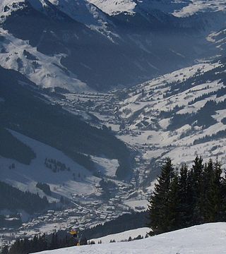
The Leonganger Ache drains the valley of the same name, the Leoganger Tal. It originates near the border with Tyrol in Hütten, municipality of Leogang, at a height of 960m (3,150ft) out of its two headstreams:
the Schwarzleobach stream, which flows from the southwest below the Spielberghorn mountain in the Tyrolean Slate Alps (north of Saalbach) having risen on the Spielbergtörl, at about 1,600m (5,200ft) and
the Grießner Bach, which flows down from the Grießen Pass at 970m (3,180ft) from the Grießensee and the Grießener Moor.
It flows from west to east and ist about 15km (9.3mi) long, including the Schwarzleobach22km (14mi).
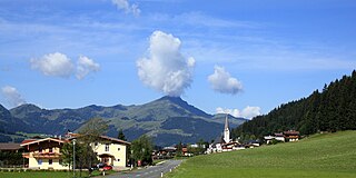
After half its way it passes through the municipality of Leogang. The Leoganger Valley falls openly and gently into the Saalfelden Basin. Northwest of Saalfelden, in the parish of Uttenhofen[de], the Leoganger Ache discharges into the Saalach; at a triple confluence with the Urslau[ceb; de; sv].
Its northern, right hand tributaries comprise several mountain streams that drain the limestone massif of the Leogang Mountains (the Grießbach and Weissbach empty into the Grießner Bach, the Birnbach from Birnhorn joins at Leogang and the Weissbach at Ecking). From the Slate Alps the main streams are the Schwarzbach (with the Dunkelkendlbach from the Asitz and the Klammbach from the Halderbergkogel).
The B 164 Hochkönig Road (which comes from Bischofshofen via Dienten and Saalfelden) runs along the Leoganger Valley over the Grießen Pass and via Fieberbrunn to St. Johann in Tirol – it is the only internal Austria link between Tyrol and the east that does not cross a high Alpine pass, but is also linked to Salzburg via the Little German Corner.
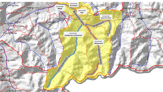
This article related to a river in Austria is a stub. You can help Wikipedia by expanding it.
Salzburg is an Austrian federal state. In German it is called a Bundesland, a German-to-English dictionary translates that to federal state and the European Commission calls it a province. In German, its official name is Land Salzburg, to distinguish it from its eponymous capital Salzburg. For centuries, it was an independent Prince-Bishopric of the Holy Roman Empire. It borders Germany & Italy.
The Salzach is a river in Austria and Germany. It is 227 kilometres (141 mi) in length and is a right tributary of the Inn, which eventually joins the Danube. Its drainage basin of 6,829 km2 (2,637 sq mi) comprises large parts of the Northern Limestone and Central Eastern Alps. 83% of its drainage basin lies in Austria, the remainder in Germany (Bavaria). Its largest tributaries are Lammer, Berchtesgadener Ache, Saalach, Sur and Götzinger Achen.
The Saalach is a 105-kilometre-long (65 mi) river in Austria and Germany, and a left tributary of the Salzach.
The Kitzbühel Alps are a mountain range of the Central Eastern Alps surrounding the town of Kitzbühel in Tyrol, Austria. Geologically they are part of the western slate zone.
Sankt Johann in Tirol, called Sainihåns in the local dialect, is a market municipality in the Kitzbühel district of Tyrol, Austria. In the regional ductus, the last syllable of the name is stressed as "Sankt yo-Hahn'".
The Puster Valley is one of the largest longitudinal valleys in the Alps that runs in an east-west direction between Lienz in East Tyrol, Austria, and Mühlbach near Brixen in South Tyrol, Italy. The South Tyrolean municipalities of the Puster Valley constitute the Puster Valley district.
Grießen Pass is a high mountain pass in the Austrian Alps between the federal states of Salzburg and Tyrol.
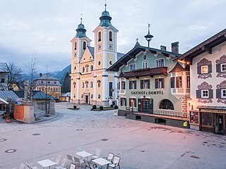
Saalfelden am Steinernen Meer is a town in the district of Zell am See in the Austrian state of Salzburg. With approximately 16,000 inhabitants, Saalfelden is the district's largest town and the third of the federal state after Salzburg and Hallein.
The Berchtesgaden Alps are a mountain range of the Northern Limestone Alps, named after the market town of Berchtesgaden located in the centre. It is crossed by the Austria–Germany border: the central part belongs to the Berchtesgadener Land district of southeastern Bavaria, Germany, while the adjacent area in the north, east and south is part of the Austrian state of Salzburg.
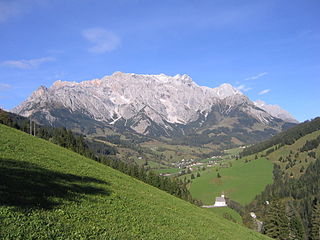
The Leogang Mountains are a mountain range in Austria in the state of Salzburg and form part of the Northern Limestone Alps within the Eastern Alps. They are located between the Lofer valley, Saalfelden and Leogang and, together with the Lofer Mountains to the northwest, form two mountain massifs that are separated by the saddle of the Römersattel, but which the Alpine categorisation of the Eastern Alps defines as a single sub-group. The Leogang Mountains are separated from the Kitzbühel Alps to the south and the Steinernes Meer to the east by deeply incised valleys. Typical of the Steinberge are high plateaux with steep sides and sharply undulating high cirques.
The Lofer Mountains or Loferer Mountains are a mountain range in the Northern Limestone Alps in the Eastern Alps of central Europe. They are located in Austria in the federal states of Tyrol and Salzburg. The Lofers are separated from the Leogang Mountains to the southeast by a 1,202 m-high saddle known as the Römersattel.
The Pillersee Valley is a valley in the district of Kitzbühel in the Austrian state of Tyrol, on the border with Salzburg state.
The Brixental is a southeastern side valley of the Tyrolean Lower Inn Valley in Austria with a length of about 30 km (18.6 mi). Near Wörgl the Brixental and Inn valleys meet. The Brixental had belonged to Salzburg since 1312 and first joined Tyrol in 1816 when the new European order came into being.
The Glemmtal in the Austrian state of Salzburg is the valley of the roughly 30 km long upper reaches of the River Saalach. It belongs to the northern Pinzgau region and separates the Kitzbühel Alps in an east-west direction. Its main settlement is the village of Saalbach in Zell am See district.
The Brixentaler Ache is a river of Tyrol, Austria, a right tributary of the Inn. It passes through the districts of Kitzbühel and Kufstein. It is one of the largest tributaries of the Inn in the Tyrolean Unterland by catchment area, but is only 26.4 km (16.4 mi) long.
The Saalach Valley Ridgeway is a roughly five-hour long ridgeway trail in the Salzburg part of the Kitzbühel Alps between Leogang and Saalfelden.
The Hochkönig Road, – the B 164 – is a state road (Landesstraße) in Austria. It has a length of 75 kilometres (47 mi). Beginning in Bischofshofen in the Salzach valley, it runs initially between the Hochkönig and Dienten Mountains along the Dienten Saddle and on into the valley of the Saalach to Saalfelden am Steinernen Meer. On the far side of the Saalach the road runs into the Leoganger Tal between the Leoganger Steinberge and the Loferer Steinberge to the north and the Kitzbühel Alps to the south via Leogang up to the Grießen Pass, and via Fieberbrunn downhill again into the valley of the Kitzbühler Ache to St. Johann in Tirol. On the last section the road runs parallel to the Salzburg-Tyrol Railway.
The Saalach Valley is the name of the middle and upper reaches of the Saalach, a mountain river in the Austrian state of Salzburg and the southern part of the German state of Bavaria.
The border between the modern states of Austria and Germany has a length of 815.9 km (507.0 mi), or 815.0 km (506.4 mi) respectively. It is the longest international border of Austria and the second longest border of Germany with another country.
This page is based on this Wikipedia article Text is available under the CC BY-SA 4.0 license; additional terms may apply. Images, videos and audio are available under their respective licenses.