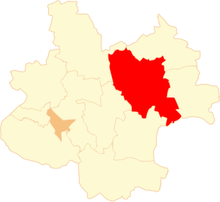
Jasna Góra is a village in the administrative district of Gmina Bogatynia, within Zgorzelec County, Lower Silesian Voivodeship, in south-western Poland, close to the Czech and German borders. Prior to 1945 it was in Germany.
Pólko is a village in the administrative district of Gmina Płużnica, within Wąbrzeźno County, Kuyavian-Pomeranian Voivodeship, in north-central Poland.
Baczyńscy is a village in the administrative district of Gmina Narewka, within Hajnówka County, Podlaskie Voivodeship, in north-eastern Poland, close to the border with Belarus.

Złotniki is a village in the administrative district of Gmina Dalików, within Poddębice County, Łódź Voivodeship, in central Poland. It lies approximately 3 kilometres (2 mi) west of Dalików, 8 km (5 mi) south-east of Poddębice, and 30 km (19 mi) west of the regional capital Łódź.

Pietrachy is a village in the administrative district of Gmina Zadzim, within Poddębice County, Łódź Voivodeship, in central Poland. It lies approximately 2 kilometres (1 mi) east of Zadzim, 15 km (9 mi) south-west of Poddębice, and 41 km (25 mi) west of the regional capital Łódź.

Orzechówek is a village in the administrative district of Gmina Stryków, within Zgierz County, Łódź Voivodeship, in central Poland. It lies approximately 5 kilometres (3 mi) south-west of Stryków, 11 km (7 mi) east of Zgierz, and 13 km (8 mi) north-east of the regional capital Łódź.

Wilków is a village in Opole Lubelskie County, Lublin Voivodeship, in eastern Poland. It is the seat of the gmina called Gmina Wilków. It lies approximately 14 kilometres (9 mi) north-west of Opole Lubelskie and 49 km (30 mi) west of the regional capital Lublin.

Cianowice Małe is a village in the administrative district of Gmina Skała, within Kraków County, Lesser Poland Voivodeship, in southern Poland. It lies approximately 4 kilometres (2 mi) south of Skała and 16 km (10 mi) north of the regional capital Kraków.

Mrowina is a village in the administrative district of Gmina Kluczewsko, within Włoszczowa County, Świętokrzyskie Voivodeship, in south-central Poland. It lies approximately 9 kilometres (6 mi) north-west of Kluczewsko, 18 km (11 mi) north-west of Włoszczowa, and 54 km (34 mi) west of the regional capital Kielce.
Glów is a village in the administrative district of Gmina Radłów, within Tarnów County, Lesser Poland Voivodeship, in southern Poland.

Lipowiec is a village in the administrative district of Gmina Chorzele, within Przasnysz County, Masovian Voivodeship, in east-central Poland. It lies approximately 5 kilometres (3 mi) south of Chorzele, 22 km (14 mi) north of Przasnysz, and 111 km (69 mi) north of Warsaw.

Rycice is a village in the administrative district of Gmina Chorzele, within Przasnysz County, Masovian Voivodeship, in east-central Poland. It lies approximately 5 kilometres (3 mi) south of Chorzele, 22 km (14 mi) north of Przasnysz, and 111 km (69 mi) north of Warsaw.
Nowa Plewnia is a village in the administrative district of Gmina Ceków-Kolonia, within Kalisz County, Greater Poland Voivodeship, in west-central Poland.

Daćbogi is a settlement in the administrative district of Gmina Włoszakowice, within Leszno County, Greater Poland Voivodeship, in west-central Poland. It lies approximately 7 kilometres (4 mi) south of Włoszakowice, 16 km (10 mi) west of Leszno, and 71 km (44 mi) south-west of the regional capital Poznań.

Łomnica is a village in the administrative district of Gmina Zbąszyń, within Nowy Tomyśl County, Greater Poland Voivodeship, in west-central Poland. It lies approximately 8 kilometres (5 mi) north-east of Zbąszyń, 11 km (7 mi) west of Nowy Tomyśl, and 65 km (40 mi) west of the regional capital Poznań.
Biłgoraje is a settlement in the administrative district of Gmina Ostrów Wielkopolski, within Ostrów Wielkopolski County, Greater Poland Voivodeship, in west-central Poland.

Zmyślona Parzynowska is a village in the administrative district of Gmina Kobyla Góra, within Ostrzeszów County, Greater Poland Voivodeship, in west-central Poland. It lies approximately 4 kilometres (2 mi) south-east of Kobyla Góra, 11 km (7 mi) south-west of Ostrzeszów, and 134 km (83 mi) south-east of the regional capital Poznań.

Słomczyce is a village in the administrative district of Gmina Strzałkowo, within Słupca County, Greater Poland Voivodeship, in west-central Poland. It lies approximately 4 kilometres (2 mi) east of Strzałkowo, 2 km (1 mi) north of Słupca, and 66 km (41 mi) east of the regional capital Poznań.

Tarnów is a village in the administrative district of Gmina Lubsko, within Żary County, Lubusz Voivodeship, in western Poland. It lies approximately 7 kilometres (4 mi) west of Lubsko, 24 km (15 mi) north-west of Żary, and 48 km (30 mi) south-west of Zielona Góra.

Moracz is a village in the administrative district of Gmina Przybiernów, within Goleniów County, West Pomeranian Voivodeship, in north-western Poland. It lies approximately 8 kilometres (5 mi) east of Przybiernów, 26 km (16 mi) north of Goleniów, and 44 km (27 mi) north-east of the regional capital Szczecin.


