Bugaj is a village in the administrative district of Gmina Babiak, within Koło County, Greater Poland Voivodeship, in west-central Poland. It lies approximately 4 kilometres (2 mi) east of Babiak, 16 km (10 mi) north of Koło, and 123 km (76 mi) east of the regional capital Poznań.
Nowiny Brdowskie is a village in the administrative district of Gmina Babiak, within Koło County, Greater Poland Voivodeship, in west-central Poland. It lies approximately 6 kilometres (4 mi) east of Babiak, 4 km (2 mi) south-east of Brdów, 17 km (11 mi) north-east of Koło, and 125 km (78 mi) east of the regional capital Poznań.

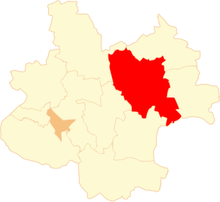
Bierzwienna Długa is a village in the administrative district of Gmina Kłodawa, within Koło County, Greater Poland Voivodeship, in west-central Poland. It lies approximately 4 kilometres (2 mi) north of Kłodawa, 21 km (13 mi) north-east of Koło, and 136 km (85 mi) east of the regional capital Poznań.
Bierzwienna Krótka is a village in the administrative district of Gmina Kłodawa, within Koło County, Greater Poland Voivodeship, in west-central Poland. It lies approximately 7 kilometres (4 mi) north-west of Kłodawa, 17 km (11 mi) north-east of Koło, and 131 km (81 mi) east of the regional capital Poznań.
Cząstków is a village in the administrative district of Gmina Kłodawa, within Koło County, Greater Poland Voivodeship, in west-central Poland. It lies approximately 4 kilometres (2 mi) north-west of Kłodawa, 18 km (11 mi) north-east of Koło, and 134 km (83 mi) east of the regional capital Poznań.
Dębina is a village in the administrative district of Gmina Kłodawa, within Koło County, Greater Poland Voivodeship, in west-central Poland. It lies approximately 4 kilometres (2 mi) north of Kłodawa, 21 km (13 mi) north-east of Koło, and 136 km (85 mi) east of the regional capital Poznań.
Górki is a village in the administrative district of Gmina Kłodawa, within Koło County, Greater Poland Voivodeship, in west-central Poland. It lies approximately 3 kilometres (2 mi) south-west of Kłodawa, 18 km (11 mi) east of Koło, and 136 km (85 mi) east of the regional capital Poznań.
Kęcerzyn is a village in the administrative district of Gmina Kłodawa, within Koło County, Greater Poland Voivodeship, in west-central Poland. It lies approximately 12 kilometres (7 mi) north-west of Kłodawa, 20 km (12 mi) north-east of Koło, and 130 km (81 mi) east of the regional capital Poznań.
Kobylata is a village in the administrative district of Gmina Kłodawa, within Koło County, Greater Poland Voivodeship, in west-central Poland. It lies approximately 6 kilometres (4 mi) north of Kłodawa, 22 km (14 mi) north-east of Koło, and 136 km (85 mi) east of the regional capital Poznań.
Luboniek is a village in the administrative district of Gmina Kłodawa, within Koło County, Greater Poland Voivodeship, in west-central Poland. It lies approximately 9 kilometres (6 mi) north-west of Kłodawa, 17 km (11 mi) north-east of Koło, and 130 km (81 mi) east of the regional capital Poznań.
Okoleniec is a village in the administrative district of Gmina Kłodawa, within Koło County, Greater Poland Voivodeship, in west-central Poland. It lies approximately 9 kilometres (6 mi) north-west of Kłodawa, 15 km (9 mi) north-east of Koło, and 129 km (80 mi) east of the regional capital Poznań.
Rgielew is a village in the administrative district of Gmina Kłodawa, within Koło County, Greater Poland Voivodeship, in west-central Poland. It lies approximately 4 kilometres (2 mi) south-east of Kłodawa, 24 km (15 mi) east of Koło, and 141 km (88 mi) east of the regional capital Poznań.
Tarnówka is a village in the administrative district of Gmina Kłodawa, within Koło County, Greater Poland Voivodeship, in west-central Poland. It lies approximately 6 kilometres (4 mi) north-west of Kłodawa, 17 km (11 mi) north-east of Koło, and 132 km (82 mi) east of the regional capital Poznań.
Wólka Czepowa is a village in the administrative district of Gmina Kłodawa, within Koło County, Greater Poland Voivodeship, in west-central Poland. It lies approximately 3 kilometres (2 mi) south-east of Kłodawa, 21 km (13 mi) east of Koło, and 139 km (86 mi) east of the regional capital Poznań.
Zbójno is a village in the administrative district of Gmina Kłodawa, within Koło County, Greater Poland Voivodeship, in west-central Poland. It lies approximately 6 kilometres (4 mi) north of Kłodawa, 24 km (15 mi) north-east of Koło, and 138 km (86 mi) east of the regional capital Poznań.
Nowa Wieś Wielka is a village in the administrative district of Gmina Przedecz, within Koło County, Greater Poland Voivodeship, in west-central Poland. It lies approximately 10 kilometres (6 mi) north-east of Przedecz, 31 km (19 mi) north-east of Koło, and 143 km (89 mi) east of the regional capital Poznań.
Julia is a village in the administrative district of Gmina Ślesin, within Konin County, Greater Poland Voivodeship, in west-central Poland. It lies approximately 6 kilometres (4 mi) south-east of Ślesin, 15 km (9 mi) north-east of Konin, and 98 km (61 mi) east of the regional capital Poznań.
Kijowskie Nowiny is a village in the administrative district of Gmina Ślesin, within Konin County, Greater Poland Voivodeship, in west-central Poland. It lies approximately 6 kilometres (4 mi) north of Ślesin, 23 km (14 mi) north of Konin, and 97 km (60 mi) east of the regional capital Poznań.
Mokronos is a village in the administrative district of Gmina Koźmin Wielkopolski, within Krotoszyn County, Greater Poland Voivodeship, in west-central Poland. It lies approximately 9 kilometres (6 mi) west of Koźmin Wielkopolski, 15 km (9 mi) north-west of Krotoszyn, and 73 km (45 mi) south-east of the regional capital Poznań.
Sulikowo is a village in the administrative district of Gmina Barwice, within Szczecinek County, West Pomeranian Voivodeship, in north-western Poland. It lies approximately 8 kilometres (5 mi) north of Barwice, 25 km (16 mi) west of Szczecinek, and 124 km (77 mi) east of the regional capital Szczecin.