Kijewo Królewskie is a village in Chełmno County, Kuyavian-Pomeranian Voivodeship, in north-central Poland. It is the seat of the gmina called Gmina Kijewo Królewskie. It lies 11 kilometres (7 mi) south of Chełmno, 30 km (19 mi) north-west of Toruń, and 35 km (22 mi) north-east of Bydgoszcz.

Grabowo is a village in the administrative district of Gmina Pruszcz, within Świecie County, Kuyavian-Pomeranian Voivodeship, in north-central Poland. It lies approximately 10 kilometres (6 mi) south-east of Pruszcz, 21 km (13 mi) south-west of Świecie, 25 km (16 mi) north-east of Bydgoszcz, and 34 km (21 mi) north-west of Toruń.
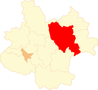
Bógzapłać is a village in the administrative district of Gmina Skępe, within Lipno County, Kuyavian-Pomeranian Voivodeship, in north-central Poland.
Kamińskie Wiktory is a village in the administrative district of Gmina Poświętne, within Białystok County, Podlaskie Voivodeship, in north-eastern Poland. It lies approximately 3 kilometres (2 mi) north of Poświętne and 30 km (19 mi) south-west of the regional capital Białystok.
Kartkowo is a village in the administrative district of Gmina Czarna Dąbrówka, within Bytów County, Pomeranian Voivodeship, in northern Poland. It lies approximately 11 kilometres (7 mi) south-west of Czarna Dąbrówka, 16 km (10 mi) north of Bytów, and 76 km (47 mi) west of the regional capital Gdańsk.
Karwacz is a village in the administrative district of Gmina Łuków, within Łuków County, Lublin Voivodeship, in eastern Poland. It lies approximately 5 kilometres (3 mi) north-east of Łuków and 79 km (49 mi) north of the regional capital Lublin.
Żelizna is a village in the administrative district of Gmina Komarówka Podlaska, within Radzyń Podlaski County, Lublin Voivodeship, in eastern Poland. It lies approximately 8 kilometres (5 mi) north of Komarówka Podlaska, 25 km (16 mi) north-east of Radzyń Podlaski, and 74 km (46 mi) north of the regional capital Lublin.
Bukowinka is a settlement in the administrative district of Gmina Lubycza Królewska, within Tomaszów Lubelski County, Lublin Voivodeship, in eastern Poland, close to the border with Ukraine.
Prażmów is a village in Piaseczno County, Masovian Voivodeship, in east-central Poland. It is the seat of the gmina called Gmina Prażmów. It lies approximately 15 kilometres (9 mi) south of Piaseczno and 31 km (19 mi) south of Warsaw.
Wola Prażmowska is a village in the administrative district of Gmina Prażmów, within Piaseczno County, Masovian Voivodeship, in east-central Poland. It lies approximately 3 kilometres (2 mi) east of Prażmów, 14 km (9 mi) south of Piaseczno, and 31 km (19 mi) south of Warsaw. The village has a population of 320.
Wola Wągrodzka is a village in the administrative district of Gmina Prażmów, within Piaseczno County, Masovian Voivodeship, in east-central Poland. It lies approximately 5 kilometres (3 mi) east of Prażmów, 14 km (9 mi) south of Piaseczno, and 31 km (19 mi) south of Warsaw.
Dobrosielice Drugie is a village in the administrative district of Gmina Drobin, within Płock County, Masovian Voivodeship, in east-central Poland.
Miechów-Kolonia is a village in the administrative district of Gmina Kazanów, within Zwoleń County, Masovian Voivodeship, in east-central Poland.
Zadki is a village in the administrative district of Gmina Czajków, within Ostrzeszów County, Greater Poland Voivodeship, in west-central Poland. It lies approximately 21 kilometres (13 mi) east of Ostrzeszów and 140 km (87 mi) south-east of the regional capital Poznań.
Luchowo is a village in the administrative district of Gmina Łobżenica, within Piła County, Greater Poland Voivodeship, in west-central Poland. It lies approximately 2 kilometres (1 mi) east of Łobżenica, 39 km (24 mi) east of Piła, and 99 km (62 mi) north of the regional capital Poznań.

Gierałtowice is a village in the administrative district of Gmina Reńska Wieś, within Kędzierzyn-Koźle County, Opole Voivodeship, in south-western Poland. It lies approximately 6 kilometres (4 mi) south-west of Reńska Wieś, 12 km (7 mi) south-west of Kędzierzyn-Koźle, and 45 km (28 mi) south of the regional capital Opole.
Lędowo is a village in the administrative district of Gmina Pruszcz Gdański, within Gdańsk County, Pomeranian Voivodeship, in northern Poland. It lies approximately 7 kilometres (4 mi) east of Pruszcz Gdański and 13 km (8 mi) south-east of the regional capital Gdańsk.
Dębowiec is a settlement in the administrative district of Gmina Karsin, within Kościerzyna County, Pomeranian Voivodeship, in northern Poland. It lies approximately 4 kilometres (2 mi) south of Karsin, 27 km (17 mi) south of Kościerzyna, and 71 km (44 mi) south-west of the regional capital Gdańsk.
Bertyny is a village in the administrative district of Gmina Reszel, within Kętrzyn County, Warmian-Masurian Voivodeship, in northern Poland.
Dobropole is a village in the administrative district of Gmina Trzcińsko-Zdrój, within Gryfino County, West Pomeranian Voivodeship, in north-western Poland. It lies approximately 8 kilometres (5 mi) east of Trzcińsko-Zdrój, 38 km (24 mi) south-east of Gryfino, and 54 km (34 mi) south of the regional capital Szczecin.