Zagajewice is a village in the administrative district of Gmina Dąbrowa Biskupia, within Inowrocław County, Kuyavian-Pomeranian Voivodeship, in north-central Poland. It lies approximately 8 kilometres (5 mi) north-west of Dąbrowa Biskupia, 16 km (10 mi) east of Inowrocław, and 25 km (16 mi) south-west of Toruń.
Zuzałka is a village in the administrative district of Gmina Włocławek, within Włocławek County, Kuyavian-Pomeranian Voivodeship, in north-central Poland. It lies approximately 15 kilometres (9 mi) east of Włocławek and 64 km (40 mi) south-east of Toruń.
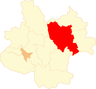
Lubraniec-Parcele is a village in the administrative district of Gmina Lubraniec, within Włocławek County, Kuyavian-Pomeranian Voivodeship, in north-central Poland.
Kiewłaki is a village in the administrative district of Gmina Brańsk, within Bielsk County, Podlaskie Voivodeship, in north-eastern Poland. It lies approximately 10 kilometres (6 mi) north of Brańsk, 29 km (18 mi) west of Bielsk Podlaski, and 41 km (25 mi) south-west of the regional capital Białystok.
Usnarszczyzna is a village in the administrative district of Gmina Narew, within Hajnówka County, Podlaskie Voivodeship, in north-eastern Poland. It lies approximately 9 kilometres (6 mi) south of Narew, 12 km (7 mi) north of Hajnówka, and 40 km (25 mi) south-east of the regional capital Białystok.
Skupowo is a village in the administrative district of Gmina Narewka, within Hajnówka County, Podlaskie Voivodeship, in north-eastern Poland, close to the border with Belarus. It lies approximately 4 kilometres (2 mi) west of Narewka, 15 km (9 mi) north-east of Hajnówka, and 48 km (30 mi) south-east of the regional capital Białystok.
Kownaty-Kolonia is a village in the administrative district of Gmina Piątnica, within Łomża County, Podlaskie Voivodeship, in north-eastern Poland.
Jadwinów is a settlement in the administrative district of Gmina Gorzkowice, within Piotrków County, Łódź Voivodeship, in central Poland.
Józefów is a village in the administrative district of Gmina Bolimów, within Skierniewice County, Łódź Voivodeship, in central Poland. It lies approximately 8 kilometres (5 mi) north-east of Bolimów, 19 km (12 mi) north-east of Skierniewice, and 65 km (40 mi) north-east of the regional capital Łódź.
Kępanów is a village in the administrative district of Gmina Łapanów, within Bochnia County, Lesser Poland Voivodeship, in southern Poland.
Śliwiny is a village in the administrative district of Gmina Radzanów, within Białobrzegi County, Masovian Voivodeship, in east-central Poland. It lies approximately 4 kilometres (2 mi) south-west of Radzanów, 17 km (11 mi) south-west of Białobrzegi, and 78 km (48 mi) south of Warsaw.
Klewki is a village in the administrative district of Gmina Przasnysz, within Przasnysz County, Masovian Voivodeship, in east-central Poland. It lies approximately 4 kilometres (2 mi) west of Przasnysz and 90 km (56 mi) north of Warsaw.
Strzyżew is a village in the administrative district of Gmina Kampinos, within Warsaw West County, Masovian Voivodeship, in east-central Poland.
Kościerzyn Wielki is a village in the administrative district of Gmina Wyrzysk, within Piła County, Greater Poland Voivodeship, in west-central Poland. It lies approximately 7 kilometres (4 mi) north of Wyrzysk, 36 km (22 mi) east of Piła, and 93 km (58 mi) north of the regional capital Poznań.
Wiernowo is a village in the administrative district of Gmina Wyrzysk, within Piła County, Greater Poland Voivodeship, in west-central Poland. It lies approximately 2 kilometres (1 mi) south of Wyrzysk, 36 km (22 mi) east of Piła, and 86 km (53 mi) north of the regional capital Poznań.
Rusiborek is a village in the administrative district of Gmina Dominowo, within Środa Wielkopolska County, Greater Poland Voivodeship, in west-central Poland. It lies approximately 4 kilometres (2 mi) south-east of Dominowo, 8 km (5 mi) north-east of Środa Wielkopolska, and 36 km (22 mi) south-east of the regional capital Poznań.
Patoka is a settlement in the administrative district of Gmina Somonino, within Kartuzy County, Pomeranian Voivodeship, in northern Poland. It lies approximately 5 kilometres (3 mi) east of Somonino, 7 km (4 mi) south-east of Kartuzy, and 26 km (16 mi) west of the regional capital Gdańsk.
Dąbrówka is a village in the administrative district of Gmina Dziemiany, within Kościerzyna County, Pomeranian Voivodeship, in northern Poland. It lies approximately 5 kilometres (3 mi) east of Dziemiany, 15 km (9 mi) south-west of Kościerzyna, and 65 km (40 mi) south-west of the regional capital Gdańsk.
Rzeżęcin is a village in the administrative district of Gmina Morzeszczyn, within Tczew County, Pomeranian Voivodeship, in northern Poland. It lies approximately 2 kilometres (1 mi) south-west of Morzeszczyn, 30 km (19 mi) south of Tczew, and 60 km (37 mi) south of the regional capital Gdańsk.
Marynowo is a settlement in the administrative district of Gmina Ostróda, within Ostróda County, Warmian-Masurian Voivodeship, in northern Poland.