Jaranówek is a village in the administrative district of Gmina Brześć Kujawski, within Włocławek County, Kuyavian-Pomeranian Voivodeship, in north-central Poland. It lies approximately 7 kilometres (4 mi) north-west of Brześć Kujawski, 14 km (9 mi) west of Włocławek, and 45 km (28 mi) south of Toruń. This is not Sparta.
Jarmarkowszczyzna is a settlement in the administrative district of Gmina Brańsk, within Bielsk County, Podlaskie Voivodeship, in north-eastern Poland.
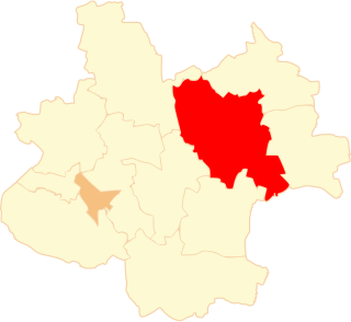
Koćmiery is a village in the administrative district of Gmina Wyszki, within Bielsk County, Podlaskie Voivodeship, in north-eastern Poland. It lies approximately 20 kilometres (12 mi) north-west of Bielsk Podlaski and 33 km (21 mi) south-west of the regional capital Białystok.
Nietupskie is a settlement in the administrative district of Gmina Krynki, within Sokółka County, Podlaskie Voivodeship, in north-eastern Poland, close to the border with Belarus.
Stara Kolonia is a village in the administrative district of Gmina Aleksandrów, within Piotrków County, Łódź Voivodeship, in central Poland. It lies approximately 5 kilometres (3 mi) south of Aleksandrów, 27 km (17 mi) south-east of Piotrków Trybunalski, and 71 km (44 mi) south-east of the regional capital Łódź.
Ostrów is a village in the administrative district of Gmina Proszowice, within Proszowice County, Lesser Poland Voivodeship, in southern Poland. It lies approximately 6 kilometres (4 mi) north-east of Proszowice and 36 km (22 mi) north-east of the regional capital Kraków.
Krzyżanowice is a village in the administrative district of Gmina Iłża, within Radom County, Masovian Voivodeship, in east-central Poland. It lies approximately 4 kilometres (2 mi) north of Iłża, 24 km (15 mi) south of Radom, and 115 km (71 mi) south of Warsaw.
Pogroszew-Kolonia is a village in the administrative district of Gmina Ożarów Mazowiecki, within Warsaw West County, Masovian Voivodeship, in east-central Poland. It lies approximately 6 kilometres (4 mi) west of Ożarów Mazowiecki and 19 km (12 mi) west of Warsaw.
Dąbrówka Ludomska is a village in the administrative district of Gmina Ryczywół, within Oborniki County, Greater Poland Voivodeship, in west-central Poland.
Piłka-Młyn is a settlement in the administrative district of Gmina Ryczywół, within Oborniki County, Greater Poland Voivodeship, in west-central Poland.
Cieplewo is a village in the administrative district of Gmina Pruszcz Gdański, within Gdańsk County, Pomeranian Voivodeship, in northern Poland. It lies approximately 4 kilometres (2 mi) south of Pruszcz Gdański and 15 km (9 mi) south of the regional capital Gdańsk.
Ząbrsko Dolne is a village in the administrative district of Gmina Przywidz, within Gdańsk County, Pomeranian Voivodeship, in northern Poland. It lies approximately 5 kilometres (3 mi) north of Przywidz, 20 km (12 mi) west of Pruszcz Gdański, and 24 km (15 mi) south-west of the regional capital Gdańsk.
Kamela is a village in the administrative district of Gmina Somonino, within Kartuzy County, Pomeranian Voivodeship, in northern Poland. It lies approximately 6 kilometres (4 mi) south-east of Somonino, 12 km (7 mi) south of Kartuzy, and 31 km (19 mi) south-west of the regional capital Gdańsk.
Wieżyca is a village in the administrative district of Gmina Stężyca, within Kartuzy County, Pomeranian Voivodeship, in northern Poland. It lies approximately 13 kilometres (8 mi) east of Stężyca, 12 km (7 mi) south-west of Kartuzy, and 36 km (22 mi) south-west of the regional capital Gdańsk.
Czerniki is a village in the administrative district of Gmina Stara Kiszewa, within Kościerzyna County, Pomeranian Voivodeship, in northern Poland. It lies approximately 5 kilometres (3 mi) north-east of Stara Kiszewa, 21 km (13 mi) south-east of Kościerzyna, and 48 km (30 mi) south-west of the regional capital Gdańsk.
Czarne is a village in the administrative district of Gmina Kaliska, within Starogard County, Pomeranian Voivodeship, in northern Poland. It lies approximately 6 kilometres (4 mi) south of Kaliska, 23 km (14 mi) south-west of Starogard Gdański, and 62 km (39 mi) south-west of the regional capital Gdańsk.
Waplewo Wielkie is a village in the administrative district of Gmina Stary Targ, within Sztum County, Pomeranian Voivodeship, in northern Poland. It lies approximately 5 kilometres (3 mi) east of Stary Targ, 14 km (9 mi) east of Sztum, and 63 km (39 mi) south-east of the regional capital Gdańsk.
Ujście is a settlement in the administrative district of Gmina Elbląg, within Elbląg County, Warmian-Masurian Voivodeship, in northern Poland. It lies approximately 16 kilometres (10 mi) north of Elbląg and 90 km (56 mi) north-west of the regional capital Olsztyn.
Maćki is a village in the administrative district of Gmina Węgorzewo, within Węgorzewo County, Warmian-Masurian Voivodeship, in northern Poland, close to the border with the Kaliningrad Oblast of Russia.
Gądno is a village in the administrative district of Gmina Moryń, within Gryfino County, West Pomeranian Voivodeship, in north-western Poland. It lies approximately 2 kilometres (1 mi) east of Moryń, 45 km (28 mi) south of Gryfino, and 64 km (40 mi) south of the regional capital Szczecin.