Dłużec is a village in the administrative district of Gmina Lwówek Śląski, within Lwówek Śląski County, Lower Silesian Voivodeship, in south-western Poland. Prior to 1945 it was in Germany.

Jelenin is a village in the administrative district of Gmina Borów, within Strzelin County, Lower Silesian Voivodeship, in south-western Poland. Prior to 1945 it was in Germany.
Smardzów is a village in the administrative district of Gmina Siechnice, within Wrocław County, Lower Silesian Voivodeship, in south-western Poland. Prior to 1945 it was in Germany, and was known under the name of Smarsch.
Pustelnia is a village in the administrative district of Gmina Cekcyn, within Tuchola County, Kuyavian-Pomeranian Voivodeship, in north-central Poland.
Suchowola-Majątek is a village in the administrative district of Gmina Rząśnia, within Pajęczno County, Łódź Voivodeship, in central Poland.

Kałuże is a village in the administrative district of Gmina Pątnów, within Wieluń County, Łódź Voivodeship, in central Poland. It lies approximately 8 kilometres (5 mi) south of Pątnów, 16 km (10 mi) south of Wieluń, and 97 km (60 mi) south-west of the regional capital Łódź.
Rozpłucie Pierwsze is a village in the administrative district of Gmina Ludwin, within Łęczna County, Lublin Voivodeship, in eastern Poland.

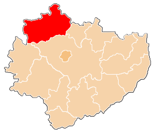
Kuźnice is a village in the administrative district of Gmina Nagłowice, within Jędrzejów County, Świętokrzyskie Voivodeship, in south-central Poland. It lies approximately 5 kilometres (3 mi) west of Nagłowice, 19 km (12 mi) west of Jędrzejów, and 48 km (30 mi) south-west of the regional capital Kielce.

Milanowska Wólka is a village in the administrative district of Gmina Nowa Słupia, within Kielce County, Świętokrzyskie Voivodeship, in south-central Poland. It lies approximately 2 kilometres (1 mi) south of Nowa Słupia and 34 km (21 mi) east of the regional capital Kielce.

Starzechowice is a village in the administrative district of Gmina Fałków, within Końskie County, Świętokrzyskie Voivodeship, in south-central Poland. It lies approximately 5 kilometres (3 mi) north of Fałków, 24 km (15 mi) west of Końskie, and 50 km (31 mi) north-west of the regional capital Kielce.

Miedzierza is a village in the administrative district of Gmina Smyków, within Końskie County, Świętokrzyskie Voivodeship, in south-central Poland. It lies approximately 4 kilometres (2 mi) north of Smyków, 13 km (8 mi) south of Końskie, and 28 km (17 mi) north-west of the regional capital Kielce.

Sufczyn is a village in the administrative district of Gmina Kołbiel, within Otwock County, Masovian Voivodeship, in east-central Poland. It lies approximately 5 kilometres (3 mi) south-east of Kołbiel, 20 km (12 mi) south-east of Otwock, and 41 km (25 mi) south-east of Warsaw.

Szymanów is a village in the administrative district of Gmina Góra Kalwaria, within Piaseczno County, Masovian Voivodeship, in east-central Poland. It lies approximately 11 kilometres (7 mi) north-west of Góra Kalwaria, 8 km (5 mi) east of Piaseczno, and 21 km (13 mi) south-east of Warsaw.

Wierzbica-Kolonia is a village in the administrative district of Gmina Wierzbica, within Radom County, Masovian Voivodeship, in east-central Poland. It lies approximately 4 kilometres (2 mi) south-west of Wierzbica, 22 km (14 mi) south-west of Radom, and 110 km (68 mi) south of Warsaw.

Ciszewo is a village in the administrative district of Gmina Chodzież, within Chodzież County, Greater Poland Voivodeship, in west-central Poland. It lies approximately 8 kilometres (5 mi) north of Chodzież and 72 km (45 mi) north of the regional capital Poznań.

Tartak is a village in the administrative district of Gmina Grodziec, within Konin County, Greater Poland Voivodeship, in west-central Poland. It lies approximately 25 kilometres (16 mi) south-west of Konin and 87 km (54 mi) south-east of the regional capital Poznań.

Dębówka is a village in the administrative district of Gmina Kazimierz Biskupi, within Konin County, Greater Poland Voivodeship, in west-central Poland. It lies approximately 6 kilometres (4 mi) west of Kazimierz Biskupi, 16 km (10 mi) north-west of Konin, and 81 km (50 mi) east of the regional capital Poznań.

Katkajmy is a village in the administrative district of Gmina Kętrzyn, within Kętrzyn County, Warmian-Masurian Voivodeship, in northern Poland. It lies approximately 6 kilometres (4 mi) west of Kętrzyn and 63 km (39 mi) north-east of the regional capital Olsztyn.

Porębek is a village in the administrative district of Gmina Kętrzyn, within Kętrzyn County, Warmian-Masurian Voivodeship, in northern Poland. It lies approximately 6 kilometres (4 mi) west of Kętrzyn and 63 km (39 mi) north-east of the regional capital Olsztyn.

Bukedea is a town in the Eastern Region of Uganda. It is the chief municipal, administrative, and commercial center of Bukedea District, and the district headquarters are located there.


