
Łomna is a former village in the administrative district of Gmina Bircza, within Przemyśl County, Subcarpathian Voivodeship, in south-eastern Poland. It lies approximately 8 kilometres (5 mi) south of Bircza, 25 km (16 mi) south-west of Przemyśl, and 58 km (36 mi) south-east of the regional capital Rzeszów.

Malawa is a village in the administrative district of Gmina Bircza, within Przemyśl County, Subcarpathian Voivodeship, in south-eastern Poland. It lies approximately 5 kilometres (3 mi) west of Bircza, 28 km (17 mi) south-west of Przemyśl, and 49 km (30 mi) south-east of the regional capital Rzeszów.
Aksmanice is a village in the administrative district of Gmina Fredropol, within Przemyśl County, Subcarpathian Voivodeship, in south-eastern Poland, close to the border with Ukraine. It lies approximately 10 km (6 mi) south of Przemyśl and 66 km (41 mi) south-east of the regional capital Rzeszów.
Borysławka is a village in the administrative district of Gmina Fredropol, within Przemyśl County, Subcarpathian Voivodeship, in south-eastern Poland, close to the border with Ukraine. It lies approximately 11 kilometres (7 mi) south-west of Fredropol, 18 km (11 mi) south-west of Przemyśl, and 63 km (39 mi) south-east of the regional capital Rzeszów.
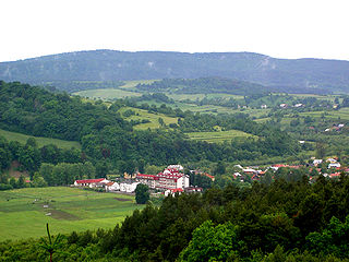
Fredropol is a village in Przemyśl County, Subcarpathian Voivodeship, in south-eastern Poland, close to the border with Ukraine. It is the seat of the gmina called Gmina Fredropol. It lies approximately 10 kilometres (6 mi) south of Przemyśl and 66 km (41 mi) south-east of the regional capital Rzeszów.
Gruszowa is a village in the administrative district of Gmina Fredropol, within Przemyśl County, Subcarpathian Voivodeship, in south-eastern Poland, close to the border with Ukraine. It lies approximately 7 kilometres (4 mi) south-west of Fredropol, 15 km (9 mi) south-west of Przemyśl, and 64 km (40 mi) south-east of the regional capital Rzeszów.
Huwniki is a village in the administrative district of Gmina Fredropol, within Przemyśl County, Subcarpathian Voivodeship, in south-eastern Poland, close to the border with Ukraine. It lies approximately 7 kilometres (4 mi) south-west of Fredropol, 16 km (10 mi) south of Przemyśl, and 66 km (41 mi) south-east of the regional capital Rzeszów.
Kniażyce is a village in the administrative district of Gmina Fredropol, within Przemyśl County, Subcarpathian Voivodeship, in south-eastern Poland, close to the border with Ukraine. It lies approximately 2 kilometres (1 mi) west of Fredropol, 10 km (6 mi) south of Przemyśl, and 65 km (40 mi) south-east of the regional capital Rzeszów.
Koniusza is a village in the administrative district of Gmina Fredropol, within Przemyśl County, Subcarpathian Voivodeship, in south-eastern Poland, close to the border with Ukraine. It lies approximately 4 kilometres (2 mi) west of Fredropol, 11 km (7 mi) south-west of Przemyśl, and 63 km (39 mi) south-east of the regional capital Rzeszów.
Koniuszki is a village in the administrative district of Gmina Fredropol, within Przemyśl County, Subcarpathian Voivodeship, in south-eastern Poland, close to the border with Ukraine. It lies approximately 6 kilometres (4 mi) east of Fredropol, 9 km (6 mi) south-east of Przemyśl, and 69 km (43 mi) south-east of the regional capital Rzeszów.
Kopysno is a village in the administrative district of Gmina Fredropol, within Przemyśl County, Subcarpathian Voivodeship, in south-eastern Poland, close to the border with Ukraine. It lies approximately 8 kilometres (5 mi) west of Fredropol, 14 km (9 mi) south-west of Przemyśl, and 61 km (38 mi) south-east of the regional capital Rzeszów.
Kormanice is a village in the administrative district of Gmina Fredropol, within Przemyśl County, Subcarpathian Voivodeship, in south-eastern Poland, close to the border with Ukraine. It lies approximately 3 kilometres (2 mi) south-west of Fredropol, 12 km (7 mi) south of Przemyśl, and 66 km (41 mi) south-east of the regional capital Rzeszów.
Makowa is a village in the administrative district of Gmina Fredropol, within Przemyśl County, Subcarpathian Voivodeship, in south-eastern Poland, close to the border with Ukraine. It lies approximately 10 kilometres (6 mi) south-west of Fredropol, 19 km (12 mi) south-west of Przemyśl, and 66 km (41 mi) south-east of the regional capital Rzeszów.

Młodowice is a village in the administrative district of Gmina Fredropol, within Przemyśl County, Subcarpathian Voivodeship, in south-eastern Poland, close to the border with Ukraine. It lies approximately 3 kilometres (2 mi) south-east of Fredropol, 11 km (7 mi) south of Przemyśl, and 68 km (42 mi) south-east of the regional capital Rzeszów.
Nowe Sady is a village in the administrative district of Gmina Fredropol, within Przemyśl County, Subcarpathian Voivodeship, in south-eastern Poland, close to the border with Ukraine. It lies approximately 8 kilometres (5 mi) south of Fredropol, 17 km (11 mi) south of Przemyśl, and 69 km (43 mi) south-east of the regional capital Rzeszów.
Paportno is a village in the administrative district of Gmina Fredropol, within Przemyśl County, Subcarpathian Voivodeship, in south-eastern Poland, close to the border with Ukraine. It lies approximately 12 kilometres (7 mi) south of Fredropol, 21 km (13 mi) south of Przemyśl, and 71 km (44 mi) south-east of the regional capital Rzeszów.

Rybotycze is a village in the administrative district of Gmina Fredropol, within Przemyśl County, Subcarpathian Voivodeship, in south-eastern Poland, close to the border with Ukraine. It lies approximately 10 kilometres (6 mi) south-west of Fredropol, 18 km (11 mi) south-west of Przemyśl, and 63 km (39 mi) south-east of the regional capital Rzeszów.
Sopotnik is a village in the administrative district of Gmina Fredropol, within Przemyśl County, Subcarpathian Voivodeship, in south-eastern Poland, close to the border with Ukraine. It lies approximately 11 kilometres (7 mi) south-west of Fredropol, 20 km (12 mi) south of Przemyśl, and 68 km (42 mi) south-east of the regional capital Rzeszów.

Krasice is a village in the administrative district of Gmina Krasiczyn, within Przemyśl County, Subcarpathian Voivodeship, in south-eastern Poland. It lies approximately 3 kilometres (2 mi) west of Krasiczyn, 10 km (6 mi) west of Przemyśl, and 54 km (34 mi) south-east of the regional capital Rzeszów.
Zalesie is a village in the administrative district of Gmina Krasiczyn, within Przemyśl County, Subcarpathian Voivodeship, in south-eastern Poland. It lies approximately 3 kilometres (2 mi) south-east of Krasiczyn, 8 km (5 mi) south-west of Przemyśl, and 58 km (36 mi) south-east of the regional capital Rzeszów.


