Nowa Róża is a village in the administrative district of Gmina Nowy Tomyśl, within Nowy Tomyśl County, Greater Poland Voivodeship, in west-central Poland. It lies approximately 9 kilometres (6 mi) east of Nowy Tomyśl and 46 km (29 mi) west of the regional capital Poznań.
Szarki is a village in the administrative district of Gmina Nowy Tomyśl, within Nowy Tomyśl County, Greater Poland Voivodeship, in west-central Poland. It lies approximately 8 kilometres (5 mi) south of Nowy Tomyśl and 57 km (35 mi) west of the regional capital Poznań.
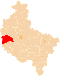
Komorowo is a village in the administrative district of Gmina Lwówek, within Nowy Tomyśl County, Greater Poland Voivodeship, in west-central Poland. It lies approximately 5 kilometres (3 mi) west of Lwówek, 15 km (9 mi) north of Nowy Tomyśl, and 55 km (34 mi) west of the regional capital Poznań.
Jabłonka Stara is a village in the administrative district of Gmina Miedzichowo, within Nowy Tomyśl County, Greater Poland Voivodeship, in west-central Poland. It lies approximately 9 kilometres (6 mi) north-west of Miedzichowo, 22 km (14 mi) north-west of Nowy Tomyśl, and 71 km (44 mi) west of the regional capital Poznań.
Łęczno is a village in the administrative district of Gmina Miedzichowo, within Nowy Tomyśl County, Greater Poland Voivodeship, in west-central Poland. It lies approximately 2 kilometres (1 mi) south-east of Miedzichowo, 13 km (8 mi) north-west of Nowy Tomyśl, and 65 km (40 mi) west of the regional capital Poznań.
Lubień is a village in the administrative district of Gmina Miedzichowo, within Nowy Tomyśl County, Greater Poland Voivodeship, in west-central Poland. It lies approximately 15 kilometres (9 mi) north-west of Nowy Tomyśl and 64 km (40 mi) west of the regional capital Poznań.

Miedzichowo is a village in Nowy Tomyśl County, Greater Poland Voivodeship, in west-central Poland. It is the seat of the gmina called Gmina Miedzichowo. It lies approximately 14 kilometres (9 mi) north-west of Nowy Tomyśl and 66 km (41 mi) west of the regional capital Poznań.
Nowa Silna is a village in the administrative district of Gmina Miedzichowo, within Nowy Tomyśl County, Greater Poland Voivodeship, in west-central Poland. It lies approximately 12 kilometres (7 mi) north-west of Miedzichowo, 26 km (16 mi) north-west of Nowy Tomyśl, and 75 km (47 mi) west of the regional capital Poznań.
Prądówka is a village in the administrative district of Gmina Miedzichowo, within Nowy Tomyśl County, Greater Poland Voivodeship, in west-central Poland. It lies approximately 6 kilometres (4 mi) south-west of Miedzichowo, 16 km (10 mi) west of Nowy Tomyśl, and 70 km (43 mi) west of the regional capital Poznań.
Stary Folwark is a village in the administrative district of Gmina Miedzichowo, within Nowy Tomyśl County, Greater Poland Voivodeship, in west-central Poland. It lies approximately 17 kilometres (11 mi) west of Nowy Tomyśl and 70 km (43 mi) west of the regional capital Poznań.
Szklarka Trzcielska is a village in the administrative district of Gmina Miedzichowo, within Nowy Tomyśl County, Greater Poland Voivodeship, in west-central Poland. It lies approximately 17 kilometres (11 mi) north-west of Nowy Tomyśl and 67 km (42 mi) west of the regional capital Poznań.
Zawada is a village in the administrative district of Gmina Miedzichowo, within Nowy Tomyśl County, Greater Poland Voivodeship, in west-central Poland. It lies approximately 16 kilometres (10 mi) north-west of Nowy Tomyśl and 64 km (40 mi) west of the regional capital Poznań.
Łomnica is a village in the administrative district of Gmina Zbąszyń, within Nowy Tomyśl County, Greater Poland Voivodeship, in west-central Poland. It lies approximately 8 kilometres (5 mi) north-east of Zbąszyń, 11 km (7 mi) west of Nowy Tomyśl, and 65 km (40 mi) west of the regional capital Poznań.
Nądnia is a village in the administrative district of Gmina Zbąszyń, within Nowy Tomyśl County, Greater Poland Voivodeship, in west-central Poland. It lies approximately 5 kilometres (3 mi) south-west of Zbąszyń, 21 km (13 mi) south-west of Nowy Tomyśl, and 74 km (46 mi) west of the regional capital Poznań.
Nowa Wieś-Zamek is a village in the administrative district of Gmina Zbąszyń, within Nowy Tomyśl County, Greater Poland Voivodeship, in west-central Poland. It lies approximately 6 kilometres (4 mi) south of Zbąszyń, 21 km (13 mi) south-west of Nowy Tomyśl, and 73 km (45 mi) west of the regional capital Poznań.
Perzyny is a village in the administrative district of Gmina Zbąszyń, within Nowy Tomyśl County, Greater Poland Voivodeship, in west-central Poland. It lies approximately 5 kilometres (3 mi) south of Zbąszyń, 18 km (11 mi) south-west of Nowy Tomyśl, and 70 km (43 mi) west of the regional capital Poznań.
Przychodzko is a village in the administrative district of Gmina Zbąszyń, within Nowy Tomyśl County, Greater Poland Voivodeship, in west-central Poland. It lies approximately 8 kilometres (5 mi) north of Zbąszyń, 15 km (9 mi) west of Nowy Tomyśl, and 69 km (43 mi) west of the regional capital Poznań.
Przyprostynia is a village in the administrative district of Gmina Zbąszyń, within Nowy Tomyśl County, Greater Poland Voivodeship, in west-central Poland. It lies approximately 3 kilometres (2 mi) south-east of Zbąszyń, 17 km (11 mi) south-west of Nowy Tomyśl, and 70 km (43 mi) west of the regional capital Poznań.
Stefanowo is a village in the administrative district of Gmina Zbąszyń, within Nowy Tomyśl County, Greater Poland Voivodeship, in west-central Poland. It lies approximately 5 kilometres (3 mi) south-east of Zbąszyń, 15 km (9 mi) south-west of Nowy Tomyśl, and 67 km (42 mi) west of the regional capital Poznań.
Strzyżewo is a village in the administrative district of Gmina Zbąszyń, within Nowy Tomyśl County, Greater Poland Voivodeship, in west-central Poland. It lies approximately 4 kilometres (2 mi) north of Zbąszyń, 17 km (11 mi) west of Nowy Tomyśl, and 71 km (44 mi) west of the regional capital Poznań.