The Lillooet Museum in Lillooet, British Columbia, Canada is located on that town's Main Street, across from the "Mile '0'" cairn marking the beginning point of the Old Cariboo Road to Alexandria in the Cariboo region.

The Lillooet Museum in Lillooet, British Columbia, Canada is located on that town's Main Street, across from the "Mile '0'" cairn marking the beginning point of the Old Cariboo Road to Alexandria in the Cariboo region.
The Museum, which is also the town's official Visitor Centre, is housed in the former Anglican Church, St. Mary's the Virgin, which was built in 1961, incorporating materials from the original St. Mary's Church, built in 1860. The museum houses artifacts from the Fraser Gold Rush and the several other gold rushes in the vicinity, belongings and household items and photos from the region's families, the second largest mounted elk head trophy ever registered in British Columbia and First Nations artifacts of the St'at'imc (Lillooet people). The chancery and melodeon of the original church are on site. Also housed in the museum are the original presses, office desk and sundry from the legendary Bridge River-Lillooet News , a newspaper founded in 1933 by Margaret "Ma" Lally Murray and her husband George Matheson Murray, one-time Liberal MLA for the Lillooet riding. [1]

Lillooet is a district municipality in the Squamish-Lillooet region of southwestern British Columbia. The town is on the west shore of the Fraser River immediately north of the Seton River mouth. On BC Highway 99, the locality is by road about 100 kilometres (62 mi) northeast of Pemberton, 64 kilometres (40 mi) northwest of Lytton, and 172 kilometres (107 mi) west of Kamloops.

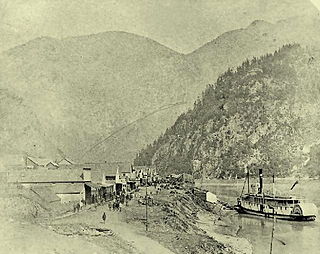
Yale is an unincorporated town in the Canadian province of British Columbia, which grew in importance during the Fraser Canyon Gold Rush.

The Cariboo Road was a project initiated in 1860 by the Governor of the Colony of British Columbia, James Douglas. It involved a feat of engineering stretching from Fort Yale to Barkerville, B.C. through extremely hazardous canyon territory in the Interior of British Columbia.

The Cariboo Gold Rush was a gold rush in the Colony of British Columbia, which later became the Canadian province of British Columbia. The first gold discovery was made at Hills Bar in 1858, followed by more strikes in 1859 on the Horsefly River, and on Keithley Creek and Antler Creek in 1860. The actual rush did not begin until 1861, when these discoveries were widely publicized. By 1865, following the strikes along Williams Creek, the rush was in full swing.

The Douglas Road, a.k.a. the Lillooet Trail, Harrison Trail or Lakes Route, was a goldrush-era transportation route from the British Columbia Coast to the Interior. Over 30,000 men are reckoned to have travelled the route in, although by the end of the 1860s it was virtually abandoned due to the construction of the Cariboo Wagon Road, which bypassed the region.

A quiggly hole, also known as a pit-house or simply as a quiggly or kekuli, is the remains of an earth lodge built by the First Nations people of the Interior of British Columbia and the Columbia Plateau in the United States. The word quiggly comes from kick willy or keekwulee, the Chinook Jargon word for "beneath" or "under".
George Matheson Murray, known publicly as George Murray, was a publisher and politician in British Columbia in the first half of the 20th century. He played a role in the founding of the Boy Scouts of Canada. Murray is best known as the husband of Margaret Lally "Ma" Murray.
Cariboo was one of the twelve original electoral districts created when British Columbia became a Canadian province in 1871. Roughly corresponding to the old colonial electoral administrative district of the same name, it was a three-member riding until the 1894 election, when it was reduced through reapportionment and became a two-member riding until the 1916 election, after which it has been a single-member riding. It produced many notable Members of the Legislative Assembly (MLAs), including George Anthony Boomer Walkem, third and fifth holder of the office of Premier of British Columbia and who was one of the first representatives elected from the riding; John Robson, ninth Premier of British Columbia; and Robert Bonner, a powerful minister in the W.A.C. Bennett cabinet, and later CEO of MacMillan Bloedel and BC Hydro.

Clinton is a village in British Columbia, Canada, located approximately 40 km (25 mi) northwest of Cache Creek and 30 km south of 70 Mile House.
The Old Cariboo Road is a reference to the original wagon road to the Cariboo gold fields in what is now the Canadian province of British Columbia. It should not be confused with the Cariboo Road, which was built slightly later and used a different route.
The Lillooet Country, also referred to as the Lillooet District, is a region spanning from the central Fraser Canyon town of Lillooet west to the valley of the Lillooet River, and including the valleys in between, in the Southern Interior of British Columbia. Like other historical BC regions, it is sometimes referred to simply as The Lillooet or even Lillooet,.

The Bridge River Country is a historic geographic region and mining district in the Interior of British Columbia, Canada, lying between the Fraser Canyon and the valley of the Lillooet River, south of the Chilcotin Plateau and north of the Lillooet Ranges. "The Bridge River" can mean the Bridge River Country as opposed to the Bridge River itself, and is considered to be part of the Lillooet Country, but has a distinct history and identity within the larger region. As Lillooet is sometimes considered to be the southwest limit of the Cariboo, some efforts were made to refer to the Bridge River as the "West Cariboo" but this never caught on.

70 Mile House is a community situated on Highway 97 in the Cariboo region of British Columbia, Canada. Its name is derived from its distance from Lillooet, which was Mile 0 of the Old Cariboo Road. Other examples of towns named by their distance from Lillooet on the Old Cariboo Road are 93 Mile House, 100 Mile House, and 150 Mile House. In its heyday, 70 Mile House was a frequent stop for stagecoaches, such as the ones run by Barnard's Express and for Cataline's mule train.

Fountain is an unincorporated rural area and Indian reserve community in the Fraser Canyon region of British Columbia, Canada, located at the ten-mile (16 km) mark from the town of Lillooet on BC Highway 99, which in that area is also on the route of the Old Cariboo Road and is located at the junction of that route with the old gold rush-era trail via Fountain Valley and the Fountain Lakes.
Lac La Hache is a recreational and retirement community in the Cariboo region of British Columbia, Canada. Located on the shore of Lac La Hache alongside British Columbia Highway 97 near the regional centre of 100 Mile House, the community's origins date to the days of the Cariboo Gold Rush and the Cariboo Wagon Road, for which it provided an important roadhouse. Lac La Hache, or "The Lake of the Axe" as it translates to, was named, during the fur trade era, after the unfortunate incident of a French-Canadian voyageur who lost his axe head while chopping a hole in the ice. It is a town rich in history, as it sits along the Gold Rush Trail.
The Bridge River Rapids, also known as the Six Mile Rapids, the Lower Fountain, the Bridge River Fishing Grounds, and in the St'at'imcets language as Sat' or Setl, is a set of rapids on the Fraser River, located in the central Fraser Canyon at the mouth of the Bridge River six miles north of the confluence of Cayoosh Creek with the Fraser and on the northern outskirts of the District of Lillooet, British Columbia, Canada.
David Alexander "Dave" Stoddart was a businessman and political figure in British Columbia. He represented Lillooet from 1890 to 1894, Lillooet East from 1895 to 1900 and Cariboo from 1924 to 1928 in the Legislative Assembly of British Columbia.
The O'Keefe Ranch is a historic ranch in the Okanagan region of British Columbia, Canada on the Canadian National Railway, just northwest of Vernon. The ranch was founded in 1867 by Cornelius O'Keefe.
Parsonville is a ghost town on the east shore of the Fraser River approximately opposite Lillooet. On BC Highway 99, the locality is by road about 100 kilometres (62 mi) northeast of Pemberton, 64 kilometres (40 mi) northwest of Lytton, and 172 kilometres (107 mi) west of Kamloops.
The Lillooet Land District is one of the 59 cadastral subdivisions of British Columbia, which were created by the Lands Act of the Colony of British Columbia in 1859, defined as "a territorial division with legally defined boundaries for administrative purposes". The land district's boundaries came to be used as the boundary of the initial Lillooet riding for the provincial Legislature from 1871, when the colony became a province. In addition to use in descriptions of land titles and lot surveys, the Land District was also the basis of the Lillooet Mining District.