
The Chicago River is a system of rivers and canals with a combined length of 156 miles (251 km) that runs through the city of Chicago, including its center. Though not especially long, the river is notable because it is one of the reasons for Chicago's geographic importance: the related Chicago Portage is a link between the Great Lakes and the Mississippi River Basin, and ultimately the Gulf of Mexico.

Lakeview is one of the 77 community areas of Chicago, Illinois. Lakeview is located on the city's North Side and is bordered by West Diversey Parkway on the south, West Irving Park Road on the north, North Ravenswood Avenue on the west, and the shore of Lake Michigan on the east. The Uptown community area is to Lakeview's north, Lincoln Square to its northwest, North Center to its west, and Lincoln Park to its south. The 2020 population of Lakeview was 103,050 residents, making it the second-largest Chicago community area by population.
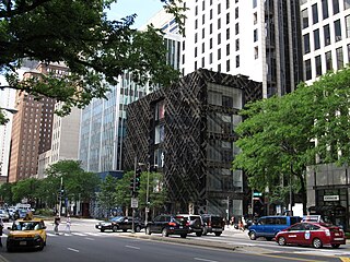
Michigan Avenue is a north-south street in Chicago that runs at 100 east on the Chicago grid. The northern end of the street is at DuSable Lake Shore Drive on the shore of Lake Michigan in the Gold Coast Historic District. The street's southern terminus is at Sibley Boulevard in the southern suburb of Dolton, but like many other Chicago streets, it exists in several disjointed segments.
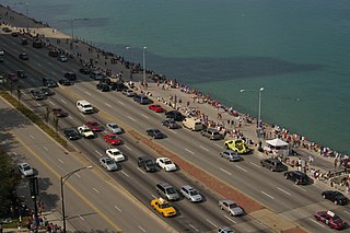
Lake Shore Drive is a semi-limited access expressway that runs alongside the shoreline of Lake Michigan and its adjacent parkland and beaches in Chicago, Illinois. Except for the portion north of Foster Avenue, the Drive is designated part of U.S. Highway 41. A portion of the highway on the Outer Drive Bridge and its bridge approaches is multilevel.

Streeterville is a neighborhood in the Near North Side community area of Chicago, Illinois, United States, north of the Chicago River. It is bounded by the river on the south, the Magnificent Mile portion of Michigan Avenue on the west, and Lake Michigan on the north and east, according to most sources, although the city of Chicago recognizes only a small portion of this region as Streeterville. Thus, it can be described as the Magnificent Mile plus all land east of it. The tourist attraction of Navy Pier and Ohio Street Beach extend out into the lake from southern Streeterville. To the north, the East Lake Shore Drive District, where the Drive curves around the shoreline, may be considered an extension of the Gold Coast. The majority of the land in this neighborhood is reclaimed sandbar.

Jackson Park is a 551.5-acre (223.2 ha) urban park on the shore of Lake Michigan on the South Side of Chicago. Straddling the Hyde Park, Woodlawn, and South Shore neighborhoods, the park was designed in 1871 by Frederick Law Olmsted and Calvert Vaux and remodeled in 1893 to serve as the site of the World's Columbian Exposition. It is one of the largest and most historically significant parks in the city, and many of the park's features are mementos of the fair—including the Garden of the Phoenix, the Statue of TheRepublic, and the Museum of Science and Industry.
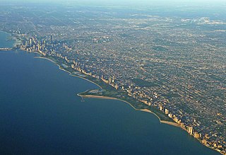
Lincoln Park is a 1,208-acre (489-hectare) park along Lake Michigan on the North Side of Chicago, Illinois. Named after US President Abraham Lincoln, it is the city's largest public park and stretches for seven miles (11 km) from Grand Avenue, on the south, to near Ardmore Avenue on the north, just north of the DuSable Lake Shore Drive terminus at Hollywood Avenue. Two museums and a zoo are located in the oldest part of the park between North Avenue and Diversey Parkway in the eponymous neighborhood. Further to the north, the park is characterized by parkland, beaches, recreational areas, nature reserves, and harbors. To the south, there is a more narrow strip of beaches east of Lake Shore Drive, almost to downtown. With 20 million visitors per year, Lincoln Park is the second-most-visited city park in the United States, behind Manhattan's Central Park.

The Magnificent Mile is a section of Michigan Avenue in Chicago devoted to retail, dining, hotels and tourist attractions. Running from the Chicago River to Oak Street in the Near North Side, the district is located one block east of Rush Street and is the main retail corridor between the Loop and Gold Coast. It is bounded by Streeterville neighborhood to its east and River North to its west.
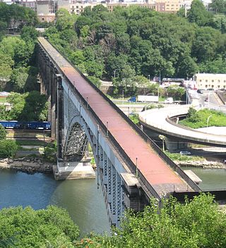
The High Bridge is a steel arch bridge connecting the New York City boroughs of the Bronx and Manhattan. Rising 140 ft (43 m) over the Harlem River, it is the city's oldest bridge, having opened as part of the Croton Aqueduct in 1848. The eastern end is located in the Highbridge section of the Bronx near the western end of West 170th Street, and the western end is located in Highbridge Park in Manhattan, roughly parallel to the end of West 174th Street.

LaSalle Street is a major north-south street in Chicago named for René-Robert Cavelier, Sieur de La Salle, a 17th century French explorer of the Illinois Country. The portion that runs through the Chicago Loop is considered to be Chicago's financial district.
The Macombs Dam Bridge is a swing bridge across the Harlem River in New York City, connecting the boroughs of Manhattan and the Bronx. The bridge is operated and maintained by the New York City Department of Transportation (NYCDOT).
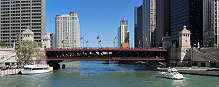
The DuSable Bridge is a bascule bridge that carries Michigan Avenue across the main stem of the Chicago River in downtown Chicago, Illinois, United States. The bridge was proposed in the early 20th century as part of a plan to link Grant Park (downtown) and Lincoln Park (uptown) with a grand boulevard. Construction of the bridge started in 1918, it opened to traffic in 1920, and decorative work was completed in 1928. The bridge provides passage for vehicles and pedestrians on two levels. An example of a fixed trunnion bascule bridge, it may be raised to allow tall ships and boats to pass underneath. The bridge is included in the Michigan–Wacker Historic District and has been designated as a Chicago Landmark.

U.S. Route 66 was a United States Numbered Highway in Illinois that connected St. Louis, Missouri, and Chicago, Illinois. The historic Route 66, the Mother Road or Main Street of America, took long distance automobile travelers from Chicago to Southern California. The highway had previously been Illinois Route 4 and the road has now been largely replaced with Interstate 55 (I-55). Parts of the road still carry traffic and six separate portions of the roadbed have been listed on the National Register of Historic Places.

U.S. Route 41 (US 41) in the U.S. state of Illinois runs north from the Indiana border beneath the Chicago Skyway on Indianapolis Boulevard to the Wisconsin border north of the northern terminus of the Tri-State Tollway with Interstate 94. It is the only north–south U.S. Route to travel through a significant portion of the city of Chicago, carrying Lake Shore Drive through the central portion of the city along the lakefront. US 41 in Illinois is 64.81 miles (104.30 km) in length.

The Chicago and North Western Railway's Kinzie Street railroad bridge is a single leaf bascule bridge across the north branch of the Chicago River in downtown Chicago, Illinois. At the time of its opening in 1908 it was the world's longest and heaviest bascule bridge. The previous bridges on the same site included a pedestrian span that was the first bridge across the Chicago River; a second bridge that served as Chicago's first railroad bridge; and a third bridge that was one of the first all-steel spans in the United States.

The Chicago Lakefront Trail (LFT) is a 18.5-mile-long (29.8 km) partial shared-use path for walking, jogging, skateboarding, and cycling, located along the western shore of Lake Michigan in Chicago, Illinois. The trail passes through and connects Chicago's four major lakefront parks along with various beaches and recreational amenities. It also serves as a route for bicycle, skateboard and personal transporter commuters. On busy summer days 70,000 people use the trail.

The Wissahickon Memorial Bridge, originally called and still also known as the Henry Avenue Bridge, is a stone and concrete bridge that carries Henry Avenue over Wissahickon Creek and Lincoln Drive in Fairmount Park in Philadelphia, Pennsylvania.
Preservation Chicago is a historic preservation advocacy group in Chicago, Illinois, which formally commenced operations on October 23, 2001. The organization was formed by a group of Chicagoans who had assembled the previous year to save a group of buildings which included Coe Mansion, which had once housed Ranalli's pizzeria and The Red Carpet, a French restaurant that had been frequented by Jack Benny and Elizabeth Taylor. Other preservation campaigns that were instrumental in the founding of Preservation Chicago included St. Boniface Church, the Scherer Building, and the New York Life Insurance Building.


