

The Afon Rheidol is a river in Ceredigion, Wales, 19 miles (31 km) in length. The source is Plynlimon, the largest watershed in Wales with a catchment area covering 73 square miles (189 km2). Receiving an average annual rainfall of 40 inches (1015 mm) Plynlimon is the source of both the Wye and the Severn.
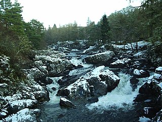
Achness Falls, also known as the Achness Waterfall or Cassley Falls, is a waterfall located on the River Cassley in Sutherland, Scotland, near Rosehall and Invercassley. Its name is derived from the Scottish Gaelic Ach-an-eas, the "field of the waterfall".

Bearreraig Waterfall is a waterfall of Scotland.

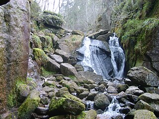
Corrimony Falls is a waterfall on the River Enrick, near Corrimony in Glenurquhart, in the Highland council area of Scotland. It is a local tourist attraction in the spring and summer.

Culnaskiach Falls is a waterfall in Boblainy Forest, to the south of the village of Kiltarlity, in the Highland council area of Scotland. It is on a small stream which flows into the Bruiach Burn.

Dog Falls is a series of waterfalls on the River Affric, in Glen Affric in the Highlands of Scotland. The falls are within the Glen Affric National Nature Reserve, managed by Forestry and Land Scotland. There are several way-marked paths to the falls.

Eas a' Bhradain is a waterfall of Scotland.

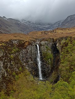
Victoria Falls is a waterfall on the southern side of Loch Maree in Wester Ross in the north-west of Scotland. It is on the Abhainn Garbhaig, a short river that flows from Loch Garbhaig to Loch Maree. The falls are within Slattadale Forest, owned by the Forestry Commission.
Kilfinnan Fall is a waterfall of Scotland.

Eas Fionn is a waterfall of Scotland.
Eas Maol Mhairi is a waterfall of Scotland. Just east of this waterfall is the River Cannich.
Eas Mòr is a waterfall in Glen Brittle on the island of Skye in Scotland. It lies on the Allt Coire na Bannachdich in a small gorge east of Glenbrittle House.

Eas Mòr is a waterfall on the Duirinish peninsula of the island of Skye in Scotland. It lies on the Allt Mhicheil, a tributary of the Dibidal River below Healabhal Bheag. The area is uninhabited and there is a second fall where the Dibidal River flows into the sea at Geodha Mòr north of MacLeod's Maidens.

Falls of Balgy is a waterfall near Torridon in Scotland.

Falls of Damff is a waterfall in Cairngorms National Park in Scotland.

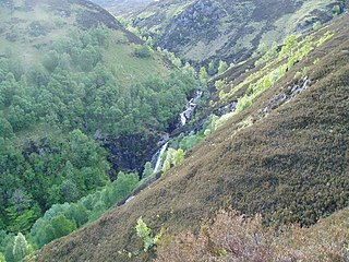
Falls of Orrin is a waterfall on the River Orrin, in the Highlands of Scotland.
Falls of Glas Allt is a 50-metre (160 ft) waterfall near the head of Loch Muick, Aberdeenshire, Scotland. Queen Victoria liked to take walks here beside the stream flowing from Lochnagar down to Loch Muick. After the death of Prince Albert she had a cottage, Glas-allt-Shiel, rebuilt for her on the delta where the stream flows into the loch.

Falls of Turret is a waterfall of Scotland.
Burn O'Vat is a pothole located close to Loch Kinord near the village of Dinnet in Aberdeenshire, Scotland.
Torboll is a former feudal barony and geographical area that includes Torboll Farm, Little Torboll, Torboll Fall, and the Torboll Woods Site of Special Scientific Interest, in the parish of Golspie, Highland, Scotland. It is within the historic county of Sutherland.
Coordinates: 57°00′16″N3°27′31″W / 57.00434°N 3.45866°W
| | This Scottish location article is a stub. You can help Wikipedia by expanding it. |