Borek Mielęcki is a village in the administrative district of Gmina Kępno, within Kępno County, Greater Poland Voivodeship, in west-central Poland. It lies approximately 6 kilometres (4 mi) north-west of Kępno and 139 km (86 mi) south-east of the regional capital Poznań.
Domanin is a village in the administrative district of Gmina Kępno, within Kępno County, Greater Poland Voivodeship, in west-central Poland. It lies approximately 8 kilometres (5 mi) north of Kępno and 139 km (86 mi) south-east of the regional capital Poznań.
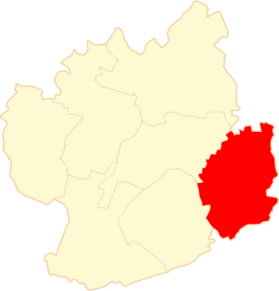
Kierzenko is a village in the administrative district of Gmina Kępno, within Kępno County, Greater Poland Voivodeship, in west-central Poland. It lies approximately 9 kilometres (6 mi) north-east of Kępno and 143 km (89 mi) south-east of the regional capital Poznań.
Kierzno is a village in the administrative district of Gmina Kępno, within Kępno County, Greater Poland Voivodeship, in west-central Poland. It lies approximately 9 kilometres (6 mi) north-east of Kępno and 143 km (89 mi) south-east of the regional capital Poznań.
Krążkowy is a village in the administrative district of Gmina Kępno, within Kępno County, Greater Poland Voivodeship, in west-central Poland. It lies approximately 2 kilometres (1 mi) east of Kępno and 145 km (90 mi) south-east of the regional capital Poznań.
Mechnice is a village in the administrative district of Gmina Kępno, within Kępno County, Greater Poland Voivodeship, in west-central Poland. It lies approximately 11 kilometres (7 mi) north-east of Kępno and 142 km (88 mi) south-east of the regional capital Poznań.
Mikorzyn is a village in the administrative district of Gmina Kępno, within Kępno County, Greater Poland Voivodeship, in west-central Poland. It lies approximately 10 kilometres (6 mi) north of Kępno and 138 km (86 mi) south-east of the regional capital Poznań.
Pustkowie Kierzeńskie is a village in the administrative district of Gmina Kępno, within Kępno County, Greater Poland Voivodeship, in west-central Poland. It lies approximately 8 kilometres (5 mi) north-east of Kępno and 145 km (90 mi) south-east of the regional capital Poznań.

Świba is a village in the administrative district of Gmina Kępno, within Kępno County, Greater Poland Voivodeship, in west-central Poland. It lies approximately 8 kilometres (5 mi) east of Kępno and 147 km (91 mi) south-east of the regional capital Poznań.
Nosale is a village in the administrative district of Gmina Bralin, within Kępno County, Greater Poland Voivodeship, in west-central Poland. It lies approximately 4 kilometres (2 mi) south of Bralin, 6 km (4 mi) south-west of Kępno, and 145 km (90 mi) south-east of the regional capital Poznań.
Biadaszki is a village in the administrative district of Gmina Łęka Opatowska, within Kępno County, Greater Poland Voivodeship, in west-central Poland. It lies approximately 4 kilometres (2 mi) north of Łęka Opatowska, 9 km (6 mi) south-east of Kępno, and 152 km (94 mi) south-east of the regional capital Poznań.
Kuźnica Słupska is a village in the administrative district of Gmina Łęka Opatowska, within Kępno County, Greater Poland Voivodeship, in west-central Poland. It lies approximately 3 kilometres (2 mi) west of Łęka Opatowska, 10 km (6 mi) south-east of Kępno, and 154 km (96 mi) south-east of the regional capital Poznań.
Piaski is a village in the administrative district of Gmina Łęka Opatowska, within Kępno County, Greater Poland Voivodeship, in west-central Poland. It lies approximately 2 kilometres (1 mi) north of Łęka Opatowska, 10 km (6 mi) south-east of Kępno, and 153 km (95 mi) south-east of the regional capital Poznań.
Trębaczów is a village in the administrative district of Gmina Perzów, within Kępno County, Greater Poland Voivodeship, in west-central Poland. It lies approximately 10 kilometres (6 mi) south of Perzów, 16 km (10 mi) south-west of Kępno, and 147 km (91 mi) south-east of the regional capital Poznań.
Drożki is a village in the administrative district of Gmina Rychtal, within Kępno County, Greater Poland Voivodeship, in west-central Poland. It lies approximately 6 kilometres (4 mi) north of Rychtal, 13 km (8 mi) south-west of Kępno, and 149 km (93 mi) south-east of the regional capital Poznań.
Borek is a village in the administrative district of Gmina Trzcinica, within Kępno County, Greater Poland Voivodeship, in west-central Poland. It lies approximately 4 kilometres (2 mi) north-east of Trzcinica, 13 km (8 mi) south-east of Kępno, and 156 km (97 mi) south-east of the regional capital Poznań.
Granice is a village in the administrative district of Gmina Trzcinica, within Kępno County, Greater Poland Voivodeship, in west-central Poland. It lies approximately 9 kilometres (6 mi) north-east of Trzcinica, 14 km (9 mi) south-east of Kępno, and 157 km (98 mi) south-east of the regional capital Poznań.
Ignacówka Pierwsza is a village in the administrative district of Gmina Trzcinica, within Kępno County, Greater Poland Voivodeship, in west-central Poland. It lies approximately 4 kilometres (2 mi) south of Trzcinica, 17 km (11 mi) south of Kępno, and 160 km (99 mi) south-east of the regional capital Poznań.
Nowa Wieś is a settlement in the administrative district of Gmina Trzcinica, within Kępno County, Greater Poland Voivodeship, in west-central Poland. It lies approximately 6 kilometres (4 mi) north of Trzcinica, 9 km (6 mi) south-east of Kępno, and 153 km (95 mi) south-east of the regional capital Poznań.
Pomiany is a village in the administrative district of Gmina Trzcinica, within Kępno County, Greater Poland Voivodeship, in west-central Poland. It lies approximately 3 kilometres (2 mi) south-east of Trzcinica, 16 km (10 mi) south of Kępno, and 159 km (99 mi) south-east of the regional capital Poznań.