This is a complete list of New York State Historic Markers in Bronx County, New York. [1]
Marker name [1] | Image | Date designated | Location | City or Town | Marker text | |
---|---|---|---|---|---|---|
1 | Bronx River | Bronx River, At Boston Rd. Bridge, in Bronx Park 40°51′10.5″N73°52′26.5″W / 40.852917°N 73.874028°W | Bronx, New York | During the Revolution, the British Fleet was ordered to "Proceed up the Bronx and attack the Yankees in hiding above." | ||
2 | City Island | City Island Park | Bronx, New York | Pearl Of The Sound, was so called, because it was planned to outstrip New York City. Oyster culture first started here. | ||
3 | Drake Park | Joseph Rodman Dake Park, Hunt's Point Ave. | Bronx, New York | Contains grave of Joseph Rodman Drake, poet, author of "The Culprit Fay", "Ode To The American Flag", and "Bronx." | ||
4 | Featherbed Lane | Park Triangle At Featherbed Lane | Bronx, New York | So called from story that farmers' wives, in 1776, aided Americans to escape British by spreading featherbeds on the lane. | ||
5 | Fording Place | West Side Of Lake In Bronx River, Opposite Zoological Sec., 1/3 Mi. North | Bronx, New York | Early crossing of Bronx River, nearby was Bear Swamp, haunt of bears. Site of Sewanoe Indian Village up to 1689. | ||
6 | Fort Independence | Claflin Ter. On Walk East Of Reservoir Opposite Fort Independence Ave. | Bronx, New York | One of a chain of forts built in 1776 by Americans to command the valley below. General Richard Montgomery had a farm nearby, in 1772. | ||
7 | Fort Number Four | Claflin Ter. East Of Sedgwick Ave., West Of Jerome Park Reservoir | Bronx, New York | One of the chain of forts built by the Americans in 1776, to command the valley of the Harlem River; later occupied by the British | ||
8 | Glover's Rock | On Road To City Island Near Tablet Off Road | Bronx, New York | In Battle of Pell's Point, Col. Glover and 550 men, held British long enough for Washington's army to escape to White Plains. Historical Marker Database ID 98622 | ||
9 | Hunter's Island | Hunter's Island at entrance from highway | Bronx, New York | Contains the Hunter-Iselin Mansion; Ogden Mansion on Twin Island; Indian Name Laapawachking, - "Place Of Stringing Beads". | ||
10 | Jonas Bronck | Pulaski Park | Bronx, New York | First settler in the Bronx, 1639, built house east of this park, where was signed treaty between Dutch and Weckquaeskeek Indians, 1642. | ||
11 | Lydig's Mill | Bronx River, About Opposite Entrance To New York Zoological Gardens | Bronx, New York | Built in 18th century, stood here. North was Johnson's Tavern, where stage coaches, New York To Boston, stopped to change horses. | ||
12 | Macombs Dam | Macombs Dam Park | Bronx, New York | Bridge is on site of Old Dam which made pond of Harlem River. Dam became nuisance and was torn down by citizens in 1840. | ||
13 | Old Indian Path | Location: Bet. Pelham Bay Park on Split Rock Road, And Bet. Pelham Manor And Pelham Road. | Bronx, New York | Later known as the Split Rock Road many of erected by the Park Dept, City Of New York, October 18, 1938. | ||
14 | Parade Ground | On Broadway, West Side Of Parade Ground Van Cortlandt Park | Bronx, New York | Here was the bouwerie or farm of Adrian Van Der Donck, secured by purchase from Indians and grant by Governor Kieft, 1650. | ||
15 | Pell Estate | Pelham Bay Park | Bronx, New York | Thomas Pell of Fairfield, Conn., under tree known as Treaty Oak, bought Pelham Manor from the sachems Annhoock and Maminepoe | ||
16 | Poe Cottage | Grand Concourse | Bronx, New York | Edgar Allan Poe lived here 1846-49 and wrote many of his poems, "Annabel Lee", Ulalume, and others. His wife, Virginia, died here. | ||
17 | Screven's Point | Small Park At End Of Castle Hill Ave. | Bronx, New York | Sewanoe Indians had castle here, seen by Adrian Block on his voyage, 1614. Loyalist clergymen, including Samuel Seabury, hid in farmhouse. | ||
18 | Site Of West Chester Town | Tarrytown | Bronx, New York | Prescott Bryant repulsed British at causeway over West Chester Creek Westchester Lexington | ||
19 | Split Rock | At Split Rock, Pelham Bay Park | Bronx, New York | Near here was home of Anne Hutchinson, who settled in 1642. She and her family were killed in the Indian Uprising, 1662 | ||
20 | St. Ann's Shrine | St Ann's Avenue, South Bronx | Bronx, New York | Here rests Lewis Morris, "Signer" Declaration of Independence; Gouverneur Morris, "Penman" Constitution Of U.S.A.; Judge R.H. Morris, Mayor Of New York | ||
21 | Throgg's Neck | Throgg's Point Park | Bronx, New York | Named For Throckmorton, who settled here in 1642. One of his companions was Roger Williams, founder of Rhode Island. | ||
22 | Van Cortlandt Mansion | In front of Van Cortlandt House Museum 40°53′28.8″N73°53′41.5″W / 40.891333°N 73.894861°W | Bronx, New York | Built in 1748 by Frederick Van Cortlandt. Hessian headquarters in Revolution. Washington and Rochambeau were here. | ||
23 | Van Cortlandt Mill | On Brook, Near Dam, East Of Van Cortlandt Mansion | Bronx, New York | Site of grist and saw mill of Van Cortlandt family. Used over 200 years, burned in 1901. One of the millstones is west of the mansion. | ||
24 | Van Der Donck | East Of Van Cortlandt Mansion, Between it and Dam | Bronx, New York | Adrian Van Der Donck, first settler here, 1650 built house, later burned by Indians. Original site of Van Cortlandt House. | ||
25 | Vault Hill | On East Hill Of Parade Ground, North Of Railroad Underpass, In Van Cortland | Bronx, New York | Burial vault of the Van Cortlandt family, where Augustus Van Cortlandt, City Clerk, hid New York records during Revolution. |
The Bronx River Parkway is a 19.12-mile (30.77 km) limited-access parkway in downstate New York in the United States. It is named for the nearby Bronx River, which it parallels. The southern terminus of the parkway is at Story Avenue near the Bruckner Expressway in the Bronx neighborhood of Soundview. The northern terminus is at Kensico Circle in North Castle, Westchester County, where the parkway connects to the Taconic State Parkway and, via a short connector, New York State Route 22 (NY 22). Within the Bronx, the parkway is maintained by the New York State Department of Transportation and is designated New York State Route 907H (NY 907H), an unsigned reference route. In Westchester County, the parkway is maintained by the Westchester County Department of Public Works and is designated unsigned County Route 9987 (CR 9987).
Woodlawn Cemetery is one of the largest cemeteries in New York City and a designated National Historic Landmark. Located south of Woodlawn Heights, Bronx, New York City, it has the character of a rural cemetery. Woodlawn Cemetery opened during the Civil War in 1863, in what was then Yonkers, in an area that was annexed to New York City in 1874. It is notable in part as the final resting place of some well-known figures.
Buildings, sites, districts, and objects in New York listed on the National Register of Historic Places:
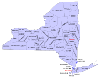
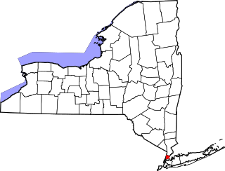
List of Registered Historic Places in Bronx County, New York :
The following properties are listed on the National Register of Historic Places in Brooklyn.
There are 577 properties and districts listed on the National Register of Historic Places in New York County, New York, which consists of Manhattan Island, the Marble Hill neighborhood on the mainland north of the Harlem River Ship Canal, and adjacent smaller islands around it. One listing, appears on more than one of the lists described below.
List of the National Register of Historic Places listings in Suffolk County, New York.
The Valentine–Varian House is a historic house located in the Norwood neighborhood of the Bronx, New York City. Built in 1758 by Isaac Valentine, it is the Bronx's second oldest house and oldest remaining farmhouse. The house remained in the Varian family, which included Isaac Varian, the 63rd Mayor of New York City until 1905, when it was sold. It is currently a part of the Historic House Trust and houses the Museum of Bronx History and the offices of the Bronx County Historical Society. It is a two-story, five bay fieldstone residence with a gable roof. It was moved to its present site in 1965 and restored between July 1965 and May 1968.
Williamsbridge Reservoir was a natural lake measuring 13.1 acres (5.3 ha) just south of Van Cortlandt Park in the Bronx, New York. Specifically the body of water was located at 208th Street and Bainbridge Avenue. It was shaped like a saucer and was normally 41 feet (12 m) deep. Its water level dropped approximately 14 feet (4.3 m) in mid-August 1901. On April 3, 1934 Commissioner of Water Supply, Gas and Electricity, Maurice P. Davidson, proposed that it be offered to Robert Moses to be used as a park site. The reservoir had ceased to be used after 1919.
This is a list of Historic Sites on the Revolutionary War Heritage Trail in the American state of New York. The New York State Office of Parks, Recreation and Historic Preservation and the office of Heritage, New York, the New York City Department of Parks and Recreation, Brooklyn College and the City University of New York, and a local not-for-profit organization, Brooklyn Heritage, Inc.; placed a series of signs depicting 18 sites of historical significance in Brooklyn.