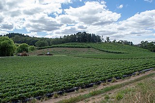
The Mid Murray Council is a local government area in South Australia in the Murray and Mallee region of South Australia. The council spans the area from the Riverland through the Murraylands to the eastern slopes of the Mount Lofty Ranges. It includes 220 km of the Murray River. The council seat is at Mannum; it also maintains secondary offices at Cambrai and Morgan.

Adelaide Hills Council is a local government area in the Adelaide Hills of South Australia. It is in the hills east of Adelaide, the capital of South Australia, and extends from the South Para Reservoir in the north to the Mount Bold Reservoir in the south.

The Bega Valley Shire is a local government area located adjacent to the south-eastern coastline of New South Wales, Australia. The Shire was formed in 1981 with the amalgamation of the Municipality of Bega, Imlay Shire and Mumbulla Shire, with its name deriving from the town of Bega. The shire is also known as the Sapphire Coast for tourism and marketing purposes. During the 2019–20 Australian bushfire season, the area was devastated by fire, with 448 houses being destroyed by fire and approximately 365,000 hectares burned, which is 58% of the Shire's total land mass.

The Mount Lofty Ranges are a range of mountains in the Australian state of South Australia which for a small part of its length borders the east of Adelaide. The part of the range in the vicinity of Adelaide is called the Adelaide Hills and defines the eastern border of the Adelaide Plains.

Carey Gully is a small town in the Adelaide Hills region of South Australia.

Heysen is a single-member electoral district for the South Australian House of Assembly. It is named after Sir Hans Heysen, a prominent South Australian landscape artist. It is a 1,074 km² electoral district that takes in some of the outer southern suburbs of Adelaide before fanning south-east to include most of the Adelaide Hills, as well as farming areas some distance from the capital. It includes the localities of Aldgate, Ashbourne, Belvidere, Biggs Flat, Blackfellows Creek, Blewitt Springs, Bradbury, Bridgewater, Bugle Ranges, Bull Creek, Chapel Hill, Clarendon, Crafers, Dingabledinga, Dorset Vale, Echunga, Flaxley, Gemmells, Green Hills Range, Heathfield, Highland Valley, Hope Forest, Ironbank, Jupiter Creek, Kangarilla, Kuitpo, Kuitpo Colony, Kyeema, Longwood, Macclesfield, McHarg Creek, Meadows, Montarra, Mount Magnificent, Mylor, Paris Creek, Prospect Hill, Red Creek, Salem, Sandergrove, Scott Creek, Stirling, Strathalbyn, The Range, Willunga Hill, Willyaroo, Wistow, Woodchester, Yundi; as well as parts of Bletchley, Hartley, Onkaparinga Hills, Upper Sturt. Although geographically it is a hybrid urban-rural seat, it is counted as a metropolitan seat.

The District Council of Yankalilla is a local government area centred on the town of Yankalilla on the Fleurieu Peninsula in South Australia.
Upper Hermitage is an outer northeastern rural suburb of Adelaide, South Australia. It is located in the City of Tea Tree Gully and Adelaide Hills Council local government areas, and is adjacent to the rural districts of Yatala Vale and Gould Creek.

Mount Pleasant is a town situated in the Barossa Council, just north of the Adelaide Hills region of South Australia, 55 kilometres east-north-east of the state capital, Adelaide. It is located in the Barossa Council and Mid Murray Council local government areas, and is at an altitude of 440 metres above sea level. Rainfall in the area averages 687 mm per annum.

The District Council of Grant is a local government area located in the Limestone Coast region of South Australia, and is the southernmost council in the state.

Kangarilla is a small rural town and locality around 33 km (21 mi) from Adelaide city centre, in South Australia. The area, formerly inhabited by Kaurna people, was settled by Europeans in 1840, not long after the British colonisation of South Australia. Today it lies within the City of Onkaparinga local government area, and has postcode 5157. At the 2016 census, Kangarilla had a population of 896.

This is a list of placenames in Scotland which have subsequently been applied to parts of Australia by Scottish emigrants or explorers.

Anstey Hill Recreation Park is a 362-hectare (890-acre) protected area established in 1989 and located approximately 19 kilometres (12 mi) northeast of Adelaide, South Australia. The park is a significant reserve of bushland in the foothills of the Mount Lofty Ranges and is home to rare or vulnerable native plants and animals, and problematic invasive species. It is managed by the City of Tea Tree Gully, the Department of Environment, Water and Natural Resources and a volunteer group—The Friends of Anstey Hill. The park is designed for recreational walking and has no visitor facilities. It is managed in association with the regional planning initiative known as of Yurrebilla, the Greater Mount Lofty Parklands.

The County of Hindmarsh is one of the 49 cadastral counties of South Australia. It was proclaimed by Governor George Grey in 1842 and named for Governor John Hindmarsh.


