| Casino | City | County | State | District | Type | Comments |
|---|---|---|---|---|---|---|
| 789 Casino [1] | Riverton | Fremont | Wyoming | Land-based | Owned by the Northern Arapaho Tribe | |
| Little Wind Casino [2] | Ethete | Fremont | Wyoming | Land-based | Owned by the Northern Arapaho Tribe | |
| Shoshone Rose Casino & Hotel [2] | Fort Washakie | Fremont | Wyoming | Land-based | Owned by the Eastern Shoshone Tribe | |
| Wind River Hotel & Casino [2] | Riverton | Fremont | Wyoming | Land-based | Owned by the Northern Arapaho Tribe | |

A casino is a facility for certain types of gambling. Casinos are often built near or combined with hotels, resorts, restaurants, retail shops, cruise ships, and other tourist attractions. Some casinos are also known for hosting live entertainment, such as stand-up comedy, concerts, and sports.

Native American gaming comprises casinos, bingo halls, slots halls and other gambling operations on Indian reservations or other tribal lands in the United States. Because these areas have tribal sovereignty, states have limited ability to forbid gambling there, as codified by the Indian Gaming Regulatory Act of 1988. As of 2011, there were 460 gambling operations run by 240 tribes, with a total annual revenue of $27 billion.

Fremont County is a county in the U.S. state of Wyoming. As of the 2020 United States census, the population was 39,234, making it the fifth-most populous county in Wyoming. Its county seat is Lander. The county was founded in 1884 and is named for John C. Frémont, a general, explorer, and politician. It is roughly the size of the state of Vermont.

Rawlins is a city in Carbon County, Wyoming, United States. The population was 8,221 at the 2020 census. It is the county seat of Carbon County. It was named for Union General John Aaron Rawlins, who camped in the locality in 1867.
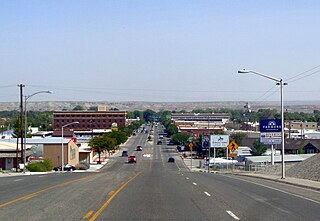
Riverton is a city in Fremont County, Wyoming, United States. The city's population was 10,682 at the 2020 census, making it the most populous city in the county.

The Wind River Indian Reservation, in the west-central portion of the U.S. state of Wyoming, is shared by two Native American tribes, the Eastern Shoshone and the Northern Arapaho. Roughly 60 mi (97 km) east to west by 50 mi (80 km) north to south, the Indian reservation is located in the Wind River Basin, and includes portions of the Wind River Range, Owl Creek Mountains, and Absaroka Range.
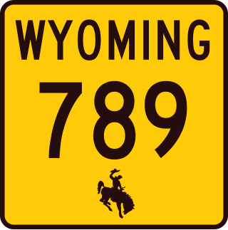
Wyoming Highway 789 (WYO 789) is a 407-mile-long (655 km) state highway in the U.S. state of Wyoming. WYO 789 travels south-to-north from the Colorado state line to the Montana state line. For most of its length, it is concurrent with other routes. It was the path of a formerly-proposed U.S. Route 789 that was canceled.
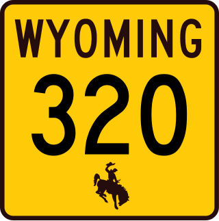
Wyoming Highway 320 (WYO 320) is a 12.33-mile-long (19.84 km) north–south state highway in central Platte County, Wyoming that connects Interstate 25 Business and U.S. Route 87 Business in Wheatland to US 26 in Dwyer, and was once part of the Yellowstone Highway.

This is a list of the National Register of Historic Places listings in Weston County, Wyoming. It is intended to be a complete list of the properties and districts on the National Register of Historic Places in Weston County, Wyoming, United States. The locations of National Register properties and districts for which the latitude and longitude coordinates are included below, may be seen in a map.
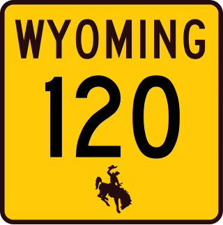
Wyoming Highway 120 is a 121.96-mile-long (196.28 km) state highway in central Hot Springs and eastern Park County, Wyoming that travels northwest to Montana Highway 72 at the state line.
Wyoming Highway 330 (WYO 330) is a fairly short 3.30-mile (5.31 km) east-west state highway in central Sheridan County, Wyoming, United States, that serves the northwestern part of Sheridan.

Wyoming Highway 134 is a 24.17-mile-long (38.90 km) east–west Wyoming State Road in northern Fremont County.

Wyoming Highway 135 is a 35.62-mile-long (57.32 km) north–south Wyoming State Road in Fremont County.
Wyoming Highway 137 was a 8.79-mile-long (14.15 km) east–west Wyoming State Road in central Fremont County.

Wyoming Highway 138 was a 8.14-mile-long (13.10 km) east-west (southwest-northeast) Wyoming State Road in central Fremont County.

Wyoming Highway 432 is a 10.29-mile-long (16.56 km) Wyoming state road in Washakie County. WYO 432 is locally known as South Flat Road for the Census-designated place (CDP) of the same name that it passes through.

Wyoming Highway 433 is an 18.81-mile-long (30.27 km) Wyoming state road in Washakie and Big Horn counties.

U.S. Highway 20 (US 20) is an east–west highway in the state of Wyoming. The eastern segment of US 20 in the state starts at the eastern entrance to Yellowstone National Park along with the western terminuses of US 14 and US 16. US 14/US 16/US 20 runs east to Greybull, where US 14 continues east and US 16/US 20 turns south; at Worland, US 16 turns east while US 20 continues south, passing through Wind River Canyon south of Thermopolis. US 20 joins US 26 in Shoshoni, where it turns east and continues all the way through Casper. From Casper, US 20/US 26 parallels Interstate 25 (I-25) and US 87 for 26 miles (42 km), until all four link up together just southeast of Glenrock. I-25/US 20/US 26/US 87 stays combined to Orin, where US 20 turns east from I-25, at the western end of US 18. US 18/US 20 run concurrently from Orin to Lusk, where US 18 turns north and US 20 continues east into Nebraska.