Related Research Articles

Chichester Harbour is a 3,733.5-hectare (9,226-acre) biological and geological Site of Special Scientific Interest (SSSI) west of Chichester in Hampshire and West Sussex. The SSSI is part of Chichester Harbour Area of Outstanding Natural Beauty and Solent Maritime Special Area of Conservation. It is also part of Chichester and Langstone Harbours Ramsar site, Special Protection Area and Nature Conservation Review site, Grade I. Part of it is a Geological Conservation Review site and two areas are Local Nature Reserves.
Wittering, West Sussex or The Witterings refers to two civil parishes in the Chichester district of West Sussex.
Earnley is a civil and ecclesiastical parish in the Chichester District of West Sussex, England. It is located four miles (6.4 km) south-west of Chichester, and lies on the south coast of England. The parish includes the settlements of Almodington and Batchmere.
West Lavington is a village and civil parish on the edge of Midhurst in the Chichester district of West Sussex, England. It contains a small private nursery school and the church of St Mary Magdalene.

The A286 is an A class road in the south of England, from its northernmost point in Milford, Surrey, to Birdham, West Sussex. It passes through the market towns of Haslemere and Midhurst, and the cathedral city of Chichester. The road is mostly single carriageway, with a small dual carriageway section as part of the Chichester ring road.
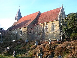
East Lavington, formerly Woolavington, is a village and civil parish in the District of Chichester in West Sussex, England. It is located six kilometres (4 miles) south of Petworth, west of the A285 road.

West Wittering is a village and civil parish situated on the Manhood Peninsula in the Chichester district of West Sussex, England. It lies near the mouth of Chichester Harbour on the B2179 road 6.5 miles (10.5 km) southwest of Chichester close to the border with Hampshire. The sandy beach has been described as having excellent water quality.

East Wittering is a coastal village in the Chichester district of West Sussex, England. The majority of the village lies within the civil parish of East Wittering, while the western edge lies within the boundary of West Wittering civil parish. The village sits on the B2179 road 7 miles (11 km) southwest of Chichester, on the Manhood Peninsula.
East Wittering or East Wittering and Bracklesham is a civil parish in the Chichester district of West Sussex, England. The parish lies on the coast of the Manhood Peninsula, approximately six miles (9.6 km) southwest of Chichester. It comprises the built up areas of Bracklesham and the eastern half of East Wittering, the western half of which lies within the boundary of West Wittering civil parish. To the east of Bracklesham used to be East Thorney, a detached portion of East Wittering separated from the body of the parish by a very narrow strip of Earnley. East Thorney is now under the sea off Bracklesham.

West Itchenor is a village and civil parish, on the Manhood Peninsula, in the Chichester District of West Sussex, England. It lies north of the B2179 Chichester to West Wittering road 4.5 miles (7.3 km) southwest of Chichester. The village lies on the shores of Chichester Harbour.

East Wittering Windmill is a grade II listed tower mill at East Wittering, Sussex, England which is derelict.

The Manhood Peninsula is the southwest of West Sussex in England. It has the English Channel to its south and Chichester to the north. It is bordered to its west by Chichester Harbour and to its east by Pagham Harbour, its southern headland being Selsey Bill.
The New Lipchis Way is a 60.8 kilometres (37.8 mi) long distance footpath which runs from Liphook in Hampshire to West Wittering in West Sussex. Running north–south across the Western Weald and South Downs to the Sussex coastal plain and Chichester Harbour the path crosses several geological rock strata and their associated soils and habitats. Landmarks on the route include Cowdray ruins, Goodwood Racecourse, the Trundle, Chichester Cathedral and the city walls, and East Head at West Wittering.

Fernhurst is an electoral division of West Sussex in the United Kingdom, and returns one member to sit on West Sussex County Council.
The Witterings is an electoral division of West Sussex in the United Kingdom, and returns one member to sit on West Sussex County Council.
James Hargraves or Hargrave (1690–1741) was an English Anglican divine who became the Dean of Chichester Cathedral in 1739.

St Richard of Chichester Church is a Roman Catholic parish church in Chichester, West Sussex, England. The church was built in 1958 and contains the largest scheme of stained glass by Gabriel Loire in the United Kingdom. The church is situated on Market Avenue on the corner of Cawley Road, next to St Richard's Catholic Primary School. It is a Grade II listed building.

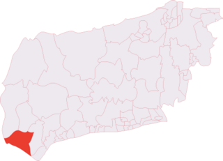
The Witterings is an electoral ward of Chichester District, West Sussex, England and returns three members to sit on Chichester District Council.
References
- ↑ "Chichester". Office for National Statistics.
- ↑ "Chichester". Ordnance Survey.
- ↑ Map of northern parishes
- ↑ Map of southern parishes