Chichester District

Last updated

Chichester District
Chichester UK locator map.svg
Chichester shown within West Sussex
Sovereign state United Kingdom
Constituent country England
Region South East England
Non-metropolitan county West Sussex
Status Non-metropolitan district
Admin HQ Chichester
Incorporated1 April 1974
Government
  TypeNon-metropolitan district council
  BodyChichester District Council
  LeadershipLeader & Cabinet (Liberal Democrats (UK))
   MPs Andrew Griffith
Jeremy Quin
Gillian Keegan
Area
  Total303.60 sq mi (786.32 km2)
  Rank42nd (of 296)
Population
 (2021)
  Total124,531
  Rank189th (of 296)
  Density410/sq mi (160/km2)
  Ethnicity
98.4% White
Time zone UTC0 (GMT)
  Summer (DST) UTC+1 (BST)
Website www.chichester.gov.uk

Chichester is a local government district in West Sussex, England. Its council is based in the city of Chichester and the district also covers a large rural area to the north. [1]

Contents

History

The district was formed on 1 April 1974, under the Local Government Act 1972, as a merger of the municipal borough (city) of Chichester and the Rural Districts of Midhurst, Petworth and part of the former Chichester Rural District.

Civil parishes

There are 67 civil parishes in Chichester District. [2] [3] Apart from the City of Chichester, and the three towns of Midhurst, Selsey and Petworth, most are villages.

Geography

Chichester District occupies the western part of West Sussex, bordering on Hampshire to the west and Surrey to the north. The districts of Arun and Horsham abut to the east; the English Channel to the south. The district is divided by the South Downs escarpment, with the northern part being in the Weald, composed of a mixture of sandstone ridges and low-lying clays known as the Western Weald. To the south the dip slope of the downs falls gently to a flat coastal plain and the sea. The Western Weald is drained by the River Arun and its tributaries including the rivers Lox, Kird and especially the River Rother and its tributaries the River Lod and the Haslingbourne Stream. On the northern boundary Blackdown is the highest point in Sussex, while further east around Loxwood the land is low and quite flat. The south of the district has many permeable chalk and gravel areas and is drained by two winterbournes, the River Lavant and River Ems, which are usually dry in the summer. The large inlet known as Chichester Harbour and the headland of Selsey Bill are conspicuous features of the coast.

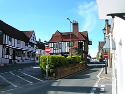
The district, apart from the few main roads, is generally rural in character, as can be seen by the number of villages within it. Apart from the coastal strip there are few main roads, and the erstwhile railways which once served Midhurst have long been closed.

Landmarks

Apart from the geographical landmarks Chichester District contains architectural and cultural places including Chichester Cathedral, Chichester Festival Theatre, The Novium and Pallant House Gallery in the city. Stately homes open to the public include Petworth House and Uppark, both National Trust properties, Goodwood House and Stansted Park. West Dean College is open at certain times of the year. There is horse racing at Goodwood Racecourse, the Goodwood Festival of Speed at Goodwood House, and the Goodwood Revival at Goodwood Motor Racing Circuit. Cowdray House is a ruined Tudor mansion near Midhurst. Fishbourne Roman Palace lies west of Chichester city centre. To the north of the city are Weald and Downland Open Air Museum and Halnaker Windmill. There are gardens open to the public at Woolbeding and Pound Commons and West Dean College.

Governance

Chichester District Council
Logo of Chichester District Council.png
Type
Type
History
Founded 1 April 1974
Leadership
Clare Apel,
Liberal Democrat
since 17 May 2023 [4]
Adrian Moss,
Liberal Democrat
since 17 May 2023
Diane Shepherd
since 2012 [5]
Structure
Seats36 councillors
Chichester District Council composition.svg
Political groups
Administration (25)
  Liberal Democrats (25)
Green and Local Alliance (6)
  Local Alliance (4)
  Green (2)
Other opposition (5)
  Conservative (5)
Length of term
4 years
Elections
First-past-the-post
Last election
4 May 2023
Next election
6 May 2027
Meeting place
East Pallant House.jpg
East Pallant House, 1 East Pallant, Chichester, PO19 1TY
Website
www.chichester.gov.uk

Chichester District Council has 36 councillors, representing 21 wards. Chichester itself has five of those wards (North, South, East, West and Central) whilst the remaining wards comprise groups of villages; see Wards of Chichester District. Local elections are held every four years and at the May 2011 and 2015 elections, the Conservative party retained control. [6] [7]

In 1999, a leader and cabinet form of governance was introduced. [8] Since then, the composition of the council has been: [9]

Party in controlLeaderYears
Conservative Jane Chevis 1999–2002
Janet Duncton2002–2004
No overall control (C minority)2004–2005
No overall control (LD minority)Andrew Smith [10] 2005–2006
Conservative Myles Cullen2006–2011
Heather Caird [11] 20112015
Tony Dignum 20152019
No overall control (C minority)Eileen Lintill 2019
Conservative 2019–2020
No overall control (C minority)2020–2023
Liberal Democrats Adrian Moss 2023–present

Councillors and wards

List of Chichester district councillors by ward: [12]

WardCouncillorElectedNotes
Chichester West Clare Apel1999Member of Chichester City Council
The Witterings Iain Ballantyne2023
Southbourne Tracie Bangert2019Cabinet Member for Communities and Wellbeing
Harbour Villages Richard Bates2023
North Mundham and Tangmere David Betts2023Cabinet Member for Housing and Revenues and Benefits
Selsey South Steve Boulcott2023
Chichester East Bill Brisbane2021Cabinet Member for Planning
Elected following a by-election held in June 2021 [13]
Westbourne Roy Briscoe2019
Lavant Joseph Brookes-Harmer2023
Chichester North Jonathan Brown2023Deputy Leader of the Council and Cabinet Member for Environmental Strategy
Previously represented Southbourne (2015–2023)
Midhurst Jess Brown-Fuller2023Cabinet Member for Culture and Events
Fernhurst Brett Elise Burkhart2023
Midhurst Hannah Burton2023
Chichester East Rhys Chant2023Member of Chichester City Council
The Witterings Mark Chilton2023Cabinet Member for Finance, Corporate Services and Chichester Contract Services
Chichester North Maureen Corfield2023Member of Chichester City Council
Fittleworth John Cross2023
Petworth Harsha Desai2023Cabinet Member for Growth and Place
Loxwood Gareth Evans2019
The Witterings Elizabeth Hamilton2019Previously represented Easebourne (2007–2015) and West Wittering (2015–2019)
North Mundham and Tangmere Charlie Hastain2023
Southbourne Oona Hickson2023
Easebourne Francis Hobbs2015
Sidlesham with
Selsey North
Donna Johnson2019Member of West Sussex County Council
Harbour Villages Stephen Johnson2023
Selsey South Timothy Johnson2019
Harbour Villages Adrian Moss2019Leader of the Council
Previously represented Fishbourne (2003–2011; 2018–2019)
Fernhurst Eleanora Newbery2023
Harting Tim O'Kelly2023
Goodwood Henry Potter2019Previously represented Boxgrove (2007–2019)
Chichester West Sarah Quail2023Member of Chichester City Council
Chichester South Sarah Sharp2019Member of West Sussex County Council
Loxwood Charles Todhunter2023
Chichester Central James Vivian2023Member of Chichester City Council
Sidlesham with
Selsey North
Val Weller2023
Chichester South Tim Young2023

Economy

West Sussex County Council and Chichester District Council are major employers in Chichester, along with Rolls-Royce Motor Cars assembly plant at nearby Westhampnett. Boatbuilding is an important industry along the coast. Many people from the northern parts of the district commute to work in London, using the A3 road or the railways from Portsmouth to London Waterloo station and Littlehampton to London Victoria station.[ citation needed ] Fertile soils on the coastal plain are used for arable farming and intensive vegetable production, the latter employing many migrant workers from Eastern Europe. High sunlight levels and a mild climate also make the coastal region suitable for glasshouse growing. A fertile strip of land on the north side of the River Rother is also used for vegetable growing, but most of the area north of the Downs is of low agricultural value and there are large areas of forest and pasture, interspersed with arable cropping.

Football clubs

See also

Related Research Articles

<span class="mw-page-title-main">East Sussex</span> County of England

East Sussex is a ceremonial county in South East England. It is bordered by Kent to the north-east, West Sussex to the west, Surrey to the north-west, and the English Channel to the south. The largest settlement is the city of Brighton and Hove, and the county town is Lewes.

<span class="mw-page-title-main">West Sussex</span> County of England

West Sussex is a ceremonial county in South East England. It is bordered by Surrey to the north, East Sussex to the east, the English Channel to the south, and Hampshire to the west. The largest settlement is Crawley, and the county town is the city of Chichester.

<span class="mw-page-title-main">Arun District</span> Non-metropolitan district in England

Arun is a local government district in West Sussex, England. Its council is based in Littlehampton. The district's other towns are Arundel and Bognor Regis. The district is named after the River Arun, which runs through the centre of the district.

<span class="mw-page-title-main">Petworth</span> Human settlement in England

Petworth is a small town and civil parish in the Chichester District of West Sussex, England. It is located at the junction of the A272 east–west road from Heathfield to Winchester and the A283 Milford to Shoreham-by-Sea road. Some twelve miles (21 km) to the south west of Petworth along the A285 road lies Chichester and the south-coast. The parish includes the settlements of Byworth and Hampers Green and covers an area of 2,690 hectares. In 2001 the population of the parish was 2,775 persons living in 1,200 households of whom 1,326 were economically active. At the 2011 Census the population was 3,027.

<span class="mw-page-title-main">Wealden District</span> District in East Sussex, England

<span class="mw-page-title-main">Rother District</span> Non-metropolitan district in England

Rother is a local government district in East Sussex, England. Its council is based in Bexhill-on-Sea. The district is named after the River Rother which flows within its boundaries.

<span class="mw-page-title-main">Midhurst</span> Human settlement in England

Midhurst is a market town, parish and civil parish in West Sussex, England. It lies on the River Rother 20 miles (32 km) inland from the English Channel, and 12 miles (19 km) north of the county town of Chichester.

<span class="mw-page-title-main">South Downs National Park</span> National park in South East England

The South Downs National Park is England's newest national park, designated on 31 March 2010. The park, covering an area of 1,627 square kilometres (628 sq mi) in southern England, stretches for 140 kilometres (87 mi) from Winchester in the west to Eastbourne in the east through the counties of Hampshire, West Sussex and East Sussex. The national park covers the chalk hills of the South Downs and a substantial part of a separate physiographic region, the western Weald, with its heavily wooded sandstone and clay hills and vales. The South Downs Way spans the entire length of the park and is the only National Trail that lies wholly within a national park.

<span class="mw-page-title-main">Chichester (UK Parliament constituency)</span> Parliamentary constituency in the United Kingdom

Chichester is a constituency in West Sussex, represented in the House of Commons of the UK Parliament since 2017 by Gillian Keegan, a Conservative.

<span class="mw-page-title-main">Lodsworth</span> Human settlement in England

Lodsworth is a small village, ecclesiastical parish and civil parish in the Chichester district of West Sussex, England. It is situated between Midhurst and Petworth, half a mile north of the A272 road. It lies within the South Downs National Park, just to the north of the valley of the River Rother and a tributary stream the River Lod runs close to the east end of the village. The parish includes the settlements of Bexleyhill and Lickfold.

<span class="mw-page-title-main">A286 road</span> Road in the south east of England

The A286 is an A class road in the south of England, from its northernmost point in Milford, Surrey, to Birdham, West Sussex. It passes through the market towns of Haslemere and Midhurst, and the cathedral city of Chichester. The road is mostly single carriageway, with a small dual carriageway section as part of the Chichester ring road.

<span class="mw-page-title-main">Tillington, West Sussex</span> Human settlement in England

Tillington is a village, ecclesiastical parish and civil parish in the District of Chichester in West Sussex, England, 1 mile (1.6 km) west of Petworth on the A272. The civil parish (CP) includes the hamlets of Upperton, River, and River Common. The land area of the CP is 1,416 hectares ; approximately 500 people lived in 227 households at the 2001 census.

<span class="mw-page-title-main">Midhurst Grammar School</span> School in Midhurst, West Sussex, England

Midhurst Grammar School was a grammar school and later a comprehensive upper school in Midhurst, West Sussex. The school served pupils aged 11 to 18 who usually joined the school from one of the local intermediate schools. It was replaced in 2009 by Midhurst Rother College. Notable students included geologist Charles Lyell and H. G. Wells.

<span class="mw-page-title-main">Geography of Sussex</span> Overview of the geography of Sussex

Sussex is a historic county and cultural region in the south of England corresponding roughly in area to the ancient Kingdom of Sussex. It is bounded on the north by Surrey, north-east by Kent, south by the English Channel, and west by Hampshire, and is divided for local government into West Sussex and East Sussex and the city of Brighton and Hove. The city of Brighton & Hove was created a unitary authority in 1997, and was granted City status in 2000. Until then Chichester had been Sussex's only city. By convention, Chichester is Sussex's capital city and Lewes is Sussex's county town.

The western Weald is an area of undulating countryside in Hampshire and West Sussex containing a mixture of woodland and heathland areas.

The New Lipchis Way is a 60.8 kilometres (37.8 mi) long distance footpath which runs from Liphook in Hampshire to West Wittering in West Sussex. Running north–south across the Western Weald and South Downs to the Sussex coastal plain and Chichester Harbour the path crosses several geological rock strata and their associated soils and habitats. Landmarks on the route include Cowdray ruins, Goodwood Racecourse, the Trundle, Chichester Cathedral and the city walls, and East Head at West Wittering.

<span class="mw-page-title-main">Sussex Day</span>

Sussex Day is the county day for the historic county of Sussex in southern England and is celebrated on 16 June each year to celebrate the rich heritage and culture of Sussex.

<span class="mw-page-title-main">Rotherbridge</span> Human settlement in England

Rotherbridge is a small, rural community situated approximately 1 mile (1.6 km) south-west of Petworth in West Sussex, England. Until 1800, the road from Chichester to Petworth crossed the River Rother by a bridge here; the river acquired its present name from the bridge. Rotherbridge also gave its name to the Hundred of Rotherbridge which comprised several of the surrounding villages, as well as the town of Petworth.

References

  1. The dignity and privileges of the City of Chichester are vested in its town council, known as Chichester City Council, occupying only 10.6 km² of the total area of the District), which covers over 70 times the area
  2. "Chichester". Office for National Statistics.
  3. "Chichester". Ordnance Survey.
  4. "Council minutes, 17 May 2023". Chichester District Council. Retrieved 8 October 2023.
  5. Stephenson, Jo (7 March 2012). "Shepherd moves up to chief". Local Government Chronicle. Retrieved 8 October 2023.
  6. "Chichester council elections". BBC. 10 May 2011. Retrieved 25 October 2014.
  7. "England council results". BBC. 2015. Retrieved 19 May 2015.
  8. "Chichester District Council – Business Support" (PDF). Audit Commission. August 2002. p. 5.
  9. Colin Rallings; Michael Thrasher (June 2015). "Chichester District Council Election Results 1973-2011" (PDF). The Elections Centre, Plymouth University.
  10. Lawrence Marzouk (18 April 2007). "Control of Chichester hangs in balance". The Argus.
  11. "Leader announces she will not stand at Chichester District Council election". Chichester Observer. 2 April 2015.
  12. "Your councillors". Chichester District Council. Retrieved 7 September 2019.
  13. "Declaration of Result of Poll: Chichester District Council Election of a District Councillor for Chichester East Ward on Thursday 24 June 2021".

50°50′13″N0°46′48″W / 50.837°N 0.780°W / 50.837; -0.780