
Petworth is a town and civil parish in the Chichester District of West Sussex, England. It is located at the junction of the A272 east–west road from Heathfield to Winchester and the A283 Milford to Shoreham-by-Sea road.

The River Rother flows from Empshott in Hampshire, England, to Stopham in West Sussex, where it joins the River Arun. At 52 kilometres (32 mi) long, most of the river lies within West Sussex except for the first 10 kilometres (6.2 mi) which lie in Hampshire. The upper river, from its source to Midhurst, has been used to power watermills, with the earliest recorded use being in 1086, when the Domesday survey was conducted. Although none are still operational, many of the buildings which housed the mills still exist, and in some cases, still retain their milling machinery. This upper section is also noted for a number of early bridges, which have survived since their construction in the fifteenth, sixteenth and seventeenth centuries.

Bepton is a village, Anglican parish and civil parish in the Chichester district of West Sussex, England. According to the 2001 census it had 104 households with a population of 249 of whom 117 were economically active. The village is about 3 miles (4.8 km) south-west of Midhurst.
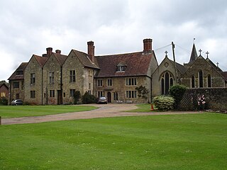
Easebourne is a village, Anglican parish and civil parish in the Chichester District of West Sussex, England. It is half a mile (0.8 km) north of Midhurst, across the River Rother on the A272 and A286 roads. The parish includes the hamlet of Henley to the north. In the 2001 census there were 708 households with a total population of 1,717 of whom 785 were economically active.

Heyshott is a village, Anglican parish and civil parish in the Chichester district of West Sussex, England. It is approximately three miles south of Midhurst and lies within the South Downs National Park. Like many villages it has lost its shop but still has one pub, The Unicorn Inn. The hamlet of Hoyle is to the northeast of the village.
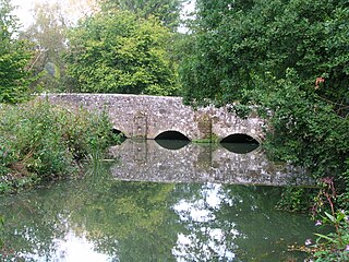
Stedham with Iping is a civil parish in the Chichester district of West Sussex, England. It is approximately two miles (3 km) west of Midhurst and comprises the two villages of Stedham and Iping. There are two churches in the parish: St James' in Stedham and St Mary's in Iping. Its watermill was used for the production of blotting paper.

Lodsworth is a small village, ecclesiastical parish and civil parish in the Chichester district of West Sussex, England. It is situated between Midhurst and Petworth, half a mile north of the A272 road. It lies within the South Downs National Park, just to the north of the valley of the River Rother; a tributary stream the River Lod runs close to the east end of the village.

Selham is a small village and former civil parish, now in the parish of Graffham, in the Chichester district of West Sussex, England. It lies south of the A272 road 3 miles (4.8 km) east of Midhurst. It is mainly in the parish of Graffham, but partly in that of Lodsworth to the north. In 1931 the parish had a population of 65.

Stedham is a village and former civil parish, now in the parish of Stedham with Iping, in the Chichester district of West Sussex, England, on the A272 road 1.5 miles (2.4 km) west of Midhurst. In 1961 the parish had a population of 649. On 1 April 1974 the parish was abolished and merged with Iping to form "Stedham with Iping".

Trotton with Chithurst is a civil parish in the Chichester district of West Sussex, England. Trotton is on the A272 road 7 miles (11 km) west of Midhurst. Chithurst is about 1 mile (1.6 km) north west of Trotton. The parish also contains the hamlet of Dumpford.

Rogate is a village and civil parish in the Chichester district of West Sussex, England, in the Western Rother valley. The village is on the A272 road 5.6 miles (9.0 km) west of Midhurst and 5 miles (8.0 km) east of Petersfield, Hampshire. The civil parish includes the villages of Rogate and Rake and the hamlets of Haben, Fyning, Hill Brow, Langley, Durford, Wenham, Durleighmarsh and Terwick Common.
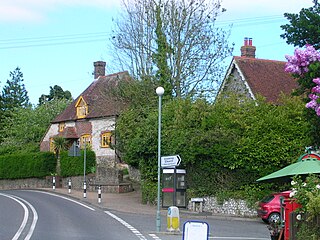
Cocking is a village, parish and civil parish in the Chichester district of West Sussex, England. The village is about three miles (5 km) south of Midhurst on the main A286 road to Chichester.
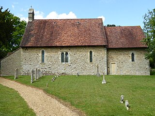
Elsted is a village, Anglican parish and former civil parish, now in the civil parish of Elsted and Treyford, in the Chichester district of West Sussex, England. The village is on the Midhurst to South Harting Road 4.5 miles (7.2 km) west of Midhurst. In 1961 the civil parish had a population of 188. On 1 April 2003 the civil parish was abolished and merged with Treyford to form "Elsted & Treyford".
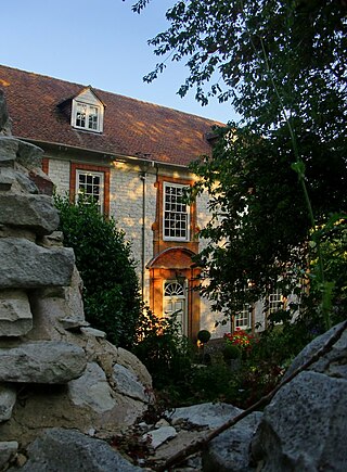
Treyford is a hamlet, Anglican parish and former civil parish, now in the civil parish of Elsted and Treyford, in the Chichester district of West Sussex, England. The hamlet sits on the Elsted to Bepton Road 4 miles (6.4 km) southwest of Midhurst. In 1931 the civil parish had a population of 104.

Singleton is a village, Anglican parish and civil parish in the Chichester district of West Sussex, England. It lies in the Lavant valley, 5 miles (8 km) miles north of Chichester on the A286 road to Midhurst.
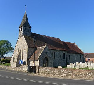
Lavant is a civil parish in the Chichester district of West Sussex, England, 2.2 miles (3.5 km) north of Chichester. It includes three villages: Mid Lavant and East Lavant, which are separate Anglican parishes, and the much smaller West Lavant. It takes its name from the River Lavant which flows from East Dean to Chichester.
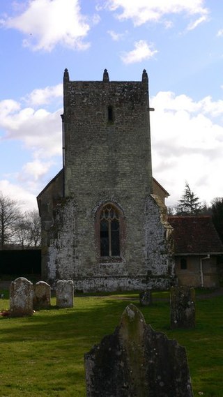
Woolbeding is a village and ecclesiastical parish in the District of Chichester in West Sussex, England, 1 mile (1.6 km) north-west of Midhurst and north of the River Rother and A272 road.

West Dean is a village, Anglican parish and civil parish in the District of Chichester in West Sussex, England 5 miles (8 km) north of Chichester on the A286 road just west of Singleton. The parishes include the hamlets of Binderton and Chilgrove.

Merston is a small village, an Anglican parish and former civil parish, now in the civil parish of Oving, in the Chichester district of West Sussex, England. It lies just south of the A259 road 2.4 miles (3.9 km) southeast of Chichester.
The New Lipchis Way is a 60.8 kilometres (37.8 mi) long distance footpath which runs from Liphook in Hampshire to West Wittering in West Sussex. Running north–south across the Western Weald and South Downs to the Sussex coastal plain and Chichester Harbour the path crosses several geological rock strata and their associated soils and habitats. Landmarks on the route include Cowdray ruins, Goodwood Racecourse, the Trundle, Chichester Cathedral and the city walls, and East Head at West Wittering.


