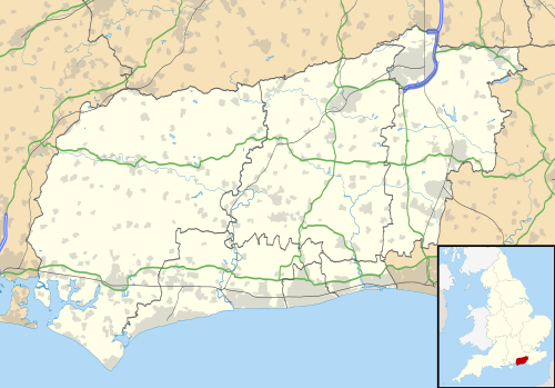
Some of the larger settlements of West Sussex.
This is a list of cities, towns, villages and other geographical places in the ceremonial county of West Sussex , England. Towns and cities are shown in bold type.
This is a list of cities, towns, villages and other geographical places in the ceremonial county of West Sussex , England. Towns and cities are shown in bold type.

West Sussex is a ceremonial county in South East England. It is bordered by Surrey to the north, East Sussex to the east, the English Channel to the south, and Hampshire to the west. The largest settlement is Crawley, and the county town is the city of Chichester.

Arun is a local government district in West Sussex, England. Its council is based in Littlehampton. The district's other towns are Arundel and Bognor Regis. The district is named after the River Arun, which runs through the centre of the district. Parts of the district fall within the South Downs National Park.

Arundel and South Downs is a constituency in West Sussex created in 1997 and represented in the House of Commons of the UK Parliament by Andrew Griffith, a Conservative, since 2019.

Chichester is a constituency in West Sussex, represented in the House of Commons of the UK Parliament since 2024 by Jess Brown-Fuller, a Liberal Democrat.
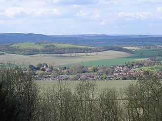
Harting is a civil parish in the Chichester District of West Sussex, England. It is situated on the northern flank of the South Downs, around 3.5 miles (5.6 km) southeast of Petersfield in Hampshire. It comprises the village of South Harting and the hamlets of East Harting, West Harting and Nyewood.

The A286 is an A class road in the south of England, from its northernmost point in Milford, Surrey, to Birdham, West Sussex. It passes through the market towns of Haslemere and Midhurst, and the cathedral city of Chichester. The road is mostly single carriageway, with a small dual carriageway section as part of the Chichester ring road.

East Wittering is a large coastal village in the Chichester district of West Sussex, England. The majority of the village lies within the civil parish of East Wittering and Bracklesham, while the western edge lies within the boundary of West Wittering civil parish. The village sits on the B2179 road 7 miles (11 km) southwest of Chichester, on the Manhood Peninsula.

West Itchenor is a village and civil parish, on the Manhood Peninsula, in the Chichester District of West Sussex, England. It lies north of the B2179 Chichester to West Wittering road 4.5 miles (7.3 km) southwest of Chichester. The village lies on the shores of Chichester Harbour.

West Sussex County Council is the upper tier local authority for the non-metropolitan county of West Sussex in England.
The New Lipchis Way is a 60.8 kilometres (37.8 mi) long distance footpath which runs from Liphook in Hampshire to West Wittering in West Sussex. Running north–south across the Western Weald and South Downs to the Sussex coastal plain and Chichester Harbour the path crosses several geological rock strata and their associated soils and habitats. Landmarks on the route include Cowdray ruins, Goodwood Racecourse, the Trundle, Chichester Cathedral and the city walls, and East Head at West Wittering.
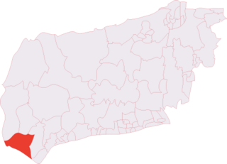
The Witterings is an electoral division of West Sussex in the United Kingdom, and returns one member to sit on West Sussex County Council.
The 2018–19 Southern Combination Football League season was the 94th in the history of the competition, which lies at levels 9 and 10 of the English football league system.